MyTopo
Arroyo Huisache Texas US Topo Map
Couldn't load pickup availability
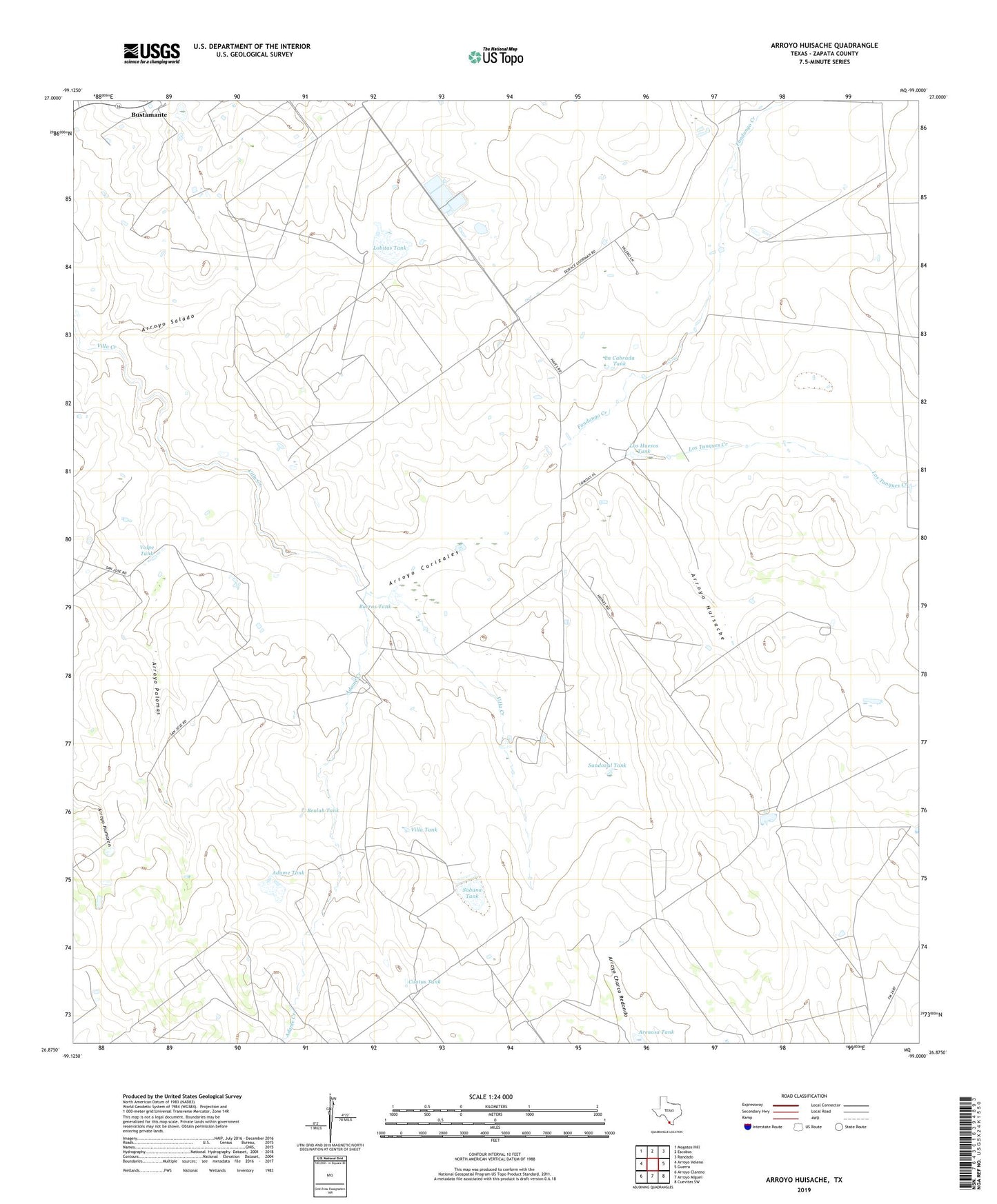
2019 topographic map quadrangle Arroyo Huisache in the state of Texas. Scale: 1:24000. Based on the newly updated USGS 7.5' US Topo map series, this map is in the following counties: Zapata. The map contains contour data, water features, and other items you are used to seeing on USGS maps, but also has updated roads and other features. This is the next generation of topographic maps. Printed on high-quality waterproof paper with UV fade-resistant inks.
Quads adjacent to this one:
West: Arroyo Veleno
Northwest: Mogotes Hill
North: Escobas
Northeast: Randado
East: Guerra
Southeast: Cuevitas SW
South: Arroyo Miguel
Southwest: Arroyo Clareno
Contains the following named places: Adame Creek, Adame Tank, Adame Tank Dam, Arroyo Carizales, Arroyo Huisache, Arroyo Palomas, Arroyo Salado, Beulah Tank, Burras Tank, Cuatus Tank, Fandango Creek, Jones and Flores Lake Dam, La Cabrada Tank, La Cabrada Tank Dam, Lobitas Tank, Los Huesos Tank, Los Tanques Creek, Sabana Tank, Sandoval Tank, Vidaurri Lake Dam, Villa Tank, Volpe Tank, Volpe Tank Dam, Zapata Division