MyTopo
Arroyo Miguel Texas US Topo Map
Couldn't load pickup availability
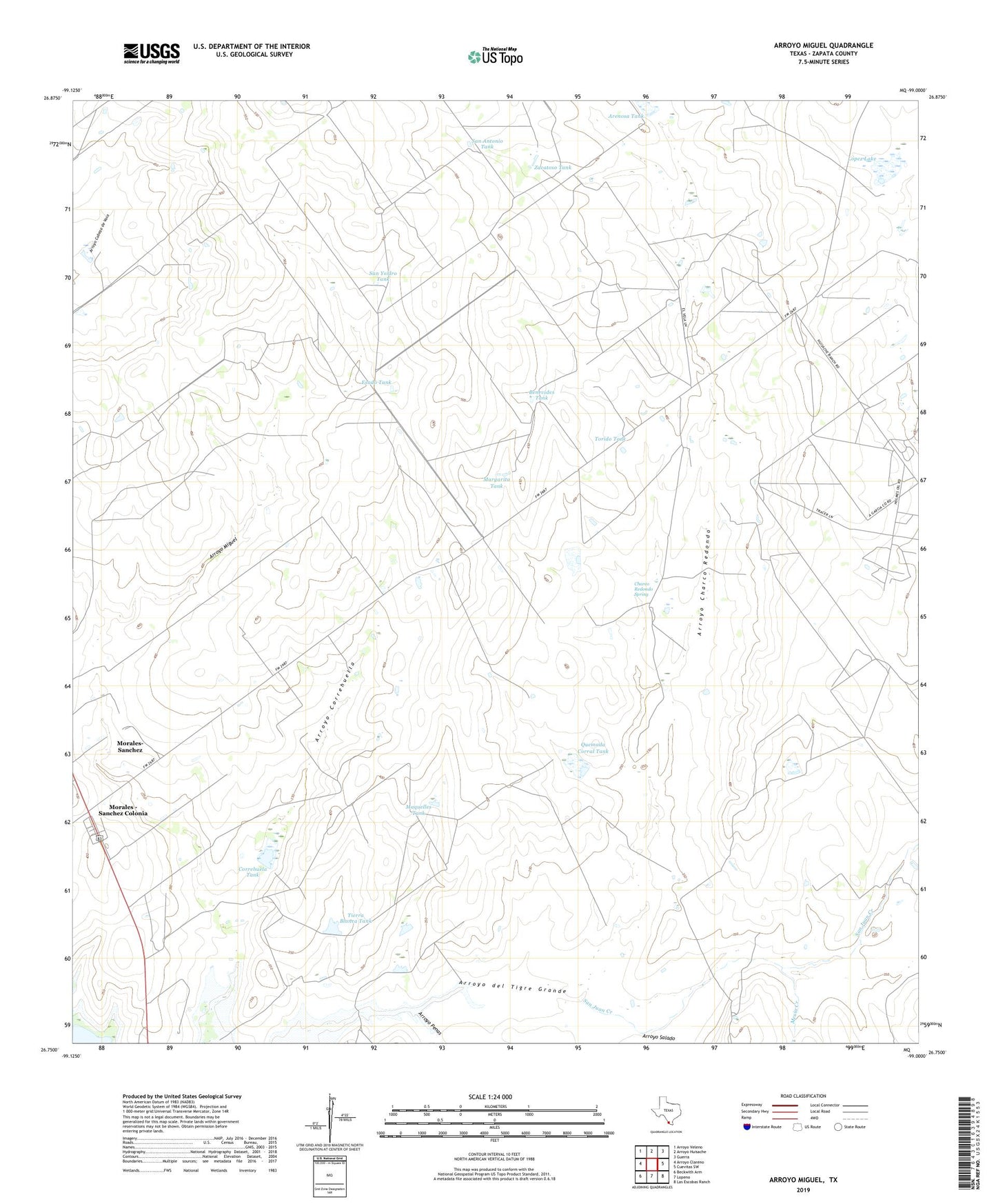
2022 topographic map quadrangle Arroyo Miguel in the state of Texas. Scale: 1:24000. Based on the newly updated USGS 7.5' US Topo map series, this map is in the following counties: Zapata. The map contains contour data, water features, and other items you are used to seeing on USGS maps, but also has updated roads and other features. This is the next generation of topographic maps. Printed on high-quality waterproof paper with UV fade-resistant inks.
Quads adjacent to this one:
West: Arroyo Clareno
Northwest: Arroyo Veleno
North: Arroyo Huisache
Northeast: Guerra
East: Cuevitas SW
Southeast: Las Escobas Ranch
South: Lopeno
Southwest: Beckwith Arm
This map covers the same area as the classic USGS quad with code o26099g1.
Contains the following named places: Arenosa Tank, Arroyo Charco Redondo, Arroyo Correhuella, Arroyo Penas, Arroyo Salado, Benevides Tank, Charco Redondo Spring, Chihuahua Farm, Correhuela Tank, Esado Tank, Juan G Benavides Lake Dam, Lopez Lake, Lopez Lake Dam, Maquelles Tank, Margarita Tank, Mexia Creek, Morales - Sanchez Colonia, Morales-Sanchez Census Designated Place, Quemada Corral Tank, Quemada Corral Tank Dam, San Antonio Tank, San Juan Creek, San Ysidro Tank, Tierra Blanca Tank, Torido Tank, Zacatoso Tank