MyTopo
Benjamin Texas US Topo Map
Couldn't load pickup availability
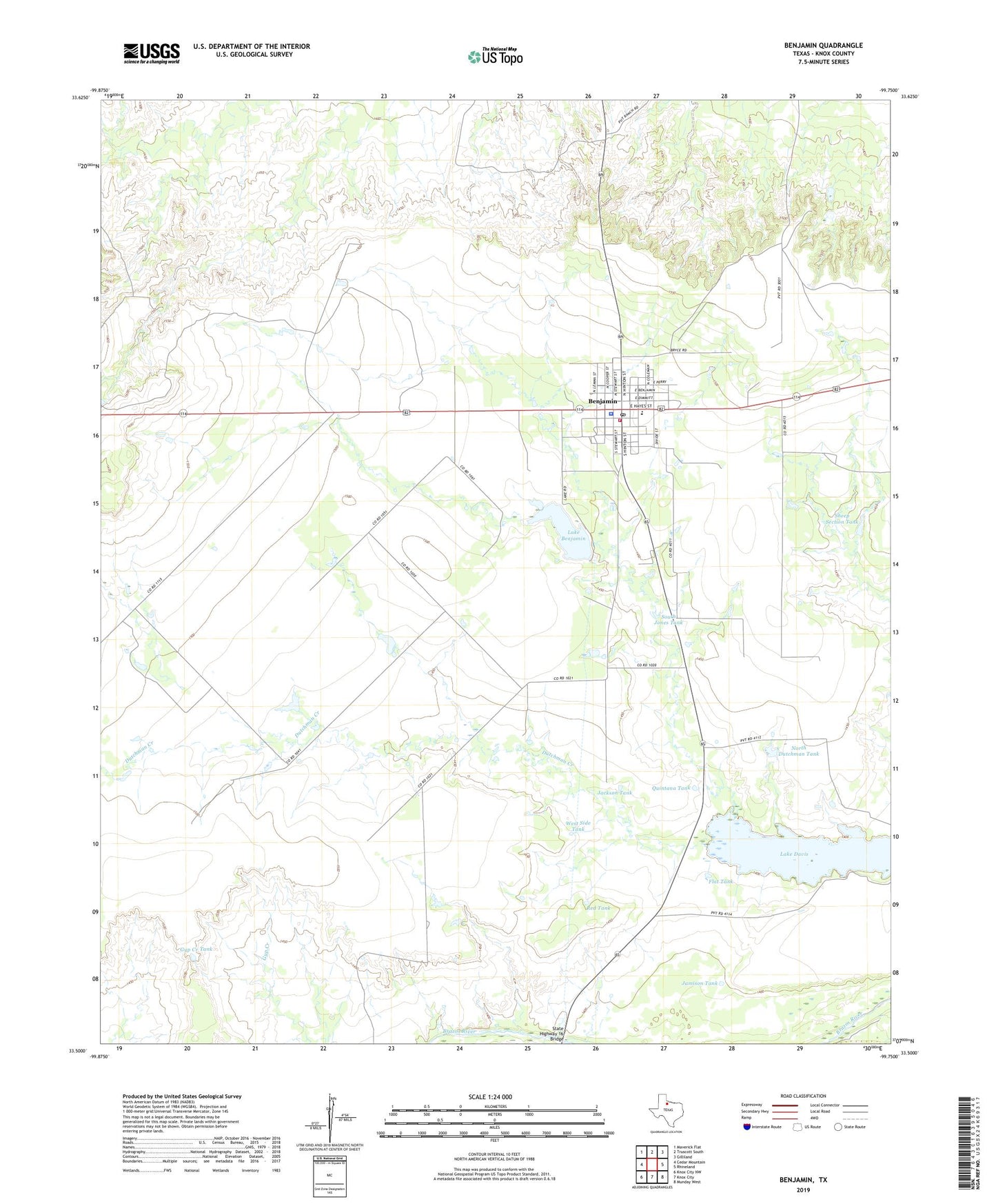
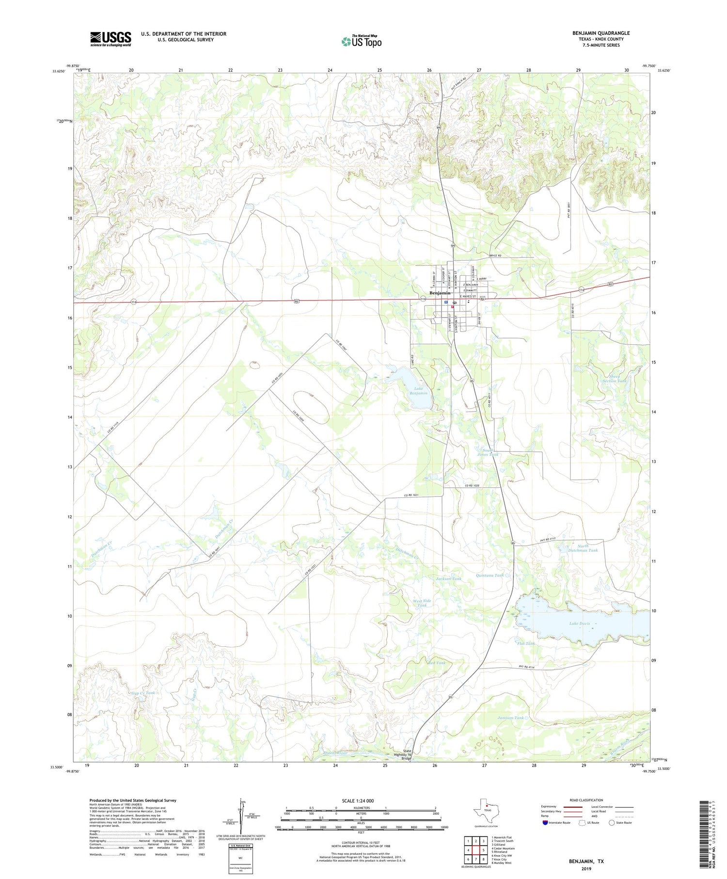
2019 topographic map quadrangle Benjamin in the state of Texas. Scale: 1:24000. Based on the newly updated USGS 7.5' US Topo map series, this map is in the following counties: Knox. The map contains contour data, water features, and other items you are used to seeing on USGS maps, but also has updated roads and other features. This is the next generation of topographic maps. Printed on high-quality waterproof paper with UV fade-resistant inks.
Quads adjacent to this one:
West: Cedar Mountain
Northwest: Maverick Flat
North: Truscott South
Northeast: Gilliland
East: Rhineland
Southeast: Munday West
South: Knox City
Southwest: Knox City NW
Contains the following named places: Benjamin, Benjamin City Hall, Benjamin Post Office, Benjamin Volunteer Fire Department, China Branch, City of Benjamin, Deer Tank, Flat Tank, Gyp Creek Tank, Hamilton Ranch, Jackson Tank, Jamison Tank, Knox County Jail, Knox County Sheriff's Office, Lake Benjamin, Lake Benjamin Dam, Lake Davis, League Ranch, North Dutchman Tank, Quintana Tank, Red Tank, Sheep Section Tank, South Jones Tank, State Highway 16 Bridge, West Side Tank, ZIP Code: 79505