MyTopo
Bevil Oaks Texas US Topo Map
Couldn't load pickup availability
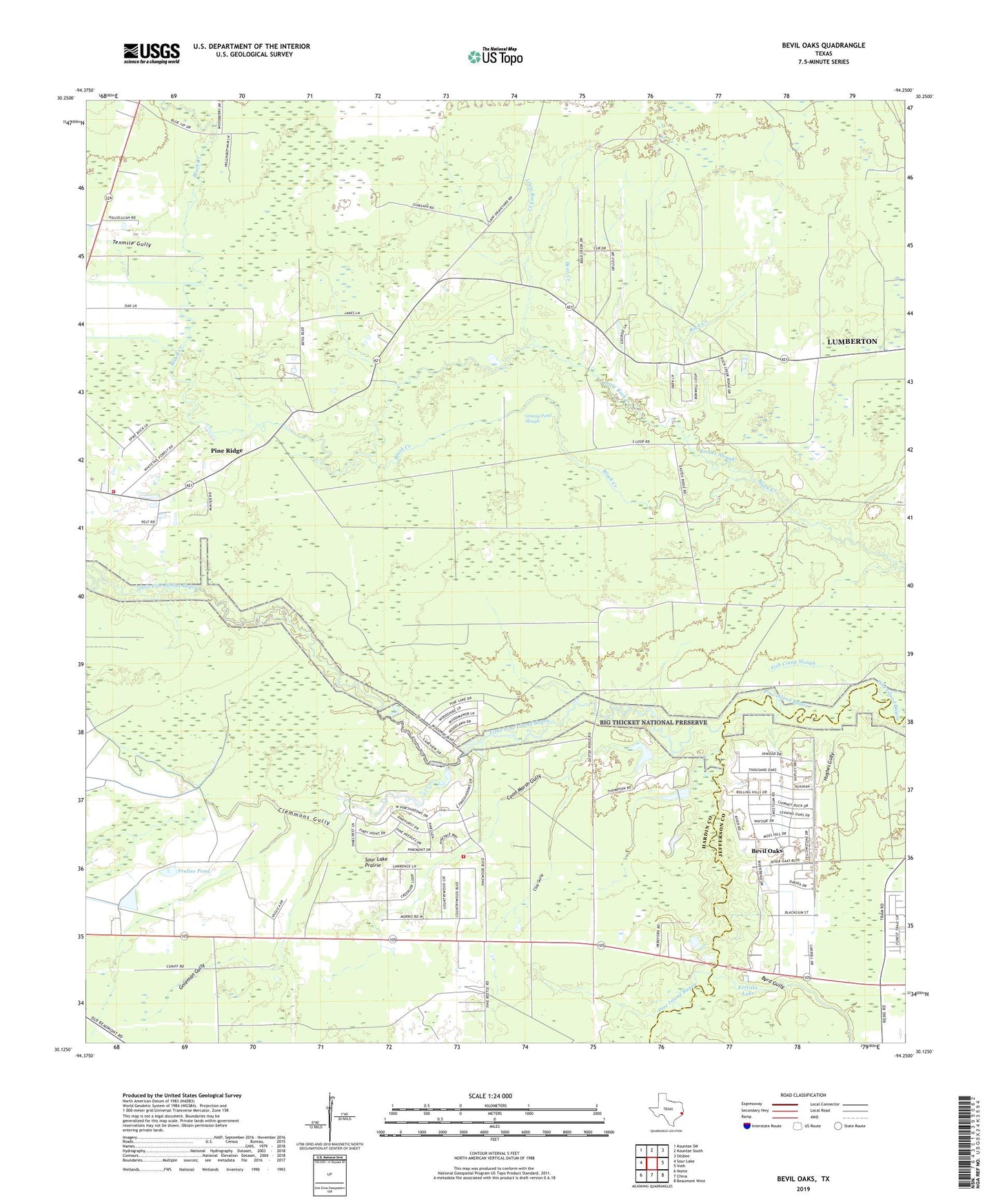
2019 topographic map quadrangle Bevil Oaks in the state of Texas. Scale: 1:24000. Based on the newly updated USGS 7.5' US Topo map series, this map is in the following counties: Hardin, Jefferson. The map contains contour data, water features, and other items you are used to seeing on USGS maps, but also has updated roads and other features. This is the next generation of topographic maps. Printed on high-quality waterproof paper with UV fade-resistant inks.
Quads adjacent to this one:
West: Sour Lake
Northwest: Kountze SW
North: Kountze South
Northeast: Silsbee
East: Voth
Southeast: Beaumont West
South: China
Southwest: Nome
Contains the following named places: Bear Creek, Bevel Acres, Bevil Oaks, Bevil Oaks City Hall, Black Creek Thicket, Byrd Gully, City of Bevil Oaks, Clay Gully, Clemmons Gully, Coon Marsh Gully, Fertitta Lake, First Baptist Church of Bevil Oaks, Fish Camp Slough, Fralise Pond, Goleman Gully, Grassy Pond, Grassy Pond Slough, Hughes Gully, Keith Brambles, Little Pine Island Bayou, Little Rock Creek, Pine Ridge, Pine Ridge Church, Pine Ridge Volunteer Fire Department, Pinewood Estates, Pinewood Estates Census Designated Place, Pinewood Volunteer Fire Department, Reeder Slough, Reeder Thicket, Rock Creek, Sour Lake Prairie, Tenmile Gully