MyTopo
Big Hill Bayou Texas US Topo Map
Couldn't load pickup availability
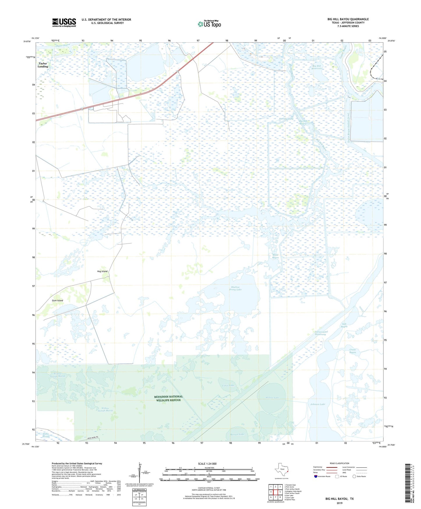
2019 topographic map quadrangle Big Hill Bayou in the state of Texas. Scale: 1:24000. Based on the newly updated USGS 7.5' US Topo map series, this map is in the following counties: Jefferson. The map contains contour data, water features, and other items you are used to seeing on USGS maps, but also has updated roads and other features. This is the next generation of topographic maps. Printed on high-quality waterproof paper with UV fade-resistant inks.
Quads adjacent to this one:
West: Alligator Hole Marsh
Northwest: Fannett East
North: Port Acres
Northeast: Port Arthur North
East: Port Arthur South
Southeast: Sabine Pass
South: Clam Lake
Southwest: Star Lake
Contains the following named places: Barnett Lake, Big Hill Bayou, Big Hill Bayou Wildlife Management Area, Big Hill Reservoir, Blind Bayou, Blind Lake, Cabin Lake, Coffee Bean Slough, Crane Bayou, Derring Gully, Gum Island, Hog Island, J D Murphee State Wildlife Management Area, Salt Bayou, Shallow Prong Lake, Shell Lake, Willow Lake