MyTopo
Sabine Pass Texas US Topo Map
Couldn't load pickup availability
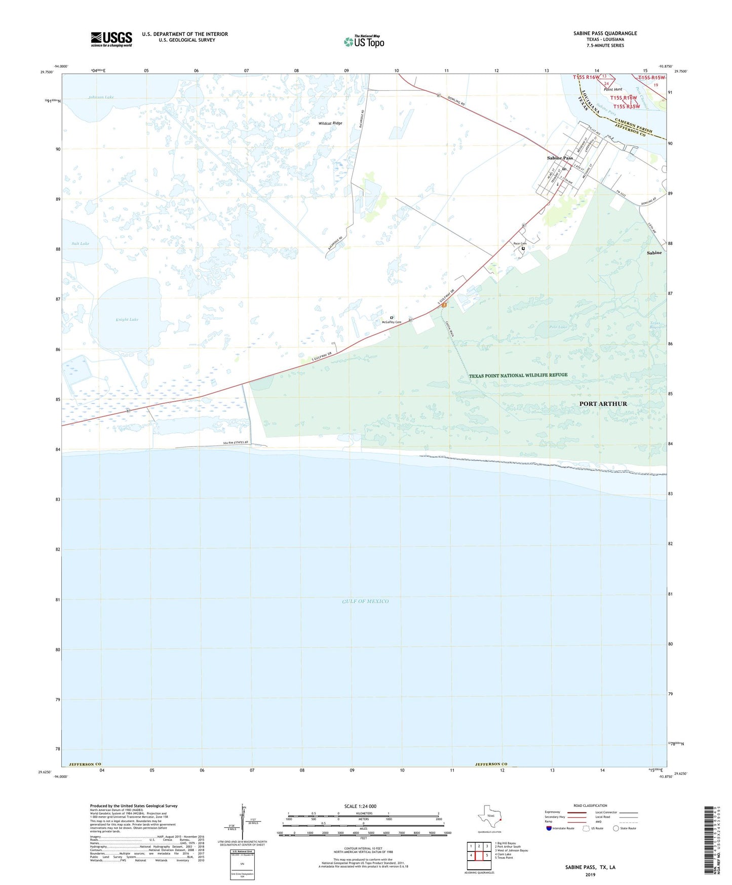
2025 topographic map quadrangle Sabine Pass in the states of Texas, Louisiana. Scale: 1:24000. Based on the newly updated USGS 7.5' US Topo map series, this map is in the following counties: Jefferson, Cameron. The map contains contour data, water features, and other items you are used to seeing on USGS maps, but also has updated roads and other features. This is the next generation of topographic maps. Printed on high-quality waterproof paper with UV fade-resistant inks.
Quads adjacent to this one:
West: Clam Lake
Northwest: Big Hill Bayou
North: Port Arthur South
Northeast: West of Johnson Bayou
East: Texas Point
This map covers the same area as the classic USGS quad with code o29093f8.
Contains the following named places: Air Logistics Sabine Heliport, City of Port Arthur, Era Helicopters Sabine Base Heliport, Evergreen Helicopters Heliport, HHI-Sabine Heliport, Knight Lake, McGaffey Cemetery, Pace Cemetery, Pass Channel, Peters Lake, Petroleum Helicopters Incorporated Heliport, Point Hunt, Pole Lake, Port Arthur Fire Department Station 4, Sabine Pass, Sabine Pass Battleground State Historical Park, Sabine Pass Post Office, Sea Rim State Park Trail, Texas Point National Wildlife Refuge, Wildcat Ridge, ZIP Code: 77655