MyTopo
Star Lake Texas US Topo Map
Couldn't load pickup availability
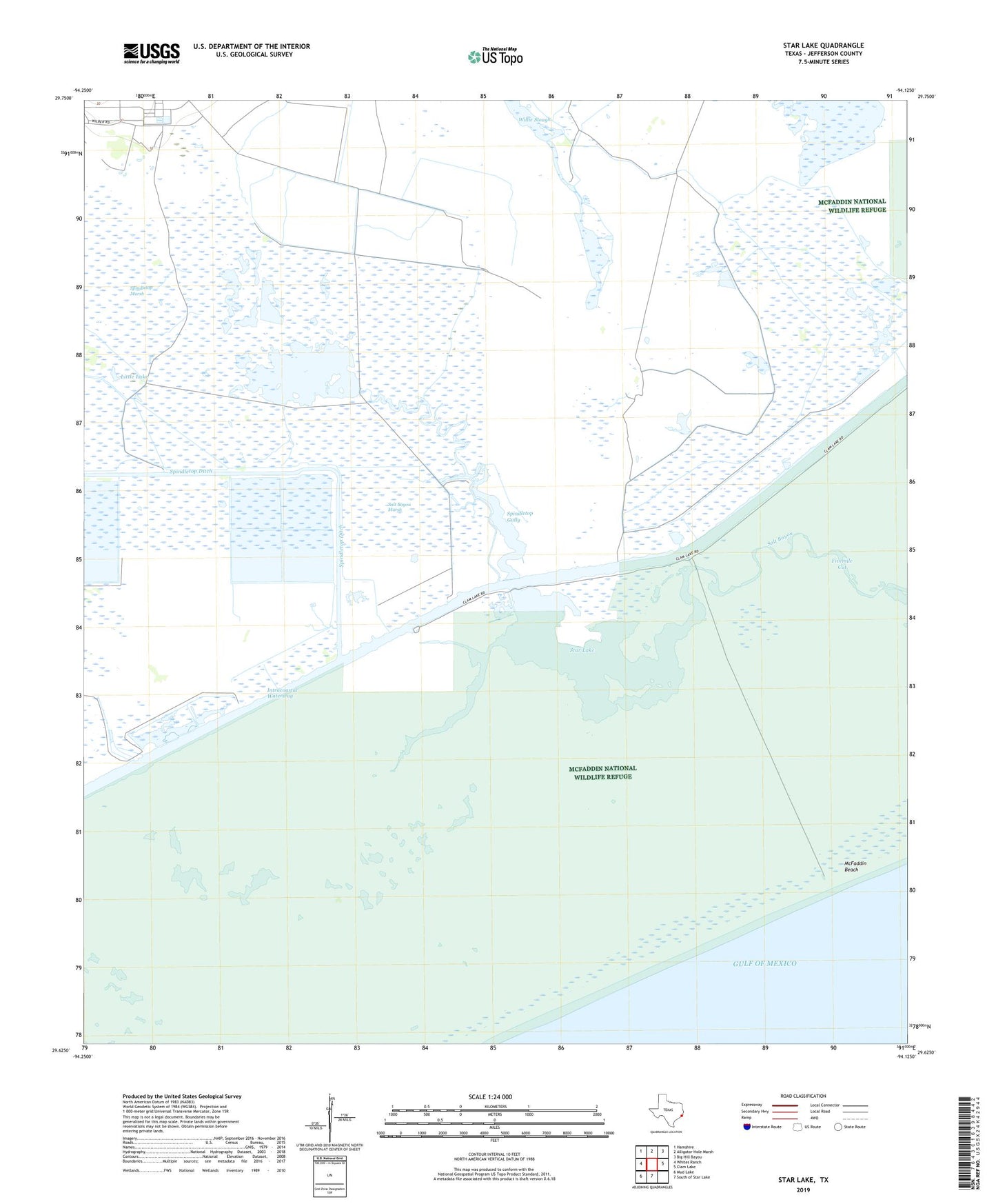
2025 topographic map quadrangle Star Lake in the state of Texas. Scale: 1:24000. Based on the newly updated USGS 7.5' US Topo map series, this map is in the following counties: Jefferson. The map contains contour data, water features, and other items you are used to seeing on USGS maps, but also has updated roads and other features. This is the next generation of topographic maps. Printed on high-quality waterproof paper with UV fade-resistant inks.
Quads adjacent to this one:
West: Whites Ranch
Northwest: Hamshire
North: Alligator Hole Marsh
Northeast: Big Hill Bayou
East: Clam Lake
South: South of Star Lake
Southwest: Mud Lake
This map covers the same area as the classic USGS quad with code o29094f2.
Contains the following named places: Beach Prong, Fivemile Cut, Little Lake, McFaddin National Wildlife Refuge, North Prong Locks, Sabine Pass Division, Salt Bayou Marsh, Spindletop Gully, Star Lake, West Prong, Willie Slough