
MyTopo
Black Gap Texas US Topo Map
Couldn't load pickup availability
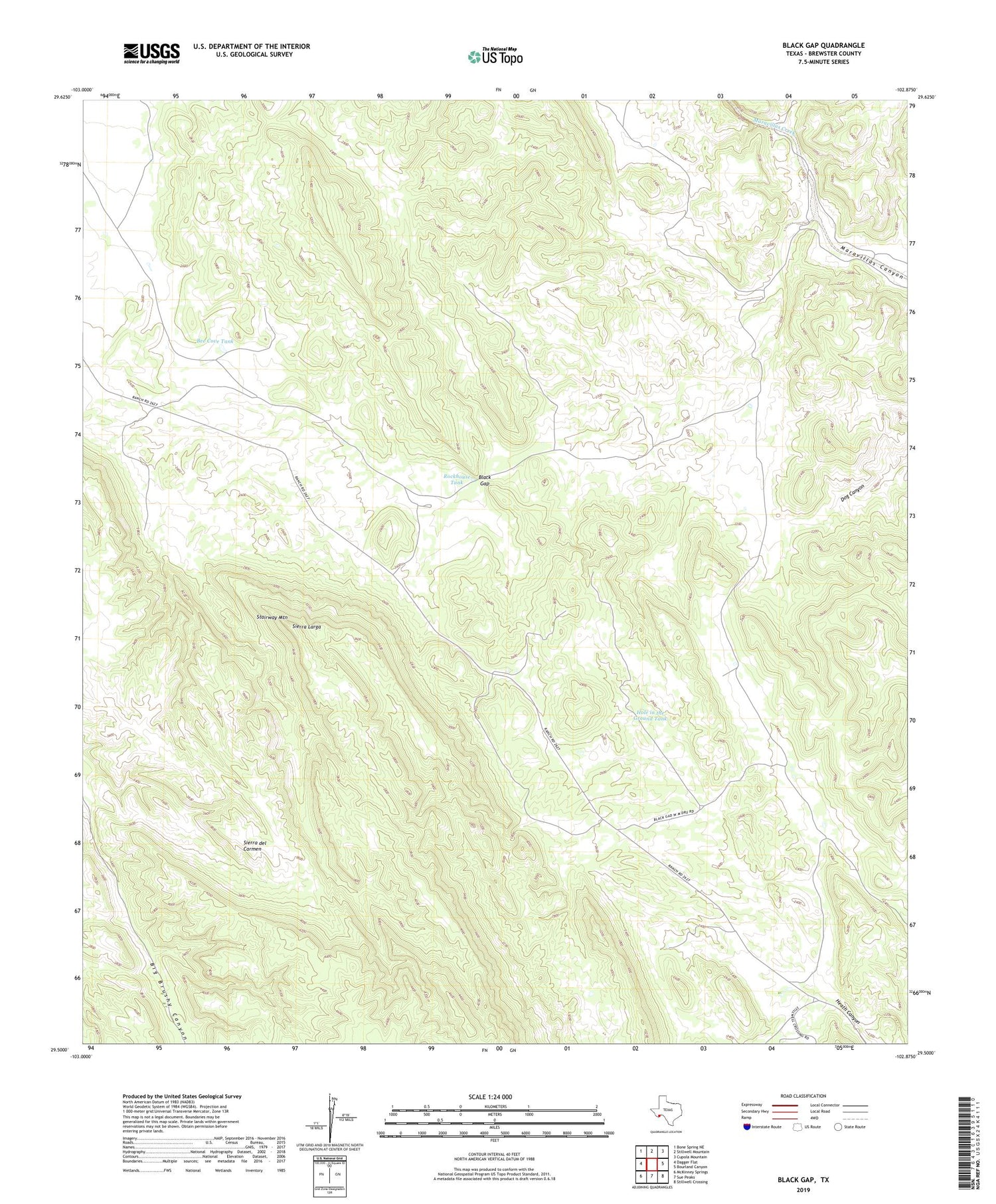
2019 topographic map quadrangle Black Gap in the state of Texas. Scale: 1:24000. Based on the newly updated USGS 7.5' US Topo map series, this map is in the following counties: Brewster. The map contains contour data, water features, and other items you are used to seeing on USGS maps, but also has updated roads and other features. This is the next generation of topographic maps. Printed on high-quality waterproof paper with UV fade-resistant inks.
Quads adjacent to this one:
West: Dagger Flat
Northwest: Bone Spring NE
North: Stillwell Mountain
Northeast: Cupola Mountain
East: Bourland Canyon
Southeast: Stillwell Crossing
South: Sue Peaks
Southwest: McKinney Springs
Contains the following named places: Bee Cove Tank, Black Gap, Black Gap Wildlife Management Area, Black Gap WMA Trail, Dett Tank, Hole in the Ground Tank, Redhouse Tank, Rockhouse Tank, Sierra Larga, Stairway Mountain


