MyTopo
Bourland Canyon Texas US Topo Map
Couldn't load pickup availability
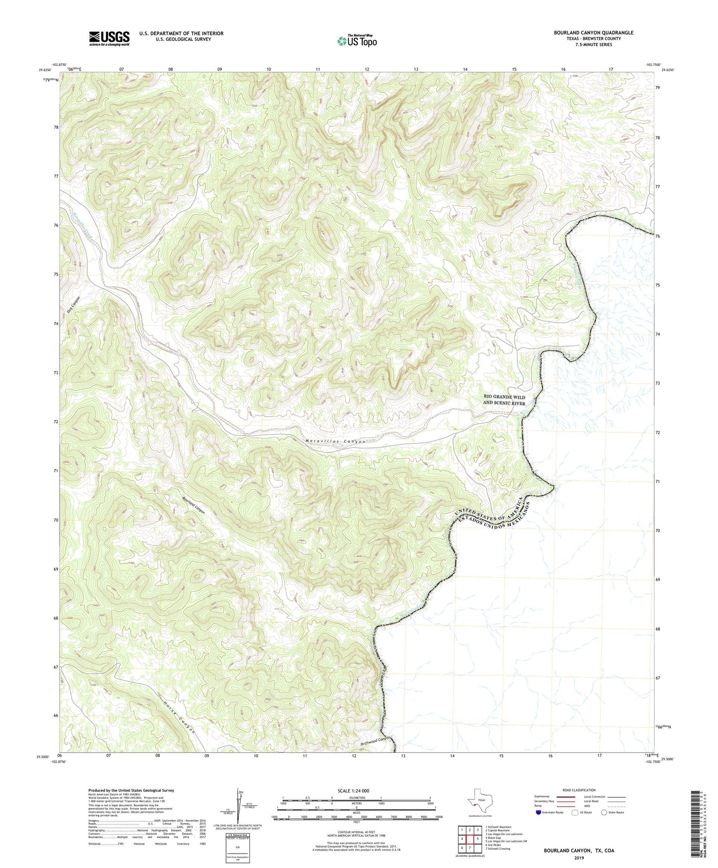
2022 topographic map quadrangle Bourland Canyon in the state of Texas. Scale: 1:24000. Based on the newly updated USGS 7.5' US Topo map series, this map is in the following counties: Brewster. The map contains contour data, water features, and other items you are used to seeing on USGS maps, but also has updated roads and other features. This is the next generation of topographic maps. Printed on high-quality waterproof paper with UV fade-resistant inks.
Quads adjacent to this one:
West: Black Gap
Northwest: Stillwell Mountain
North: Cupola Mountain
Northeast: Las Vegas De Los Ladrones
East: Las Vegas De Los Ladrones SW
South: Stillwell Crossing
Southwest: Sue Peaks
This map covers the same area as the classic USGS quad with code o29102e7.
Contains the following named places: Bourland Canyon, Cochran CountyLibrary, Dog Canyon, Driftwood Canyon, Maravillas Canyon, Maravillas Creek, Maravillas Crossing, Mouth of the Maravillas, Pettit Ranch