MyTopo
Blessing Texas US Topo Map
Couldn't load pickup availability
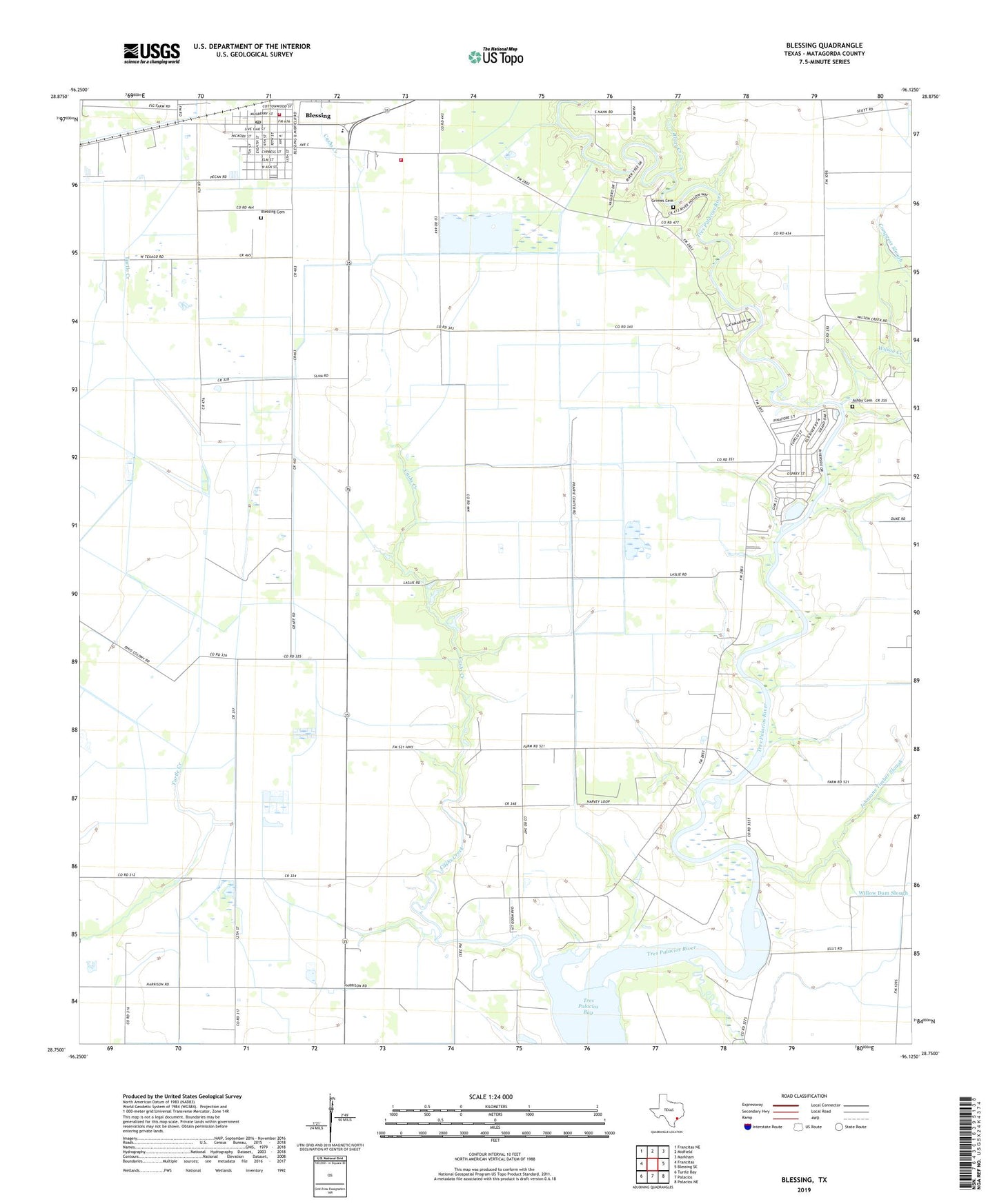
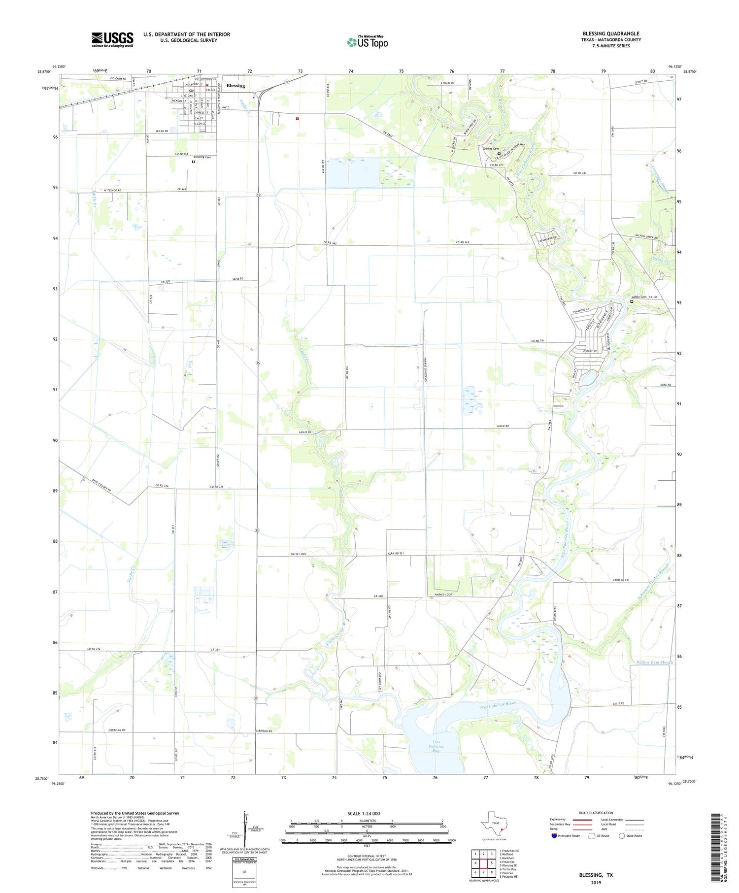
2019 topographic map quadrangle Blessing in the state of Texas. Scale: 1:24000. Based on the newly updated USGS 7.5' US Topo map series, this map is in the following counties: Matagorda. The map contains contour data, water features, and other items you are used to seeing on USGS maps, but also has updated roads and other features. This is the next generation of topographic maps. Printed on high-quality waterproof paper with UV fade-resistant inks.
Quads adjacent to this one:
West: Francitas
Northwest: Francitas NE
North: Midfield
Northeast: Markham
East: Blessing SE
Southeast: Palacios NE
South: Palacios
Southwest: Turtle Bay
Contains the following named places: Ashby Cemetery, Blessing, Blessing Cemetery, Blessing Census Designated Place, Blessing Elementary School, Blessing Post Office, Blessing School, Blessing Volunteer Fire Department, Briar Creek, Cashs Creek, Grimes Cemetery, Hotel Blessing, Johnsons Timber Slough, KMKS-FM (Bay City), KXGJ-FM (Bay City), Pheasant, Prairie Center Mission, Tres Palacios Oaks Volunteer Fire Department, Tres Palacios River, Willow Dam Slough, Wilson Creek, ZIP Code: 77465