MyTopo
Markham Texas US Topo Map
Couldn't load pickup availability
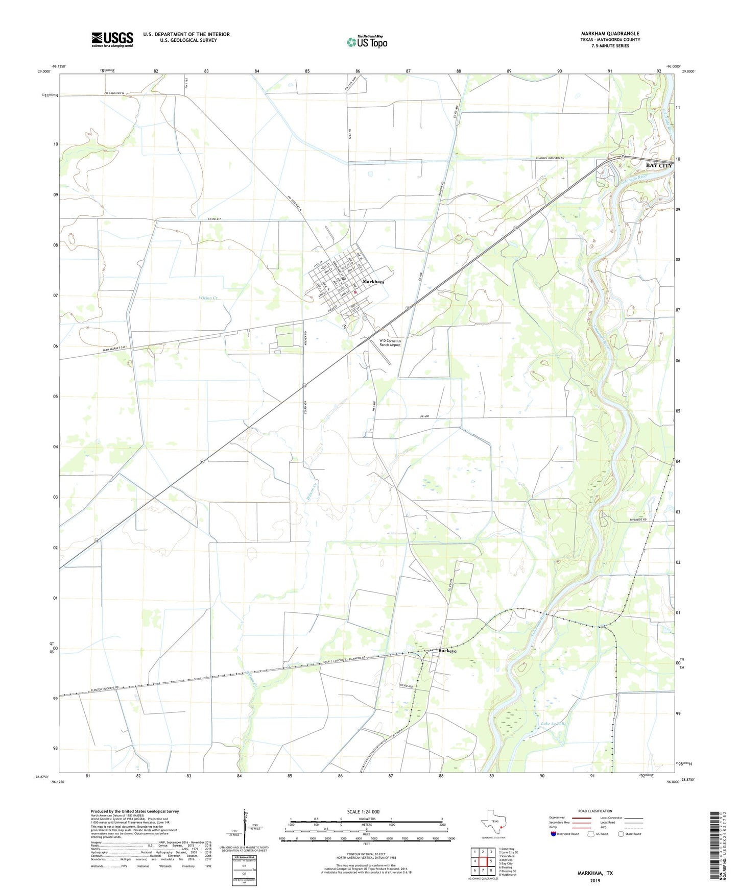
2022 topographic map quadrangle Markham in the state of Texas. Scale: 1:24000. Based on the newly updated USGS 7.5' US Topo map series, this map is in the following counties: Matagorda. The map contains contour data, water features, and other items you are used to seeing on USGS maps, but also has updated roads and other features. This is the next generation of topographic maps. Printed on high-quality waterproof paper with UV fade-resistant inks.
Quads adjacent to this one:
West: Midfield
Northwest: Danevang
North: Lane City SE
Northeast: Van Vleck
East: Bay City
Southeast: Wadsworth
South: Blessing SE
Southwest: Blessing
This map covers the same area as the classic USGS quad with code o28096h1.
Contains the following named places: Bay City Lake, Buckeye, CIG 809 Heliport, Lake Le Tulle, Lcra Dam, Le Tufle Park, Le Tulle Park, Markham, Markham Census Designated Place, Markham Elementary School, Markham Post Office, Markham Volunteer Fire Department, Matagorda County Constable's Office Precinct 4, W D Cornelius Ranch Airport