
MyTopo
Britton Texas US Topo Map
Couldn't load pickup availability
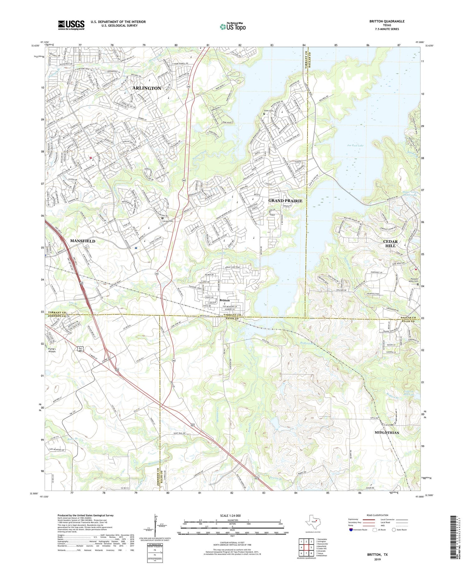
2019 topographic map quadrangle Britton in the state of Texas. Scale: 1:24000. Based on the newly updated USGS 7.5' US Topo map series, this map is in the following counties: Tarrant, Ellis, Dallas, Johnson. The map contains contour data, water features, and other items you are used to seeing on USGS maps, but also has updated roads and other features. This is the next generation of topographic maps. Printed on high-quality waterproof paper with UV fade-resistant inks.
Quads adjacent to this one:
West: Mansfield
Northwest: Kennedale
North: Arlington
Northeast: Duncanville
East: Cedar Hill
Southeast: Midlothian
South: Venus
Southwest: Alvarado
Contains the following named places: Baggett Branch, Bedford Branch, Bowman Branch, Britton, Britton Park, Calvary Cemetery, City of Mansfield, Cottonwood Creek, D P Morris Elementary School, Estes Cemetery, Estes Park, First Baptist Church of Mansfield, Friendship Church, Gifford-Hill Dam, Gifford-Hill Lake, Grassy Creek, Hogpen Branch, Hollings Branch, J L Boren Elementary School, Jack Miller Stolport, Low Branch, Loyd Park, Loyd Park Trail, Lynn Creek, Magic Valley Ranch Lake, Magic Valley Ranch Lake Dam, Mansfield City Park, Mansfield Fire Department Station 2, Mansfield Law Enforcement Center, Mansfield Police Department, Mary Orr Intermediate School, McKnight Park, Methodist Mansfield Medical Center, Newton Branch, North Side Church of Christ, Pleasant Valley Cemetery, Pleasant Valley Park, Reece Branch, Saint Paul Church, Soap Creek, Soil Conservation Service Site 11 Dam, Soil Conservation Service Site 11 Reservoir, Walnut Ridge Baptist Church, Webb Park, Willie Brown Elementary School, ZIP Codes: 75054, 76002


