MyTopo
Venus Texas US Topo Map
Couldn't load pickup availability
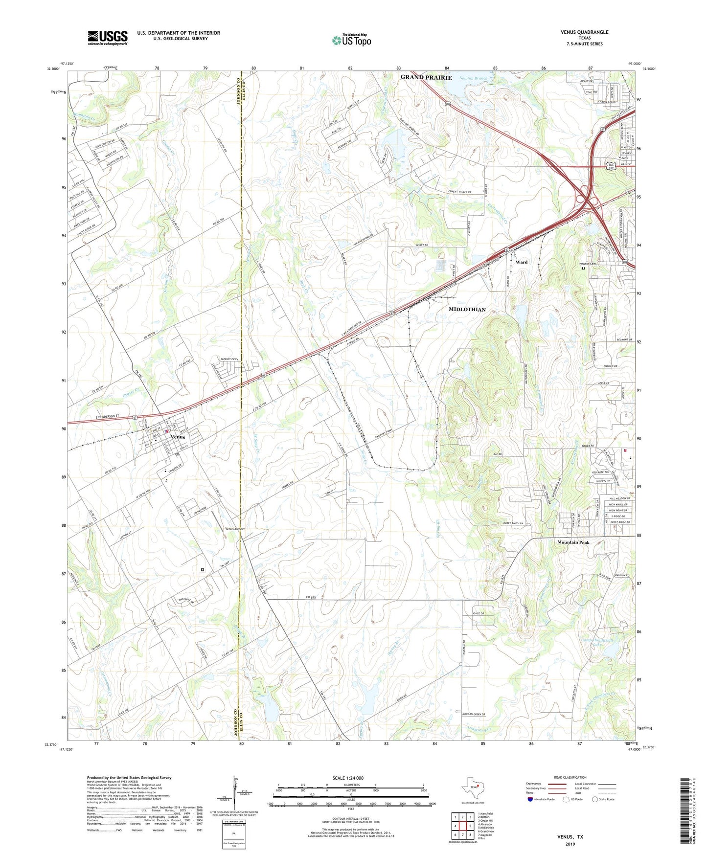
2022 topographic map quadrangle Venus in the state of Texas. Scale: 1:24000. Based on the newly updated USGS 7.5' US Topo map series, this map is in the following counties: Ellis, Johnson. The map contains contour data, water features, and other items you are used to seeing on USGS maps, but also has updated roads and other features. This is the next generation of topographic maps. Printed on high-quality waterproof paper with UV fade-resistant inks.
Quads adjacent to this one:
West: Alvarado
Northwest: Mansfield
North: Britton
Northeast: Cedar Hill
East: Midlothian
Southeast: Boz
South: Maypearl
Southwest: Grandview
This map covers the same area as the classic USGS quad with code o32097d1.
Contains the following named places: Camp Hobilitzelle Lake, Camp Hobilitzelle Lake Dam, Camp Hoblitzelle, Carroll Lake-View Airport, Cement Plant Dam, Cement Plant Lake, Crossroads Lake, Crossroads Lake Dam, Hopewell Church, Irvin Elementary School, Midlothian Division, Mountain Peak, Newton Cemetery, Sanders Estes Correctional Center, Soil Conservation Service Site 10 Dam, Soil Conservation Service Site 10 Reservoir, Soil Conservation Service Site 49a Dam, Soil Conservation Service Site 49a Reservoir, Soil Conservation Service Site 9 Dam, Soil Conservation Service Site 9 Reservoir, Town of Venus, TSA Gliderport, Venus, Venus Airport, Venus City Hall, Venus Police Department, Venus Post Office, Venus Volunteer Fire Department, Ward, West Soap Creek, ZIP Code: 76084