MyTopo
Bronco Texas US Topo Map
Couldn't load pickup availability
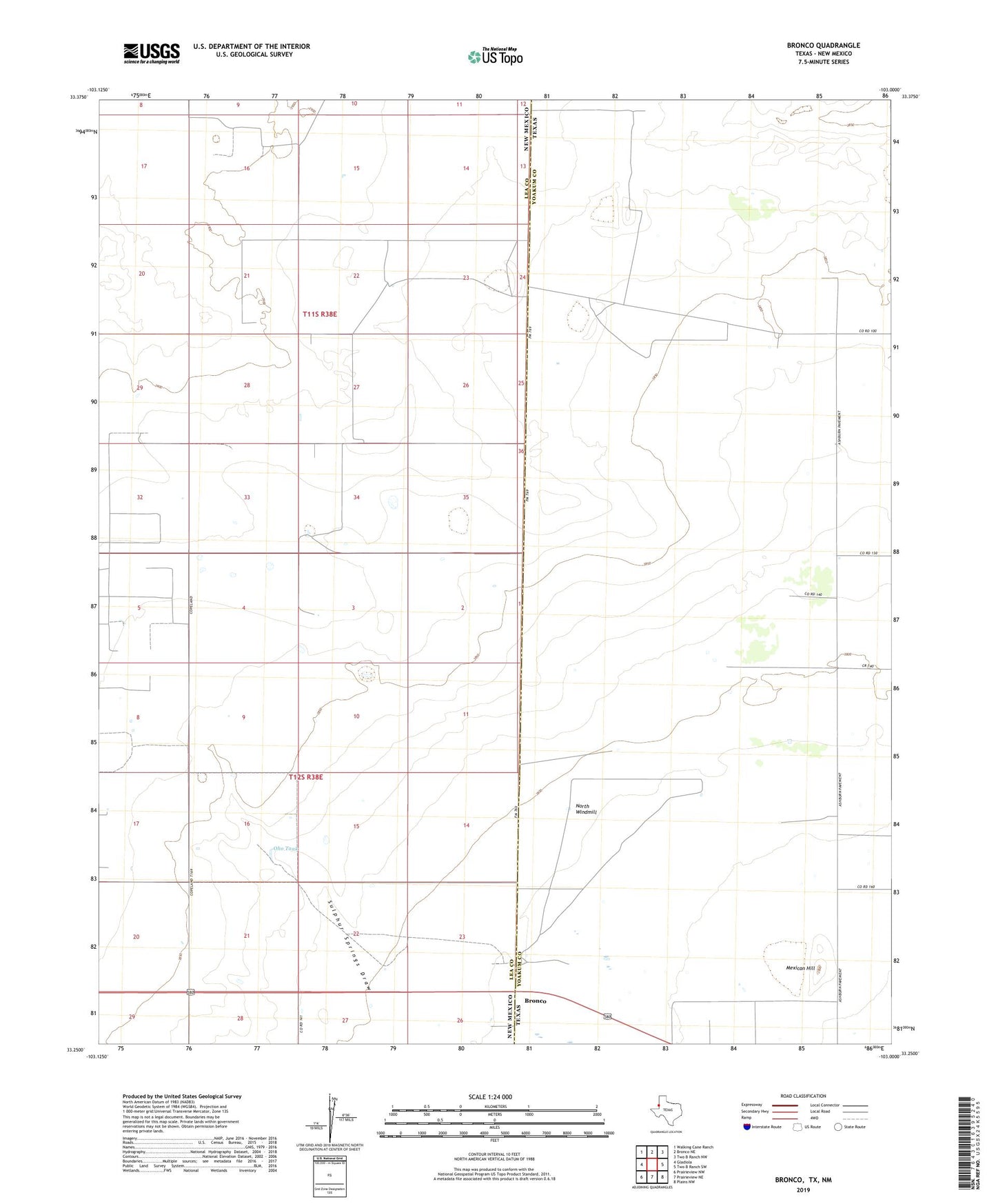
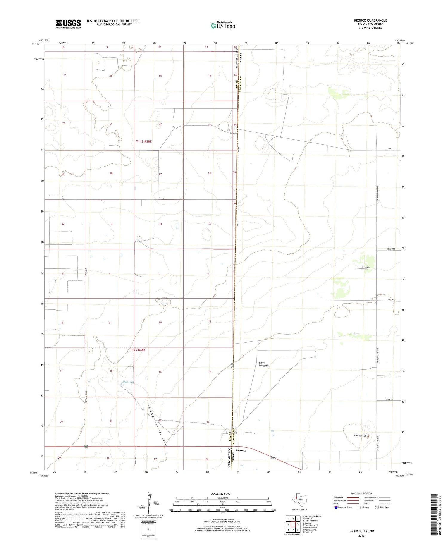
2019 topographic map quadrangle Bronco in the states of New Mexico, Texas. Scale: 1:24000. Based on the newly updated USGS 7.5' US Topo map series, this map is in the following counties: Yoakum, Lea. The map contains contour data, water features, and other items you are used to seeing on USGS maps, but also has updated roads and other features. This is the next generation of topographic maps. Printed on high-quality waterproof paper with UV fade-resistant inks.
Quads adjacent to this one:
West: Gladiola
Northwest: Walking Cane Ranch
North: Bronco NE
Northeast: Two B Ranch NW
East: Two B Ranch SW
Southeast: Plains NW
South: Prairieview NE
Southwest: Prairieview NW
Contains the following named places: 050607 Water Well, 10022 Water Well, 10714 Water Well, 10717 Water Well, 10718 Water Well, 10850 Water Well, 10851 Water Well, 10853 Water Well, 10854 Water Well, 10855 Water Well, 10856 Water Well, 10861 WAter Well, 10862 Water Well, 10863 Water Well, 12711 Water Well, 12790 Water Well, 13400 Water Well, 13402 Water Well, 13555 Water Well, 13560 Water Well, 13561 Water Well, 13562 Water Well, 13563 Water Well, 13565 Water Well, 13566 Water Well, Berry Windmill, Bronco, Bull Pasture Windmill, Center Windmill, Chapman Windmill, Darden Windmill, Dillberry Windmill, Draw Windmill, Dugout Windmill, East Windmill, Fields Oil Field, Government Windmill, High Lonesome Windmill, Lane Windmill, Mexican Hill, Middle Windmill, North Windmill, Northeast Windmill, Northwest Windmill, Oho Tank, Oho Windmill, Pit Windmill, Rumph Windmill, South Berry Windmill, West Windmill, Wilkes Windmill