MyTopo
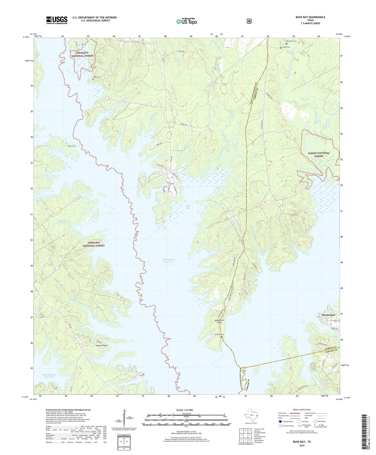
Buck Bay Texas US Topo Map
Couldn't load pickup availability
2019 topographic map quadrangle Buck Bay in the state of Texas. Scale: 1:24000. Based on the newly updated USGS 7.5' US Topo map series, this map is in the following counties: San Augustine, Sabine, Jasper. The map contains contour data, water features, and other items you are used to seeing on USGS maps, but also has updated roads and other features. This is the next generation of topographic maps. Printed on high-quality waterproof paper with UV fade-resistant inks.
Quads adjacent to this one:
West: Veach
Northwest: Harvey Creek
North: Bronson
Northeast: Pineland North
East: Pineland South
Southeast: Harrisburg
South: McGee Bend
Southwest: Ebenezer
Contains the following named places: Ayish Bayou, Bayou Boat Launch, Big Flat Branch, Blackland Cemetery, Boggy Branch, Briar Branch, Buck Bay, Buck Branch, Caney Creek, Couchatana Creek, Easley Creek, Hines Cemetery, Huckleberry Creek, Indian Camp Branch, Lakey Cemetery, Lane Creek, Little Creek, Little Flat Branch, Massey-Good Branch, McKim Creek, Mill Creek, Mill Creek Park Campground, Miller Cemetery, Miller Creek, Millertown, Mills Creek Park, Needmore, Needmore Point, Owl Creek, Parker Cemetery, Parkway, Pigeon Roost Creek, Pomponaugh Creek, Powell Park, Powell Point, Powell Town Volunteer Fire Department, San Augustine Park, San Augustine Park Campground, Sandy Creek, Trout Bayou, Williams Cemetery