MyTopo
Ebenezer Texas US Topo Map
Couldn't load pickup availability
Also explore the Ebenezer Forest Service Topo of this same quad for updated USFS data
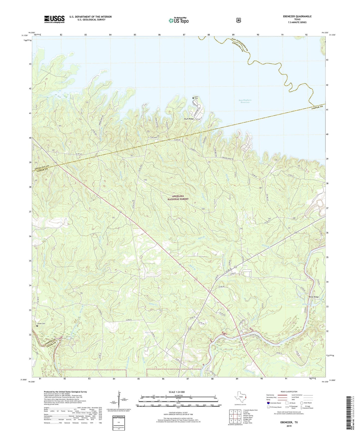
2022 topographic map quadrangle Ebenezer in the state of Texas. Scale: 1:24000. Based on the newly updated USGS 7.5' US Topo map series, this map is in the following counties: Jasper, Angelina, San Augustine, Tyler. The map contains contour data, water features, and other items you are used to seeing on USGS maps, but also has updated roads and other features. This is the next generation of topographic maps. Printed on high-quality waterproof paper with UV fade-resistant inks.
Quads adjacent to this one:
West: Boykin Spring
Northwest: Cassells-Boykin Park
North: Veach
Northeast: Buck Bay
East: McGee Bend
Southeast: Jasper West
South: Pace Hill
Southwest: Boggy Lake
This map covers the same area as the classic USGS quad with code o31094a2.
Contains the following named places: Beech Grove Branch, Black Branch, Boggy Creek, Buck Branch, Clear Creek, Cypress Branch, Dudley Branch, Ebenezer, Ferguson, Fuller Branch, Harveytown, Hensarling Cemetery, Hitt Lake, Hitt Lake Dam, Jordan Cemetery, Letney Recreation Site, May Branch, McGilberry Branch, Norris Creek, Parker Cemetery, Parker Creek, Parker Point, Plum Ridge, Plum Ridge Church, River Ridge, Rocky Branch, Salt Lick Branch, Sam Rayburn Reservoir, Sandy Creek, Sandy Creek Recreation Site, Shearwood Creek, Speir Branch, Speir Cemetery, Sulphur Spring Branch, Townsend Creek, Trout Creek, Ward Branch, Westwood, Zavala