MyTopo
Buckhorn Draw East Texas US Topo Map
Couldn't load pickup availability
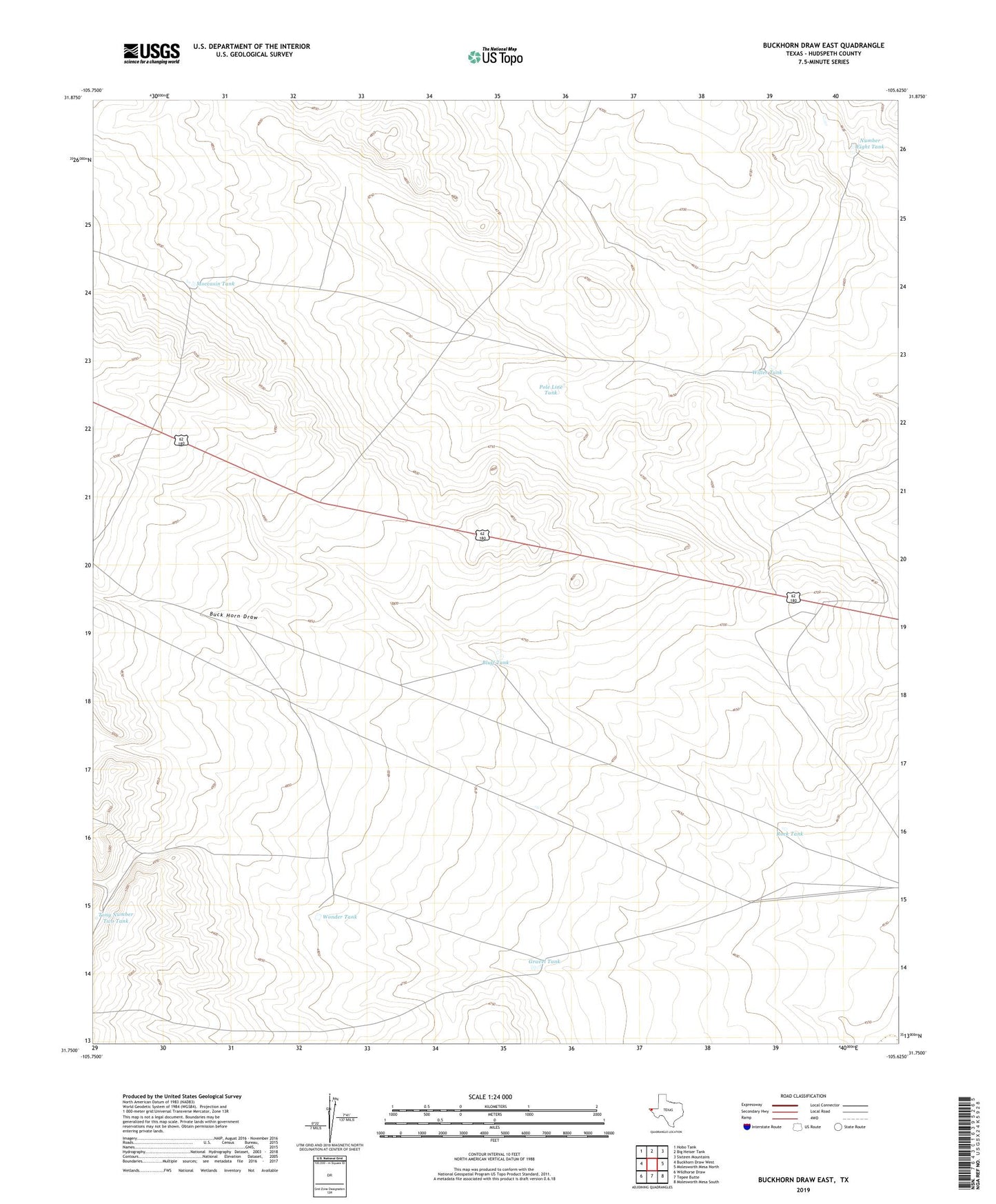
2019 topographic map quadrangle Buckhorn Draw East in the state of Texas. Scale: 1:24000. Based on the newly updated USGS 7.5' US Topo map series, this map is in the following counties: Hudspeth. The map contains contour data, water features, and other items you are used to seeing on USGS maps, but also has updated roads and other features. This is the next generation of topographic maps. Printed on high-quality waterproof paper with UV fade-resistant inks.
Quads adjacent to this one:
West: Buckhorn Draw West
Northwest: Hobo Tank
North: Big Heiser Tank
Northeast: Sixteen Mountains
East: Molesworth Mesa North
Southeast: Molesworth Mesa South
South: Tepee Butte
Southwest: Wildhorse Draw
Contains the following named places: Bluff Tank, Gravel Tank, Moccasin Tank, Number Eight Tank, Pole Line Tank, Rock Tank, Tony Number Two Tank, Willer Tank, Wonder Tank