MyTopo
Buffalo Gap Texas US Topo Map
Couldn't load pickup availability
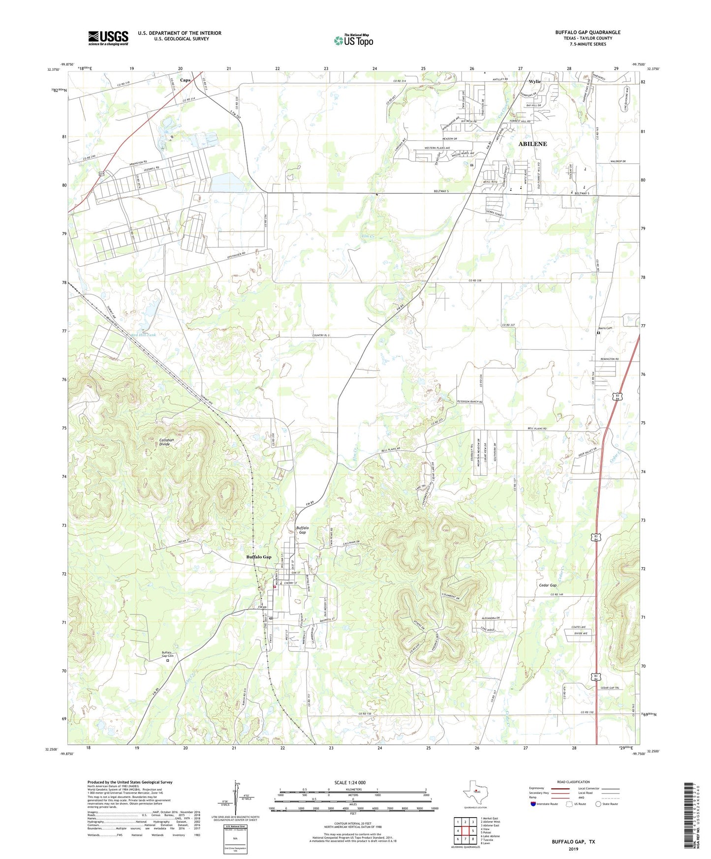
2019 topographic map quadrangle Buffalo Gap in the state of Texas. Scale: 1:24000. Based on the newly updated USGS 7.5' US Topo map series, this map is in the following counties: Taylor. The map contains contour data, water features, and other items you are used to seeing on USGS maps, but also has updated roads and other features. This is the next generation of topographic maps. Printed on high-quality waterproof paper with UV fade-resistant inks.
Quads adjacent to this one:
West: View
Northwest: Merkel East
North: Abilene West
Northeast: Abilene East
East: Potosi
Southeast: Lawn
South: Tuscola
Southwest: Lake Abilene
Contains the following named places: Abilene Speedway, Beltway Park Baptist Church, Buffalo Gap, Buffalo Gap Cemetery, Buffalo Gap Historic Village, Buffalo Gap Post Office, Buffalo Gap Volunteer Fire Department, Butterfield School, Callahan Divide, Caps, Caps Cemetery, Cedar Gap, Cedar Gap Cemetery, Feed Lot Tank, Feed Lot Tank Dam, Flying W Airport, Iberis Cemetery, Lake Abilene Filter Plant, Oakridge Church of Christ, Old Taylor County Courthouse and Jail, Red Hill Tank, Red Hill Tank Dam, Shades of Hope Rehabilitation Center, Town of Buffalo Gap, Wylie, Wylie High School, Wylie Intermediate School, Wylie Junior High School, Wylie Middle School, Wylie United Methodist Church, Wylie West Elementary School, ZIP Codes: 79508, 79606