MyTopo
Tuscola Texas US Topo Map
Couldn't load pickup availability
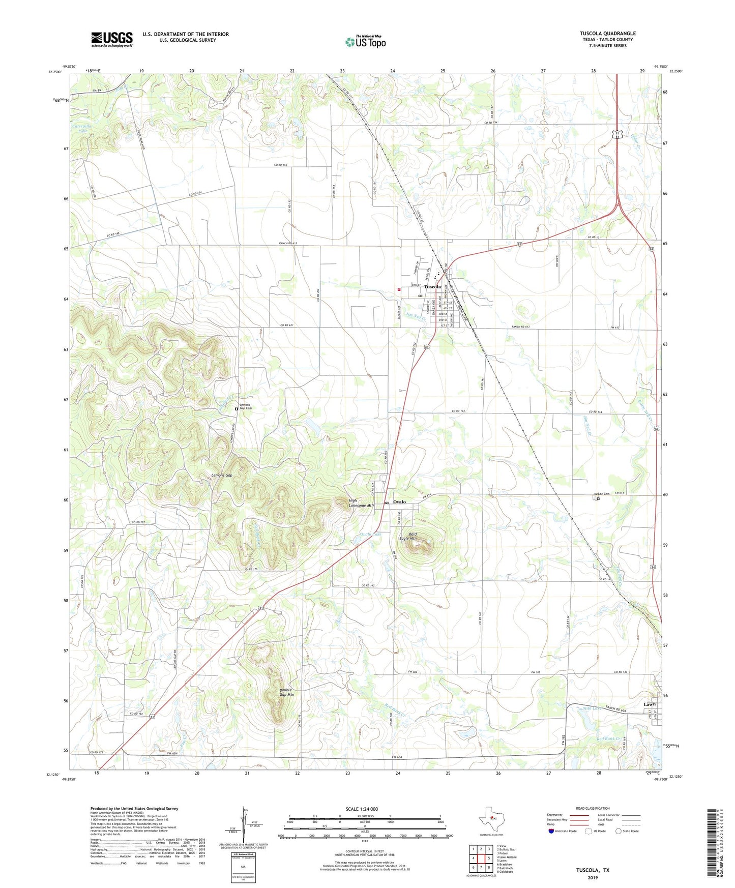
2022 topographic map quadrangle Tuscola in the state of Texas. Scale: 1:24000. Based on the newly updated USGS 7.5' US Topo map series, this map is in the following counties: Taylor. The map contains contour data, water features, and other items you are used to seeing on USGS maps, but also has updated roads and other features. This is the next generation of topographic maps. Printed on high-quality waterproof paper with UV fade-resistant inks.
Quads adjacent to this one:
West: Lake Abilene
Northwest: View
North: Buffalo Gap
Northeast: Potosi
East: Lawn
Southeast: Goldsboro
South: Bald Knob
Southwest: Bradshaw
This map covers the same area as the classic USGS quad with code o32099b7.
Contains the following named places: Bald Eagle Mountain, Booker Cemetery, Camp Tonkawa, Caterpillar Lake, City of Tuscola, Double Gap Mountain, East Jim Ned Creek, Guion, High Lonesome Mountain, Jim Ned Division, Jim Ned High School, Jim Ned Middle School, Jim Ned Volunteer Fire Department, Lake Stith Dam, Lemons Gap, Lemons Gap Cemetery, McBee Cemetery, Ovalo, Ovalo Lake, Ovalo Post Office, Snodgrass Cemetery, Soil Conservation Service Site 17b1 Dam, Soil Conservation Service Site 17b1 Reservoir, South Taylor Emergency Medical Service, Stith Lake, Taylor County Constable Office Precinct 3, Town of Lawn, Tuscola, Tuscola Cemetery, Tuscola Fire Department, Tuscola Post Office, ZIP Codes: 79541, 79562