MyTopo
Lake Abilene Texas US Topo Map
Couldn't load pickup availability
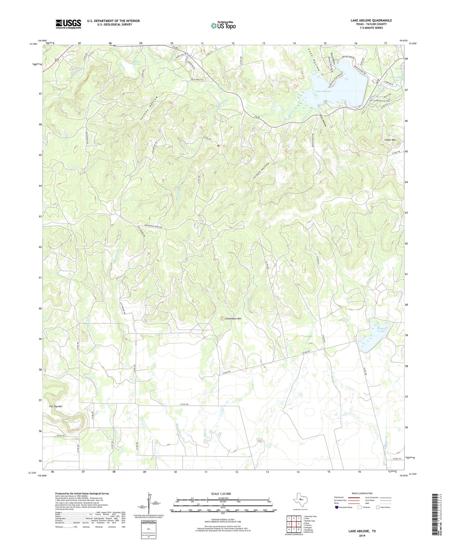
2022 topographic map quadrangle Lake Abilene in the state of Texas. Scale: 1:24000. Based on the newly updated USGS 7.5' US Topo map series, this map is in the following counties: Taylor. The map contains contour data, water features, and other items you are used to seeing on USGS maps, but also has updated roads and other features. This is the next generation of topographic maps. Printed on high-quality waterproof paper with UV fade-resistant inks.
Quads adjacent to this one:
West: Shep
Northwest: Mountain Pass
North: View
Northeast: Buffalo Gap
East: Tuscola
Southeast: Bald Knob
South: Bradshaw
Southwest: Wingate
This map covers the same area as the classic USGS quad with code o32099b8.
Contains the following named places: Abilene State Park, Abilene State Park Trail, Brock Hollow, Cedar Creek, Coon Hollow, Elm Creek Citizens Association Volunteer Fire Department Station 2, Graham Lake, Horse Fall Creek, Indian Mountain, Jordan Hollow, Lake Abilene, Lake Abilene Dam, Lake Bulger Dam, Little Elm Creek, Pleasant Run, Puckett Springs, Scott Hollow, Steamboat Mountain, Tenant Hollow