MyTopo
Buffalo Stadium Texas US Topo Map
Couldn't load pickup availability
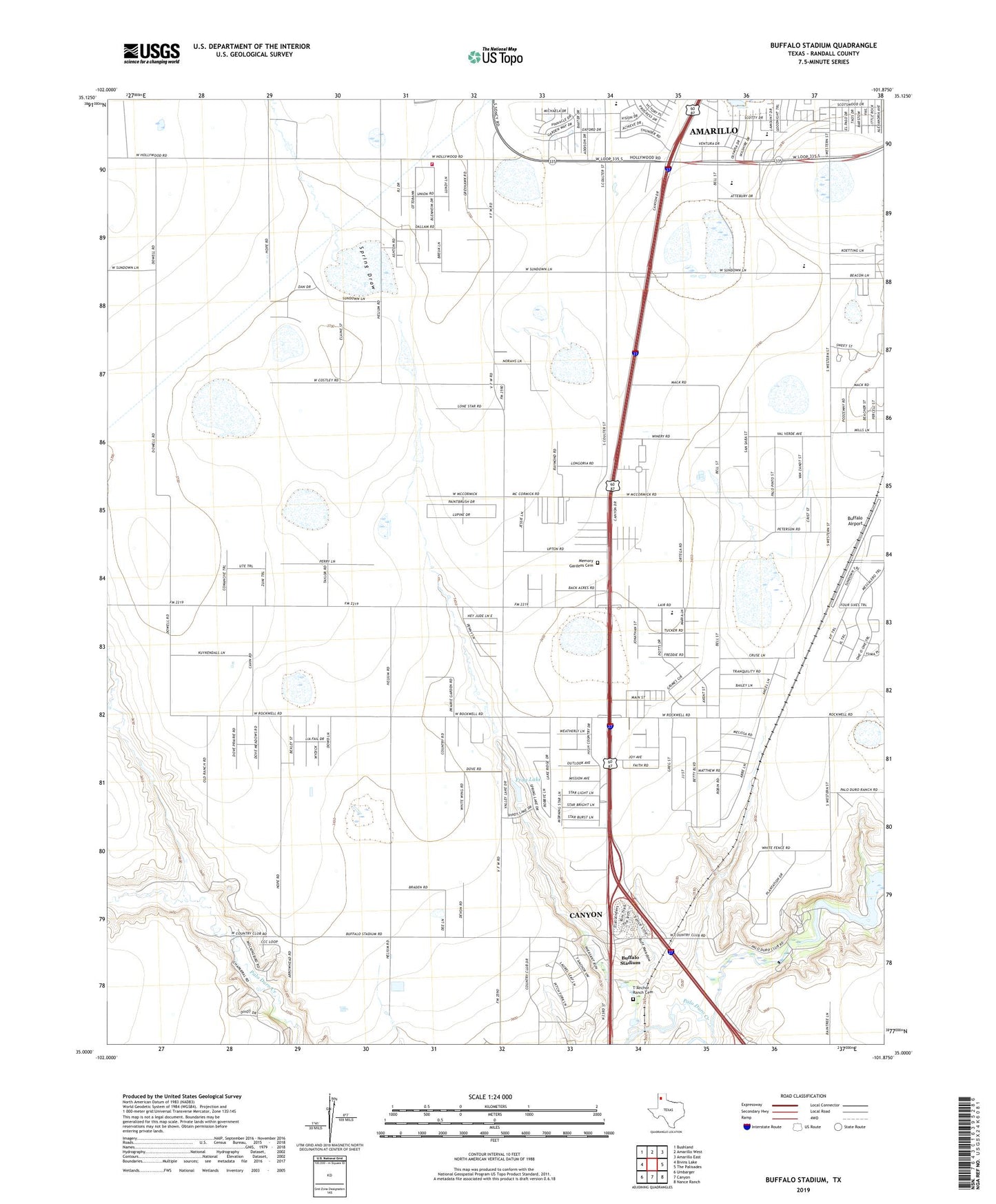
2019 topographic map quadrangle Buffalo Stadium in the state of Texas. Scale: 1:24000. Based on the newly updated USGS 7.5' US Topo map series, this map is in the following counties: Randall. The map contains contour data, water features, and other items you are used to seeing on USGS maps, but also has updated roads and other features. This is the next generation of topographic maps. Printed on high-quality waterproof paper with UV fade-resistant inks.
Quads adjacent to this one:
West: Bivins Lake
Northwest: Bushland
North: Amarillo West
Northeast: Amarillo East
East: The Palisades
Southeast: Nance Ranch
South: Canyon
Southwest: Umbarger
Contains the following named places: Amarillo Division, Amarillo Trinity Fellowship School Stadium, Buffalo Airport, Buffalo Stadium, Canyon City Club, Frog Dam, Frog Lake, Gene Howe Elementary School, KPUR-FM (Canyon), Lakeview Elementary School, Lamount Drive Baptist Church, Maples Field, Memory Gardens Cemetery, North Randall Division, Palo Duro Club Lake, Palo Duro Club Lake Dam, Palo Duro Creek, Randall County Fire and Rescue Station 2, Randall High School, Rockwell Place, Rockwell Place Census Designated Place, Spring Draw, Sundown Lane Elementary School, T-Anchor Ranch Cemetery, Tierra Blanca Creek, Valleyview Junior High School