MyTopo
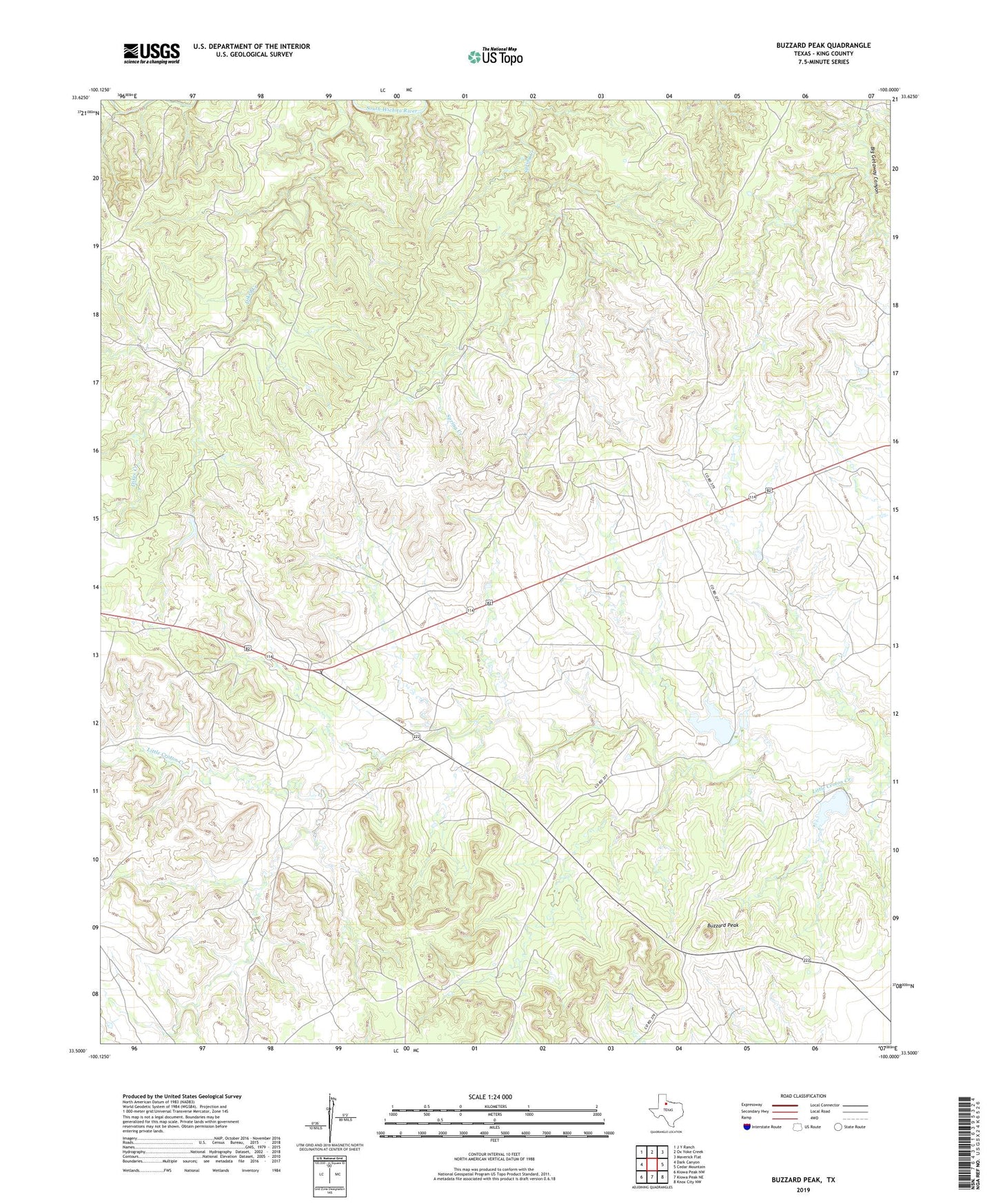
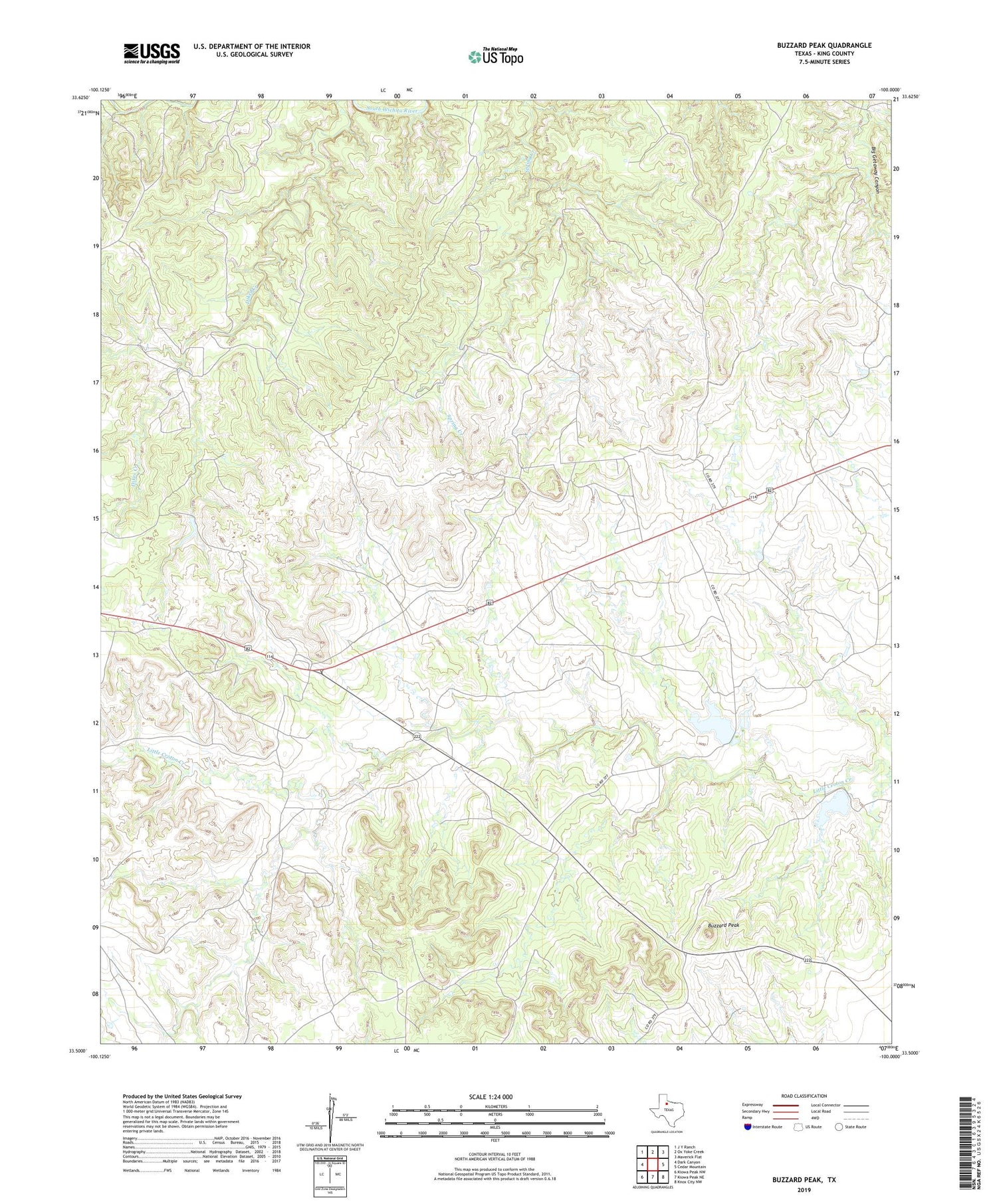
Buzzard Peak Texas US Topo Map
Couldn't load pickup availability
2019 topographic map quadrangle Buzzard Peak in the state of Texas. Scale: 1:24000. Based on the newly updated USGS 7.5' US Topo map series, this map is in the following counties: King. The map contains contour data, water features, and other items you are used to seeing on USGS maps, but also has updated roads and other features. This is the next generation of topographic maps. Printed on high-quality waterproof paper with UV fade-resistant inks.
Quads adjacent to this one:
West: Dark Canyon
Northwest: J Y Ranch
North: Ox Yoke Creek
Northeast: Maverick Flat
East: Cedar Mountain
Southeast: Knox City NW
South: Kiowa Peak NE
Southwest: Kiowa Peak NW
Contains the following named places: Buzzard Peak, Lower Blakey Windmill, Moorhouse Lake, Moorhouse Lake Dam, Moorhouse Ranch, Ross Ranch, Snake Den Tank, Snake Den Tank Dam, Upper Blakey Windmill