MyTopo
Camp Bullis Texas US Topo Map
Couldn't load pickup availability
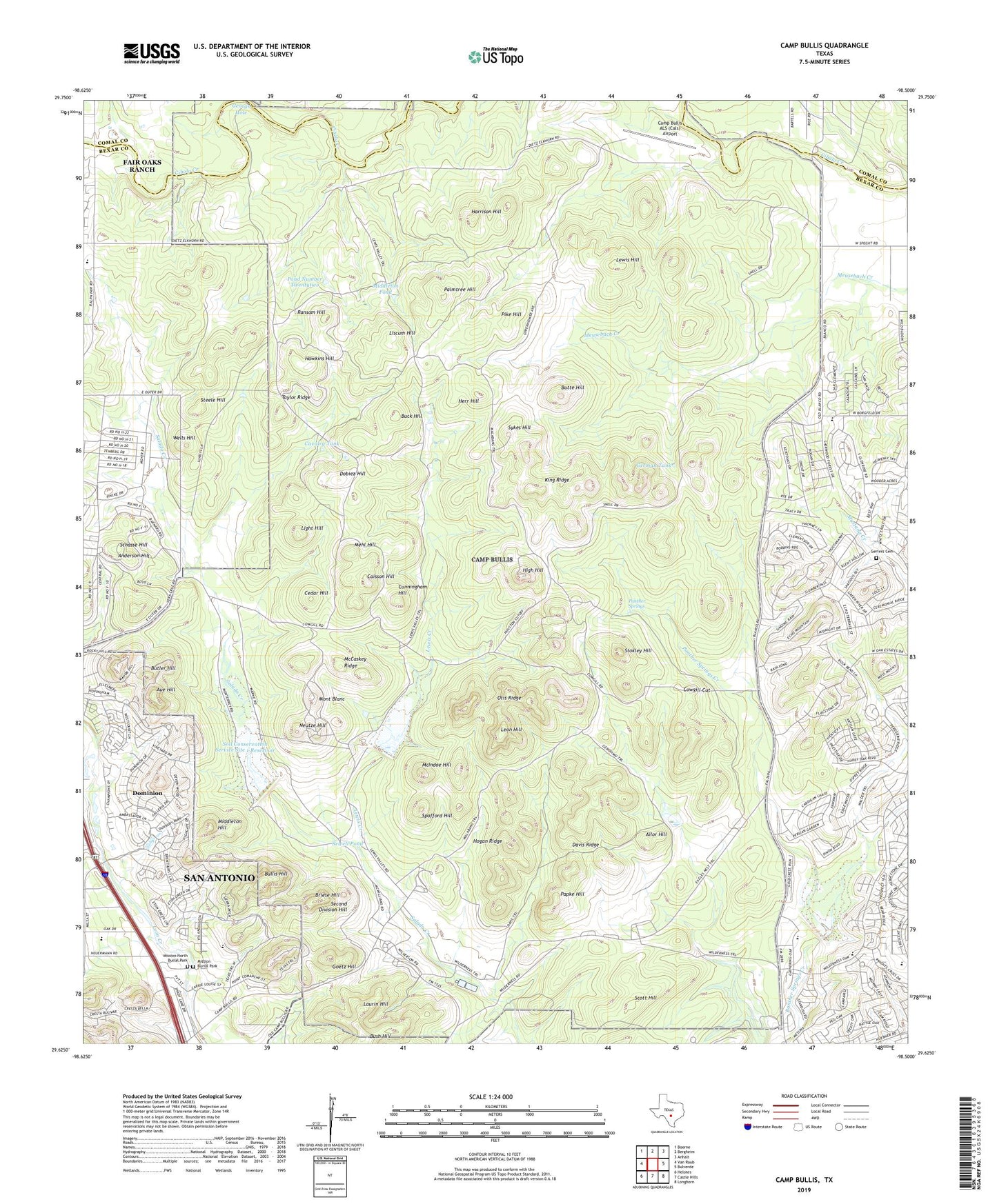
2019 topographic map quadrangle Camp Bullis in the state of Texas. Scale: 1:24000. Based on the newly updated USGS 7.5' US Topo map series, this map is in the following counties: Bexar, Comal. The map contains contour data, water features, and other items you are used to seeing on USGS maps, but also has updated roads and other features. This is the next generation of topographic maps. Printed on high-quality waterproof paper with UV fade-resistant inks.
Quads adjacent to this one:
West: Van Raub
Northwest: Boerne
North: Bergheim
Northeast: Anhalt
East: Bulverde
Southeast: Longhorn
South: Castle Hills
Southwest: Helotes
Contains the following named places: Ailor Hill, Anderson Hill, Aue Hill, Blanco Road Park, Bridgewood Wastewater Treatment Plant, Briese Hill, Buck Hill, Bullis Hill, Bush Hill, Butler Hill, Butte Hill, Caisson Hill, Camp Bullis ALS (Cals) Airport, Camp Bullis Heliport, Cavalry Tank, Cedar Hill, Cowgill Cut, Cunningham Hill, Davis Ridge, DeLeon City County Library, Dobiez Hill, Dominion, Eagles Nest Trail, Fair Oaks Ranch Elementary School, Georgs Hole, Gerfers Cemetery, German Tank, Goetz Hill, Harrison Hill, Hawkins Hill, Herr Hill, High Hill, Hogan Ridge, King Ridge, Laurin Hill, Leon Hill, Leon Springs Church, Lewis Creek, Lewis Hill, Lewis Valley Trail, Light Hill, Liscum Hill, Malabang Trail, McCaskey Ridge, McIndoe Hill, Mehl Hill, Middleton Hill, Middleton Pond, Mission Burial Park, Mission North Burial Park, Mont Blanc, Neutze Hill, Otis Ridge, Palmtree Hill, Panther Spring Park, Panther Springs, Papke Hill, Pike Hill, Pond Number Twentytwo, Ransom Hill, Rolling Hills Academy, Russell Park, San Antonio North Division, Schasse Hill, Scott Hill, Second Division Hill, Sewell Pond, Soil Conservation Service Site 1 Dam, Soil Conservation Service Site 1 Reservoir, Soil Conservation Service Site 2 Dam, Soil Conservation Service Site 2 Reservoir, Soil Conservation Service Site 5 Dam, Soil Conservation Service Site 5 Reservoir, Spofford Hill, Steele Hill, Stokley Hill, Stone Oak Presbyterian Church, Sykes Hill, Taylor Ridge, Texas Military Institute Stadium, Texas Miltary Institute Baseball Field, Wells Hill, Wilderness Trail, ZIP Code: 78257