MyTopo
Bergheim Texas US Topo Map
Couldn't load pickup availability
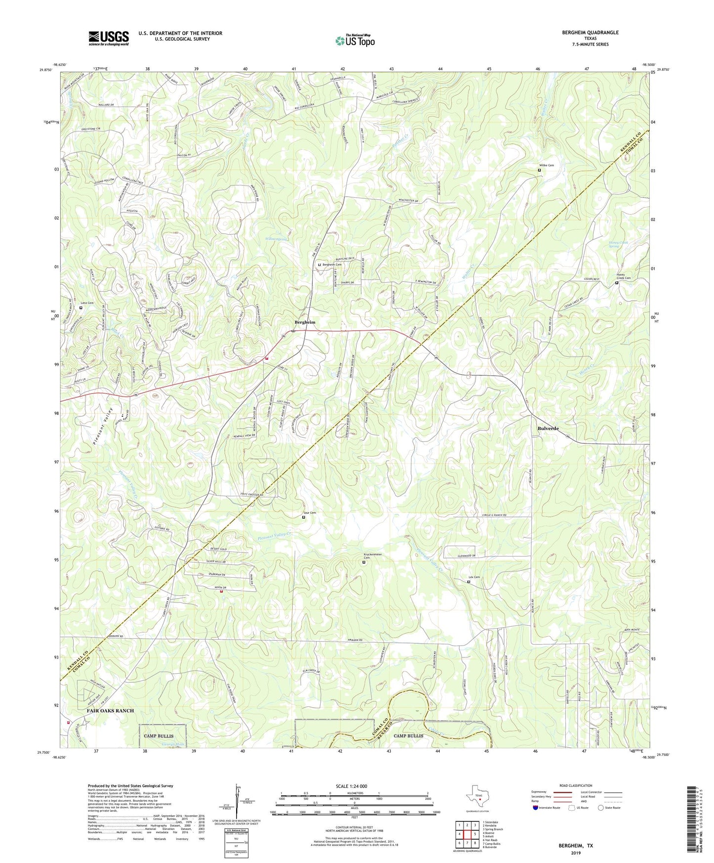
2022 topographic map quadrangle Bergheim in the state of Texas. Scale: 1:24000. Based on the newly updated USGS 7.5' US Topo map series, this map is in the following counties: Comal, Kendall, Bexar. The map contains contour data, water features, and other items you are used to seeing on USGS maps, but also has updated roads and other features. This is the next generation of topographic maps. Printed on high-quality waterproof paper with UV fade-resistant inks.
Quads adjacent to this one:
West: Boerne
Northwest: Sisterdale
North: Kendalia
Northeast: Spring Branch
East: Anhalt
Southeast: Bulverde
South: Camp Bullis
Southwest: Van Raub
This map covers the same area as the classic USGS quad with code o29098g5.
Contains the following named places: Bergheim, Bergheim Post Office, Bulverde Fire Department Station 3, Bulverde West, Canyon View Acres, City of Fair Oaks Ranch Fire Station 3, Grosser Airport, Guadalupe River State Park, Honey Creek, Honey Creek Cemetery, Honey Creek Spring, Kruckemeier Cemetery, Lenz Cemetery, Lex Cemetery, Oak Cliff Acres, Pleasant Valley, Pleasant Valley Creek, Saint Joseph Catholic Church, Saint Joseph Chapel, Saint Joseph Honey Creek Cemetery Number 3, Saur Cemetery, Silver Hills, Smith Cemetery, Willke Cemetery, Willow Spring