MyTopo
Boerne Texas US Topo Map
Couldn't load pickup availability
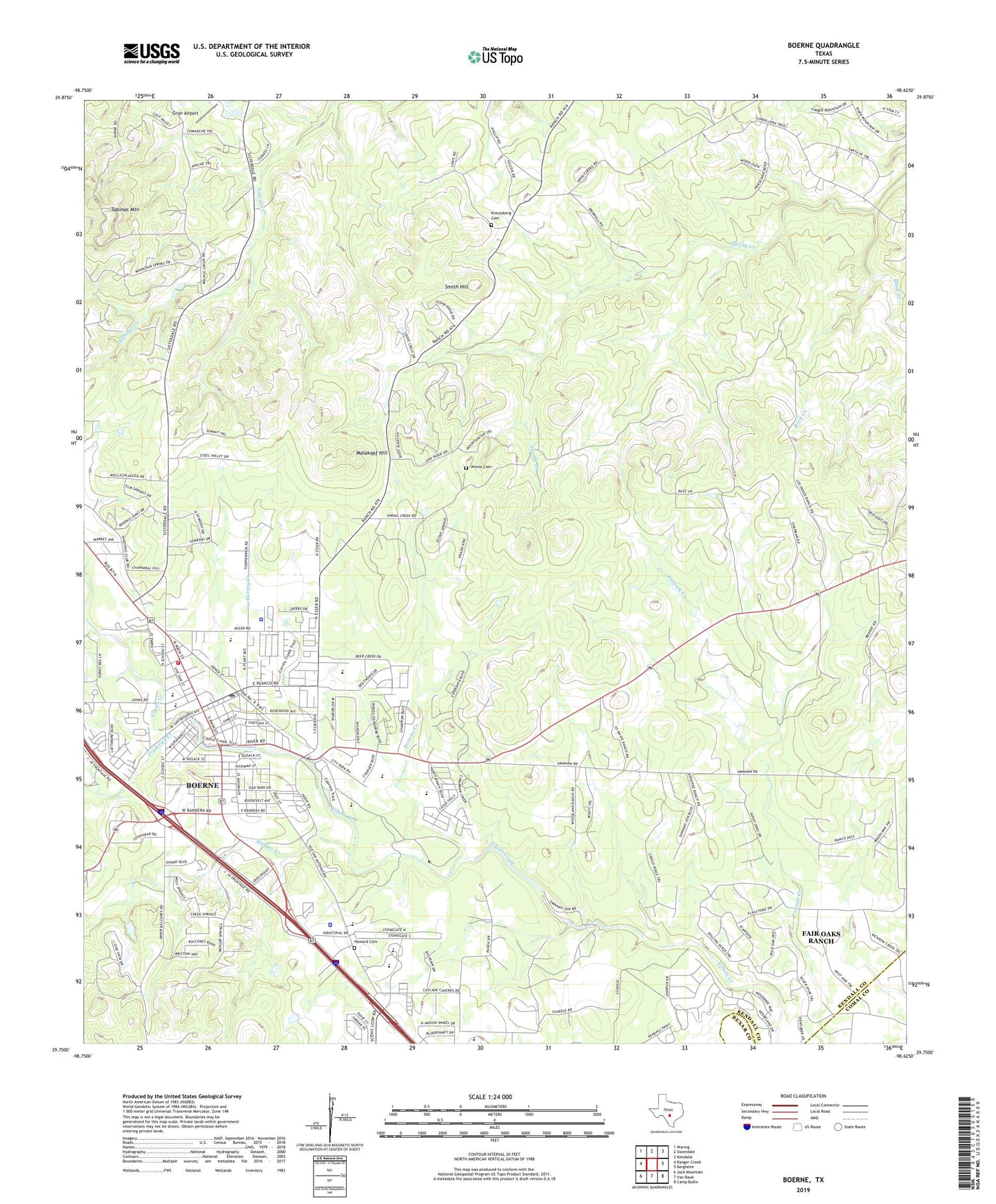
2022 topographic map quadrangle Boerne in the state of Texas. Scale: 1:24000. Based on the newly updated USGS 7.5' US Topo map series, this map is in the following counties: Kendall, Comal, Bexar. The map contains contour data, water features, and other items you are used to seeing on USGS maps, but also has updated roads and other features. This is the next generation of topographic maps. Printed on high-quality waterproof paper with UV fade-resistant inks.
Quads adjacent to this one:
West: Ranger Creek
Northwest: Waring
North: Sisterdale
Northeast: Kendalia
East: Bergheim
Southeast: Camp Bullis
South: Van Raub
Southwest: Jack Mountain
This map covers the same area as the classic USGS quad with code o29098g6.
Contains the following named places: Assembly of God Church, Benedictine Convent, Black Creek, Boerne, Boerne Cemetery, Boerne City Hall, Boerne City Park, Boerne Community Center, Boerne Division, Boerne Fire Department, Boerne High School, Boerne Library, Boerne Middle School, Boerne Middle School North, Boerne Middle School South, Boerne Park Lake, Boerne Police Department, Boerne Post Office, Boerne State Park Dam, Browns Creek, BYAA Merchant Field, Church of Christ, Cibolo Nature Center Trail, City of Boerne, Curington Elementary School, Currey Creek, Currey Creek Baptist Church, Electric Substation, Fabra Elementary School, First Baptist Church, First United Methodist Church, Frederick Creek, Grier Airport, Herff Park Fairground, Howard Cemetery, Jehovahs Witnesses of Boerne, Jesus Name Full Gospel Church, John Henry Key Airport, Joseph Dienger Building, KBRN-AM (Boerne), Kendall County Constable's Office Precinct 3, Kendall County Constable's Office Precincts 1 and 2, Kendall County Courthouse, Kendall County Emergency Medical Service, Kendall County EMS, Kendall County Sheriff's Office, Kendall Elementary School, Kendall Inn, Kreutzberg, Kreutzberg Cemetery, Kulmann-King House, Malakopf Hill, Menger Creek, Panther Creek School, Pleasant Valley Community Center, Pleasant Valley School, Rock Creek, Sabinas Mountain, Saint Helenas Episcopal Church, Saint John Lutheran Church, Saint Johns Anglican Church, Saint Mark Presbyterian Church, Saint Peter the Apostle Catholic Church, Smith Hill, The Church of Jesus Christ of Latter Day Saints, Walnut Grove, Wrenn Cemetery, ZIP Code: 78006