
MyTopo
Camp Wood Texas US Topo Map
Couldn't load pickup availability
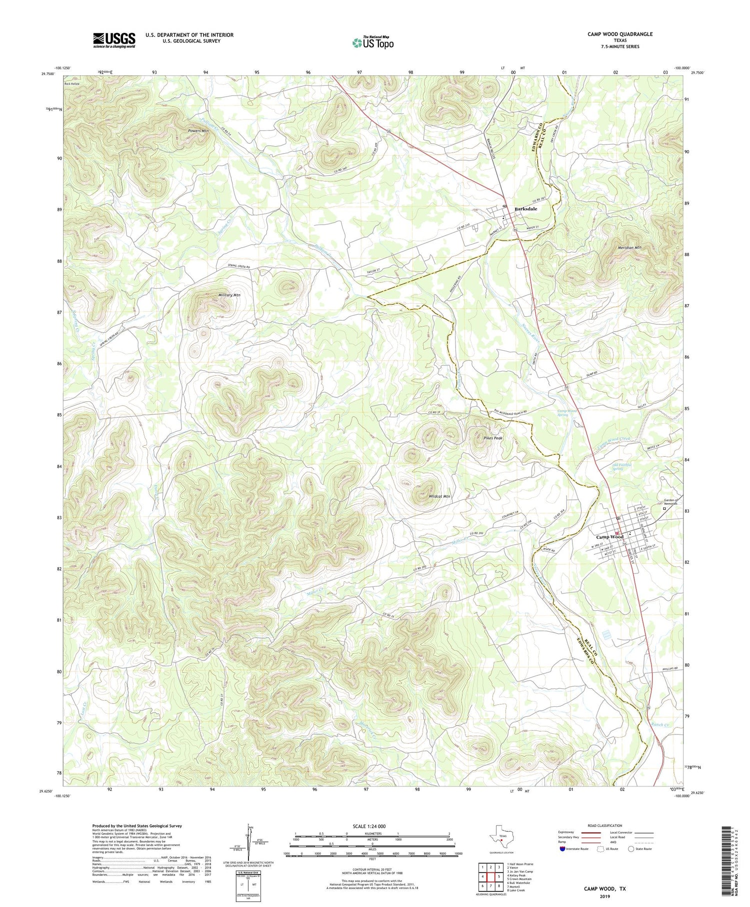
2019 topographic map quadrangle Camp Wood in the state of Texas. Scale: 1:24000. Based on the newly updated USGS 7.5' US Topo map series, this map is in the following counties: Edwards, Real. The map contains contour data, water features, and other items you are used to seeing on USGS maps, but also has updated roads and other features. This is the next generation of topographic maps. Printed on high-quality waterproof paper with UV fade-resistant inks.
Quads adjacent to this one:
West: Kelley Peak
Northwest: Half Moon Prairie
North: Vance
Northeast: Jo Jan Van Camp
East: Crown Mountain
Southeast: Lake Creek
South: Montell
Southwest: Bull Waterhole
Contains the following named places: Barksdale, Barksdale Cemetery, Barksdale Census Designated Place, Barksdale Post Office, Bruce Park, Camp Fawcett, Camp Wood, Camp Wood City Offices, Camp Wood Creek, Camp Wood Post Office, Camp Wood Spring, City of Camp Wood, Dry Creek, Dutch Creek, Emergency Medical Services Camp Wood, Garden of Memories, Meridian Mountain, Military Mountain, Miller Creek, North Spring Creek, Nueces Can High School, Nueces Canyon Volunteer Fire Department, Old Faithful Spring, Pikes Peak, Powers Mountain, Pulliam Creek, Ranch Creek, Spring Creek, Wildcat Mountain, ZIP Code: 78833


