MyTopo
Jo Jan Van Camp Texas US Topo Map
Couldn't load pickup availability
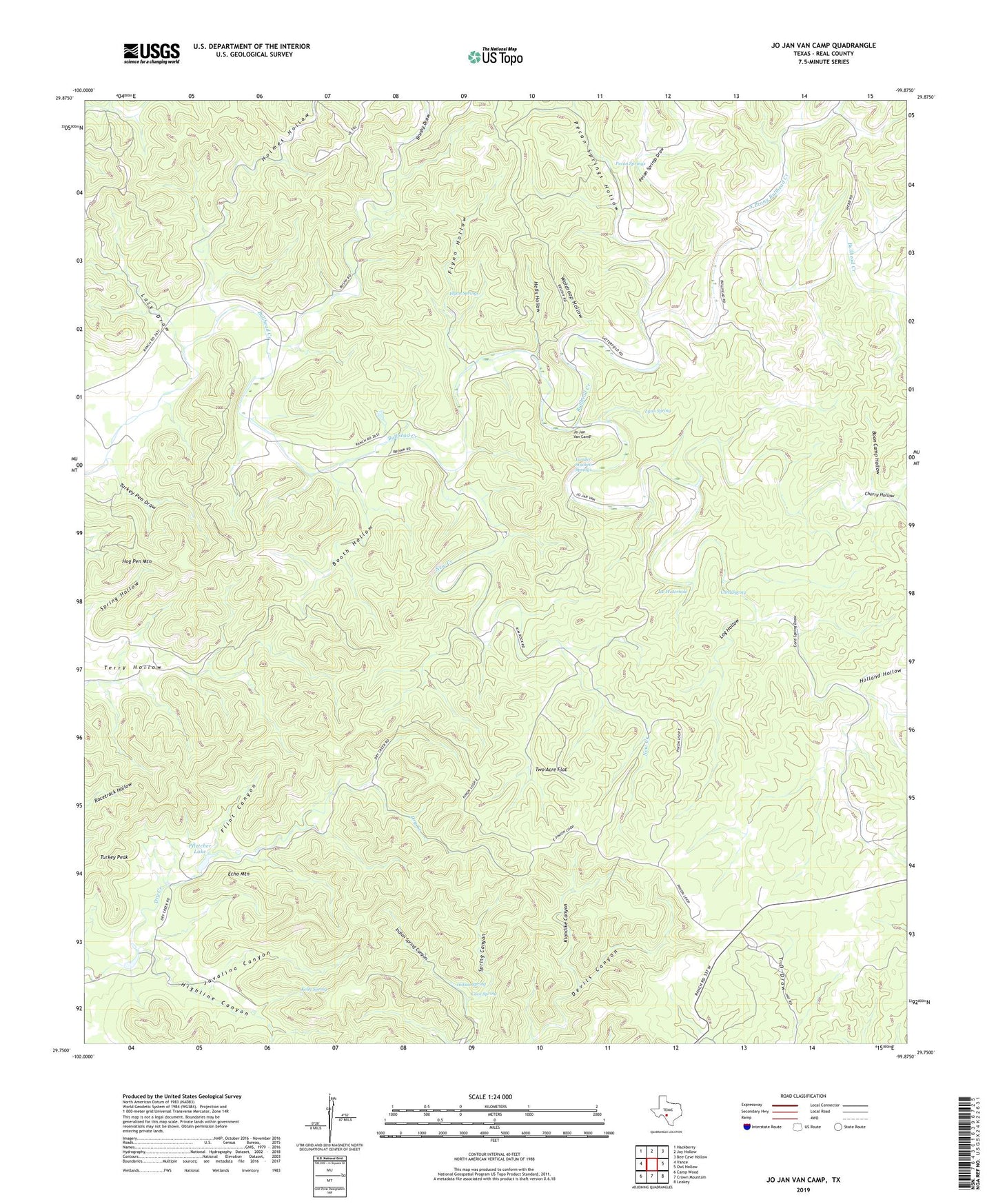
2022 topographic map quadrangle Jo Jan Van Camp in the state of Texas. Scale: 1:24000. Based on the newly updated USGS 7.5' US Topo map series, this map is in the following counties: Real. The map contains contour data, water features, and other items you are used to seeing on USGS maps, but also has updated roads and other features. This is the next generation of topographic maps. Printed on high-quality waterproof paper with UV fade-resistant inks.
Quads adjacent to this one:
West: Vance
Northwest: Hackberry
North: Joy Hollow
Northeast: Bee Cave Hollow
East: Owl Hollow
Southeast: Leakey
South: Crown Mountain
Southwest: Camp Wood
This map covers the same area as the classic USGS quad with code o29099g8.
Contains the following named places: Boon Camp Hollow, Booth Hollow, Brushy Draw, Cave Spring, Cherry Hollow, Cord Spring, Cord Spring Draw, Devils Canyon, Echo Mountain, Flint Canyon, Flynn Hollow, Flynn Springs, Hells Hollow, Highline Canyon, Hog Pen Mountain, Holland Hollow, Holmes Hollow, Ice Waterhole, Indian Spring, Indian Spring Canyon, Javalina Canyon, Jo Jan Van Camp, Kelly Spring, Klondike Canyon, Lacy Draw, Log Hollow, Lynn Spring, New Creek, North Prong Bullhead Creek, Pecan Springs, Pecan Springs Draw, Pecan Springs Hollow, Pfletcher Lake, Pletcher Lake Dam, Spring Canyon, Turkey Peak, Turkey Pen Draw, Two Acre Flat, Vander Stucken Springs, Waldroop Hollow