MyTopo
Bull Waterhole Texas US Topo Map
Couldn't load pickup availability
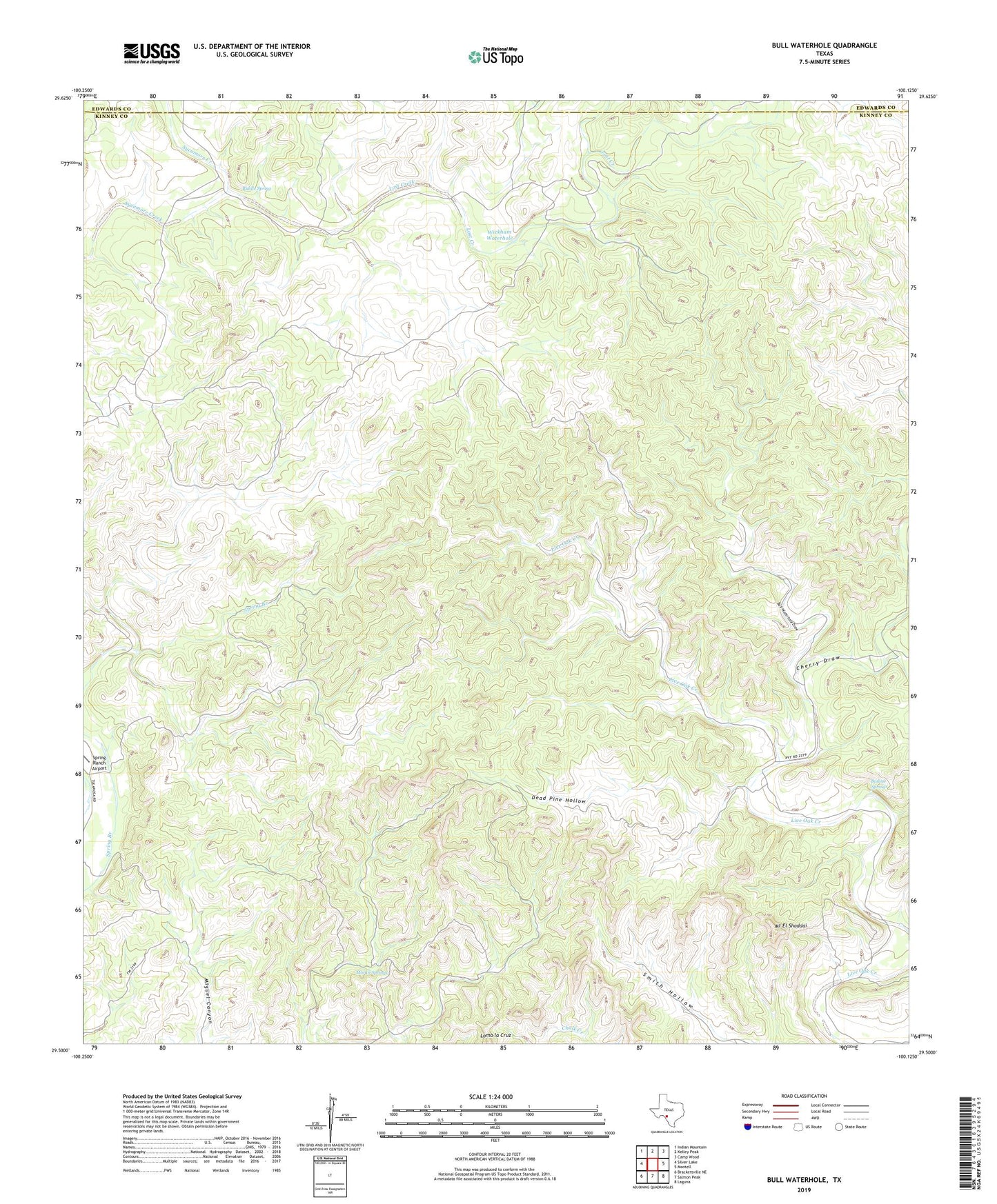
2022 topographic map quadrangle Bull Waterhole in the state of Texas. Scale: 1:24000. Based on the newly updated USGS 7.5' US Topo map series, this map is in the following counties: Kinney, Edwards. The map contains contour data, water features, and other items you are used to seeing on USGS maps, but also has updated roads and other features. This is the next generation of topographic maps. Printed on high-quality waterproof paper with UV fade-resistant inks.
Quads adjacent to this one:
West: Silver Lake
Northwest: Indian Mountain
North: Kelley Peak
Northeast: Camp Wood
East: Montell
Southeast: Laguna
South: Salmon Peak
Southwest: Brackettville NE
This map covers the same area as the classic USGS quad with code o29100e2.
Contains the following named places: Boiling Springs, Bull Waterhole, Bull Waterhole Draw, Cherry Draw, Childress Public Library, Dead Pine Hollow, Goat Waterhole, Little Windmill, Loma la Cruz, Lost Creek, Lost Creek Place, Moran Springs, Mount El Shaddai, Riddle Spring, Stratler Windmill, Wickham Waterhole