MyTopo
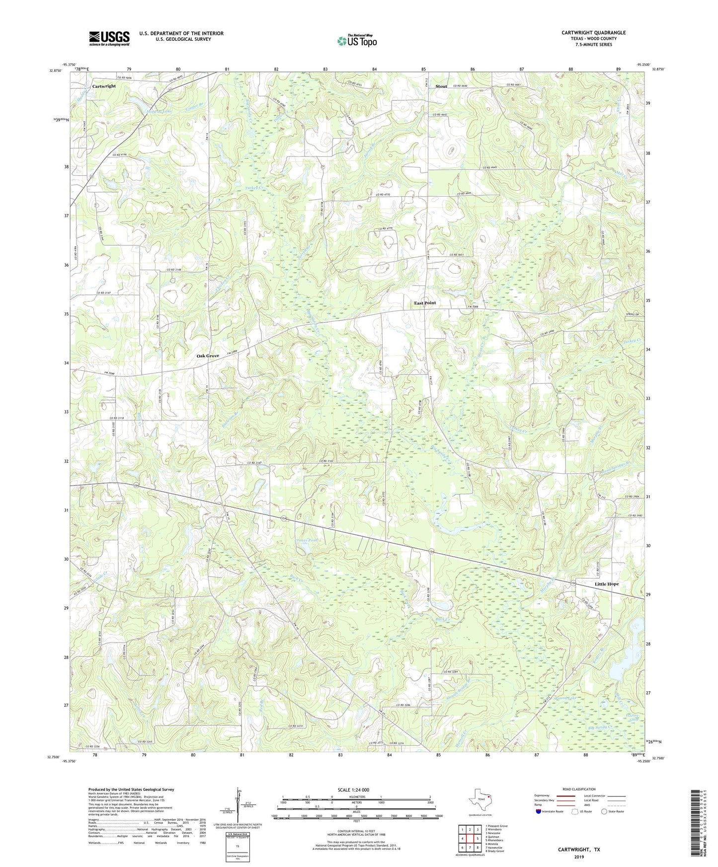
Cartwright Texas US Topo Map
Couldn't load pickup availability
2019 topographic map quadrangle Cartwright in the state of Texas. Scale: 1:24000. Based on the newly updated USGS 7.5' US Topo map series, this map is in the following counties: Wood. The map contains contour data, water features, and other items you are used to seeing on USGS maps, but also has updated roads and other features. This is the next generation of topographic maps. Printed on high-quality waterproof paper with UV fade-resistant inks.
Quads adjacent to this one:
West: Quitman
Northwest: Pleasant Grove
North: Winnsboro
Northeast: Newsome
East: Rhonesboro
Southeast: Shady Grove
South: Hainesville
Southwest: Mineola
Contains the following named places: Big Woods Spring Lake Dam, Buck Creek, Burleson Branch, Cartwright, Chicken Creek, Cooper Branch, Crones Pond, East Point, Ebenezer Church, Grinnel Lake, Homebrew Branch, Indian Creek, Jarred Branch, Liberty Church, Little Hope, Lone Grove School, Long Lake, Mansell Creek, Midway Lake, Midway Lake Dam, Mill Creek, Murphy Branch, Oak Grove, Pleasantville Branch Library, Rogers Branch, Round Lake, Sand Springs Branch, Scenic Woods Regional Library, Shady Grove Church, Slough Bridge Branch, Smith Branch Library, Stout, Stout Creek, Tarkill Lake, Turkey Creek, Tuttle Branch Library, Way Lake Oil Field, Young Branch Library