MyTopo
Newsome Texas US Topo Map
Couldn't load pickup availability
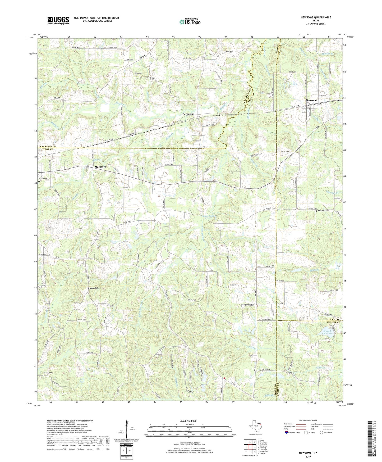
2022 topographic map quadrangle Newsome in the state of Texas. Scale: 1:24000. Based on the newly updated USGS 7.5' US Topo map series, this map is in the following counties: Wood, Franklin, Camp, Upshur. The map contains contour data, water features, and other items you are used to seeing on USGS maps, but also has updated roads and other features. This is the next generation of topographic maps. Printed on high-quality waterproof paper with UV fade-resistant inks.
Quads adjacent to this one:
West: Winnsboro
Northwest: Purley
North: New Hope
Northeast: Monticello
East: Leesburg
Southeast: Thomas
South: Rhonesboro
Southwest: Cartwright
This map covers the same area as the classic USGS quad with code o32095h2.
Contains the following named places: Angel Branch, Attway Branch, Briary Creek, Bullard Branch, Carver Branch, Clearwater, Clearwater Cemetery, Coldwater Church, Elwood Club Lake, Elwood Club Lake Dam, Gum Branch, Hepsibah Baptist Church, Hepsibah Cemetery, Hepsibah Church, Indian Creek, Maple Springs Church, Mitchell Branch, Monday Cemetery, Morris Chapel, Mount Zion Church, Musgrove, Newsome, Patterson Branch, Perryville Volunteer Fire Department, Pineview, Sand Branch, Scroggins, Scroggins Post Office, Shiner Pond, Smyrna Church, South Fork Brushy Creek, Stivers Hill, Watson Branch, West Chapel, Westbrook, Willard Cemetery, ZIP Code: 75451