
MyTopo
Causey Draw Texas US Topo Map
Couldn't load pickup availability
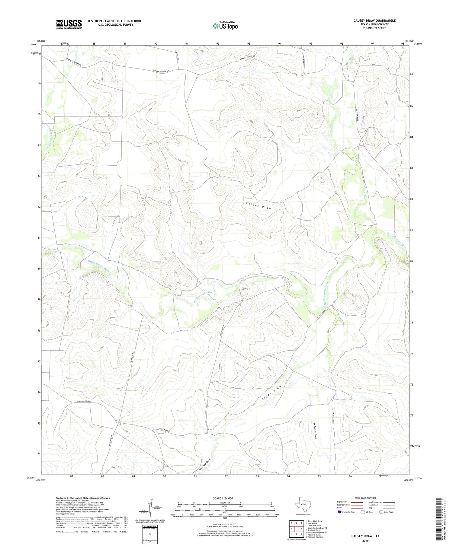
2019 topographic map quadrangle Causey Draw in the state of Texas. Scale: 1:24000. Based on the newly updated USGS 7.5' US Topo map series, this map is in the following counties: Irion. The map contains contour data, water features, and other items you are used to seeing on USGS maps, but also has updated roads and other features. This is the next generation of topographic maps. Printed on high-quality waterproof paper with UV fade-resistant inks.
Quads adjacent to this one:
West: South Mustang Draw NE
Northwest: Three Bluff Draw
North: Hay Hollow
Northeast: Coon Dive Draw
East: Bradford Draw
Southeast: Ketchum Mountain
South: Rocker B Ranch
Southwest: South Mustang Draw SE
Contains the following named places: Antelope Draw, Bull Windmill, Causey Draw, Causey Windmill, Divide Windmill, Graston Windmill, High Lonesome Windmill, Kiowa Creek, Lewis Trap Windmill, Mallard Windmill, McDowell Draw, Pecan Windmill, River Windmill, Salt House Line Camp, Seven D Ranch, Tepee Draw


