MyTopo
Hay Hollow Texas US Topo Map
Couldn't load pickup availability
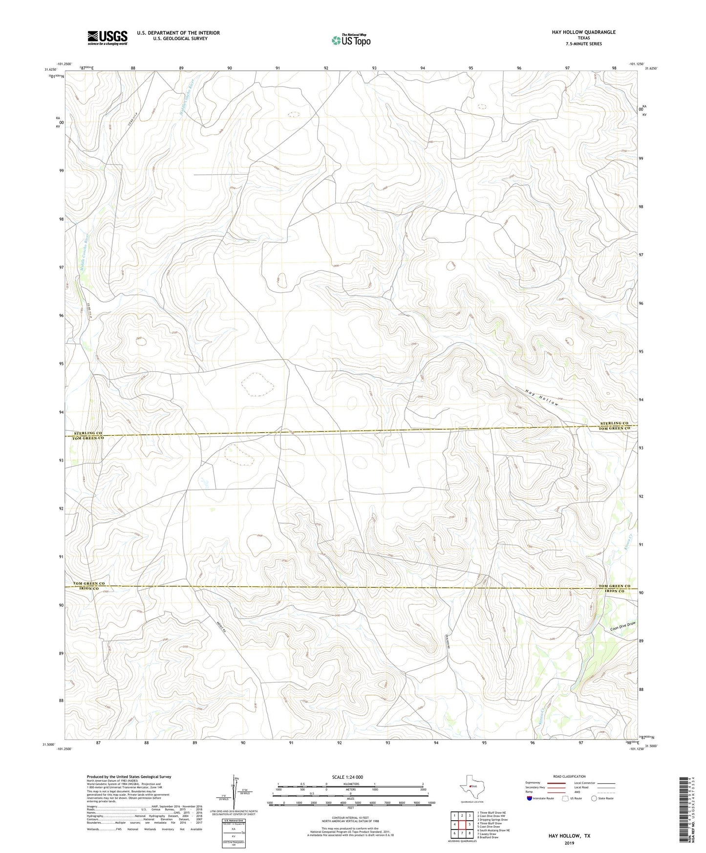
2022 topographic map quadrangle Hay Hollow in the state of Texas. Scale: 1:24000. Based on the newly updated USGS 7.5' US Topo map series, this map is in the following counties: Sterling, Tom Green, Irion. The map contains contour data, water features, and other items you are used to seeing on USGS maps, but also has updated roads and other features. This is the next generation of topographic maps. Printed on high-quality waterproof paper with UV fade-resistant inks.
Quads adjacent to this one:
West: Three Bluff Draw
Northwest: Three Bluff Draw NE
North: Coon Dive Draw NW
Northeast: Dripping Springs Draw
East: Coon Dive Draw
Southeast: Bradford Draw
South: Causey Draw
Southwest: South Mustang Draw NE
This map covers the same area as the classic USGS quad with code o31101e2.
Contains the following named places: Coon Dive Draw, Hay Hollow, Model A Windmill, Scallop Tank Windmill