MyTopo
Cee Vee Texas US Topo Map
Couldn't load pickup availability
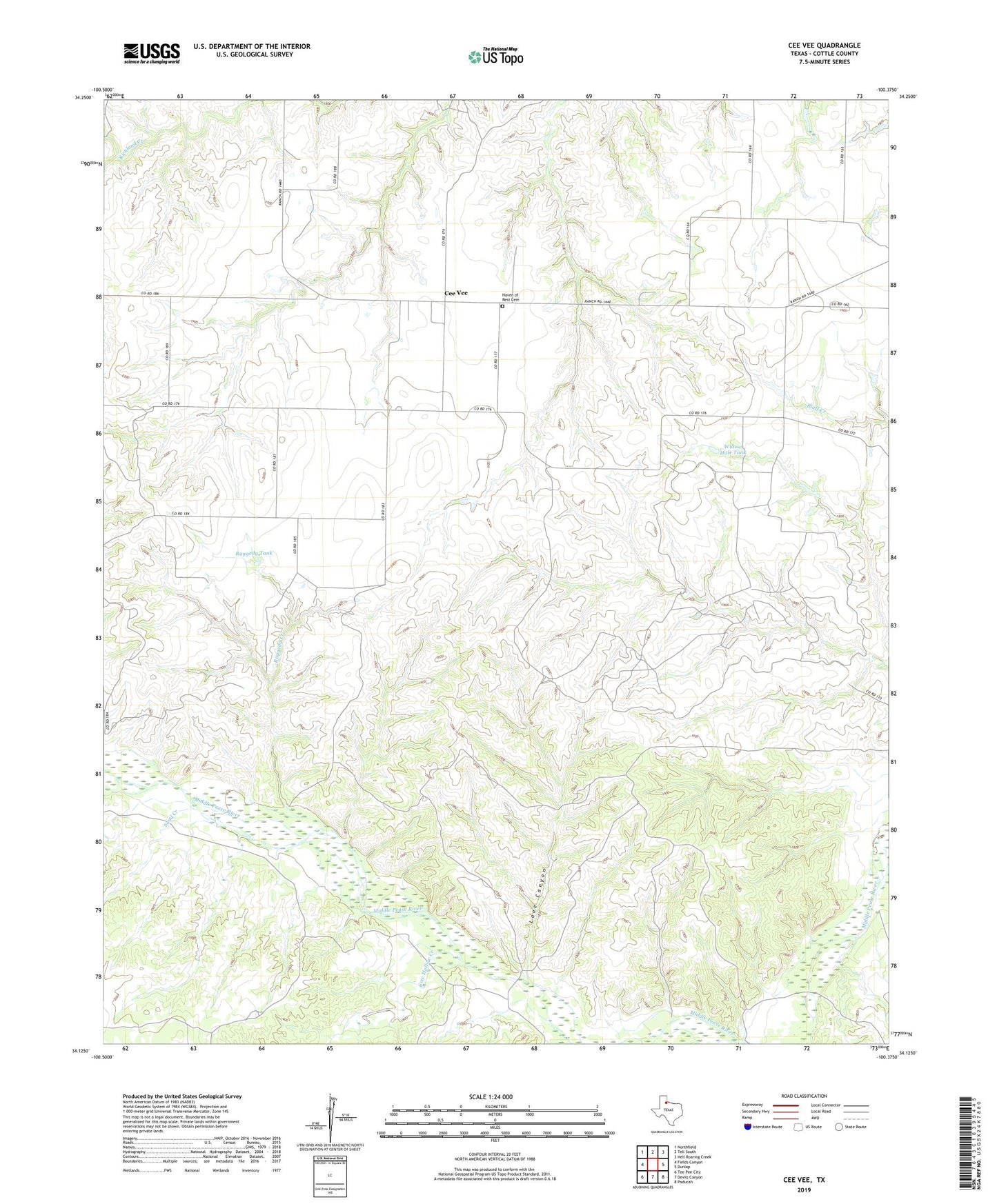
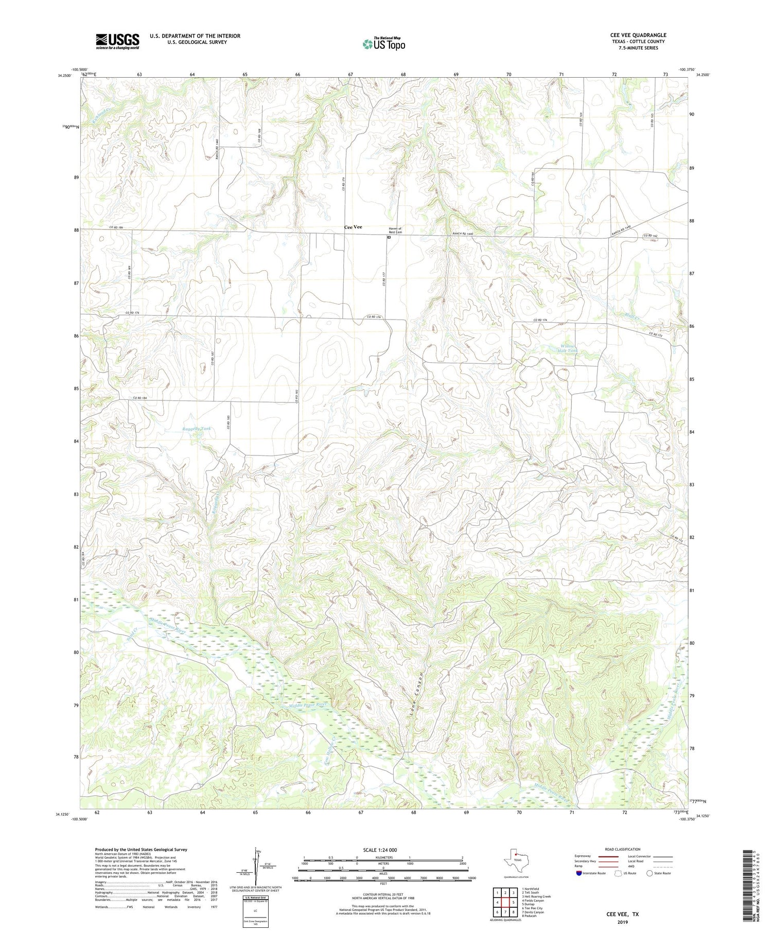
2019 topographic map quadrangle Cee Vee in the state of Texas. Scale: 1:24000. Based on the newly updated USGS 7.5' US Topo map series, this map is in the following counties: Cottle. The map contains contour data, water features, and other items you are used to seeing on USGS maps, but also has updated roads and other features. This is the next generation of topographic maps. Printed on high-quality waterproof paper with UV fade-resistant inks.
Quads adjacent to this one:
West: Fields Canyon
Northwest: Northfield
North: Tell South
Northeast: Hell Roaring Creek
East: Dunlap
Southeast: Paducah
South: Devils Canyon
Southwest: Tee Pee City
Contains the following named places: Cee Vee, Coleyville, Cow Hollow Creek, Cow Hollow Windmill, Haven of Rest Cemetery, Lone Canyon, Lone Canyon Windmill, Matador Wildlife Management Area, Raggedy Creek, Raggedy Tank, Sand Creek, Sisk Pen Windmill, Tongue River, Willow Hole Tank, Windmill Number Six, Windmill Number Three, Windmill Number Two