MyTopo
Tee Pee City Texas US Topo Map
Couldn't load pickup availability
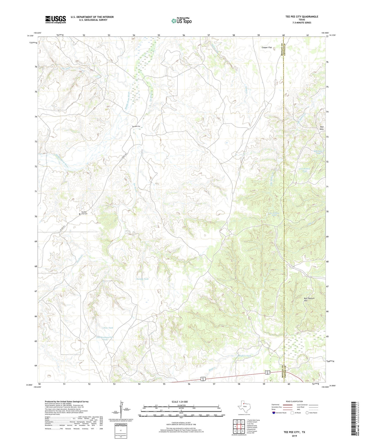
2022 topographic map quadrangle Tee Pee City in the state of Texas. Scale: 1:24000. Based on the newly updated USGS 7.5' US Topo map series, this map is in the following counties: Motley, Cottle. The map contains contour data, water features, and other items you are used to seeing on USGS maps, but also has updated roads and other features. This is the next generation of topographic maps. Printed on high-quality waterproof paper with UV fade-resistant inks.
Quads adjacent to this one:
West: Ballard Camp
Northwest: Turtle Hole Camp
North: Fields Canyon
Northeast: Cee Vee
East: Devils Canyon
Southeast: Grow NW
South: China Canyon
Southwest: Russellville
This map covers the same area as the classic USGS quad with code o34100a5.
Contains the following named places: Bluff Creek, Bluff Creek Tank, Bluff Creek Windmill, Bull Pasture Hill, Cow Hollow Tank, Cow Hollow Trap, Cow Pasture Tank, Cow Pasture Windmill, Cutting Flat Windmill, Dave Harris Windmill, Divide Windmill, Fiftythree Windmill, Humpy Tank, Lone Pole Windmill, Moore Windmill, New Tank, Old Headquarters Tank, Red Hills, Red Hills Tank, Sand Windmill, Schweitzer Windmill, South Trap Windmill, Sunday Morning Windmill, Tee Pee City, Tee Pee City Cemetery, Tee Pee City Windmill, Tee Pee Creek, The Ditch