MyTopo
Fields Canyon Texas US Topo Map
Couldn't load pickup availability
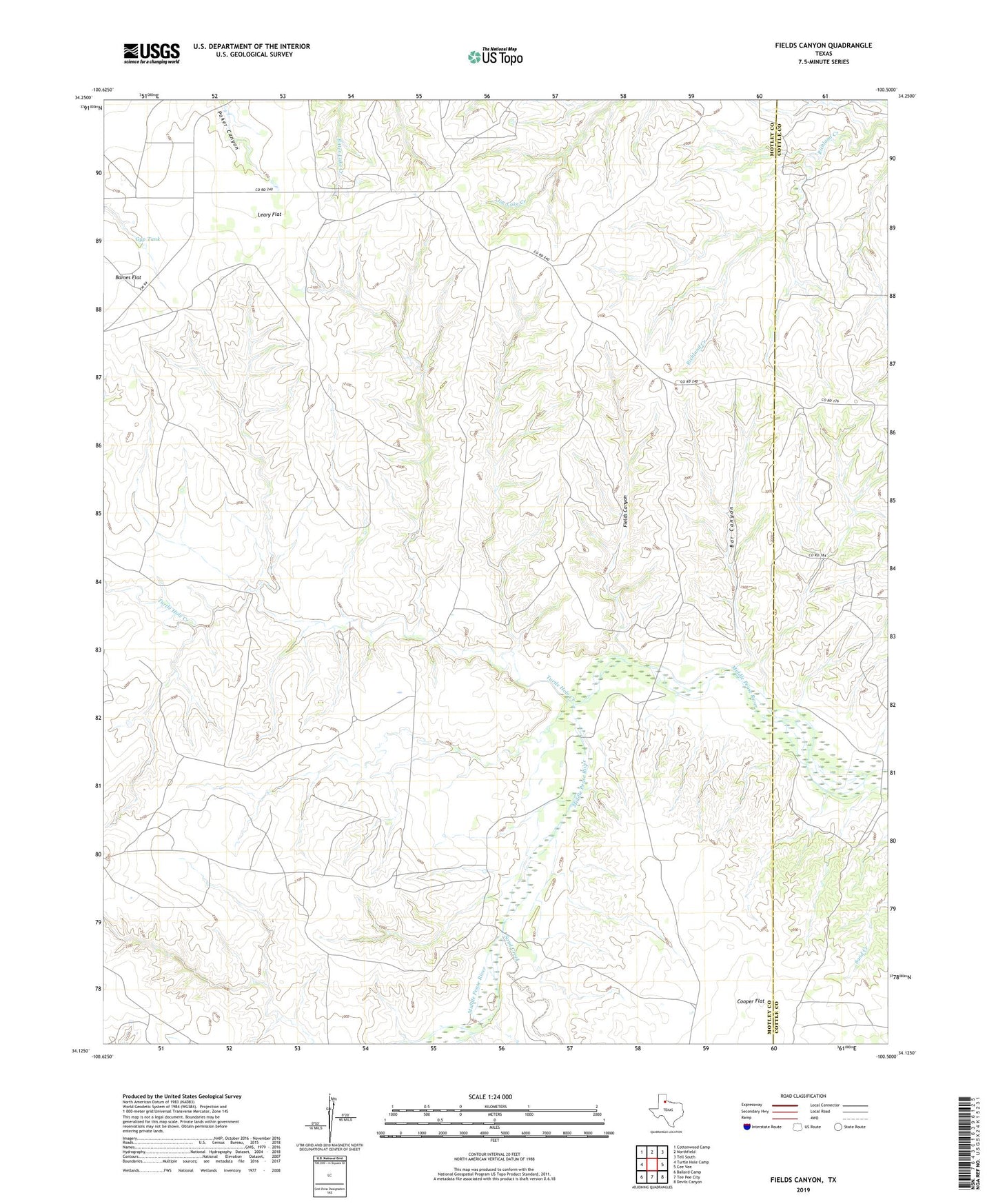
2022 topographic map quadrangle Fields Canyon in the state of Texas. Scale: 1:24000. Based on the newly updated USGS 7.5' US Topo map series, this map is in the following counties: Motley, Cottle. The map contains contour data, water features, and other items you are used to seeing on USGS maps, but also has updated roads and other features. This is the next generation of topographic maps. Printed on high-quality waterproof paper with UV fade-resistant inks.
Quads adjacent to this one:
West: Turtle Hole Camp
Northwest: Cottonwood Camp
North: Northfield
Northeast: Tell South
East: Cee Vee
Southeast: Devils Canyon
South: Tee Pee City
Southwest: Ballard Camp
This map covers the same area as the classic USGS quad with code o34100b5.
Contains the following named places: Bar Canyon, Cooper Flat, Cooper Flat Windmill, Fields Canyon, Gyp Tank, Leary Flat, Lucky Knob Windmill, Mouth of Turtle Hole Windmill, New Corral Windmill, Richland Windmill, Samson Windmill, Sand Creek, Turtle Hole Creek