MyTopo
Celeste Texas US Topo Map
Couldn't load pickup availability
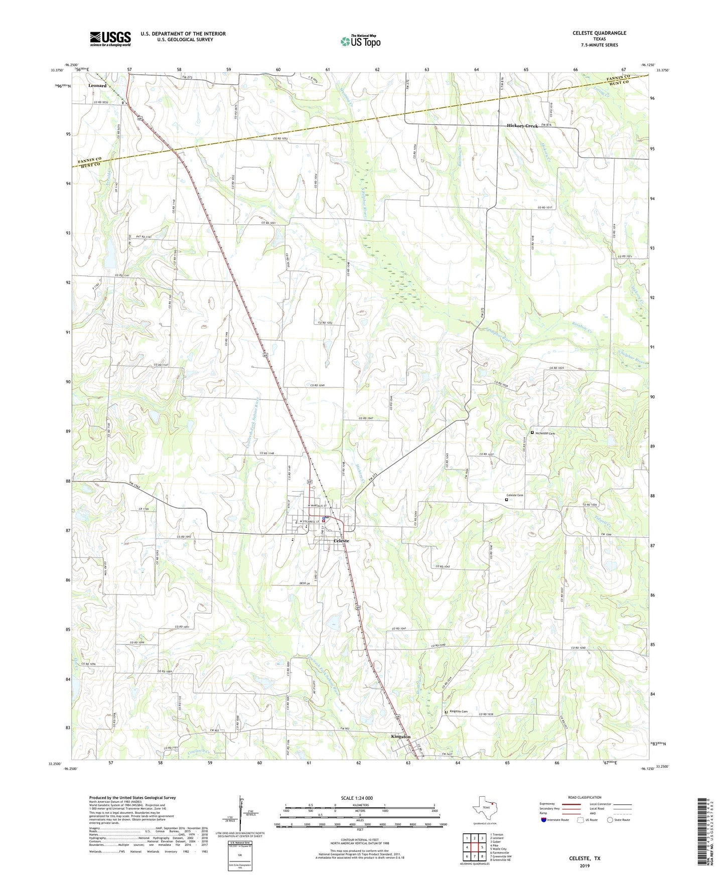
2019 topographic map quadrangle Celeste in the state of Texas. Scale: 1:24000. Based on the newly updated USGS 7.5' US Topo map series, this map is in the following counties: Hunt, Fannin. The map contains contour data, water features, and other items you are used to seeing on USGS maps, but also has updated roads and other features. This is the next generation of topographic maps. Printed on high-quality waterproof paper with UV fade-resistant inks.
Quads adjacent to this one:
West: Pike
Northwest: Trenton
North: Leonard
Northeast: Gober
East: Wolfe City
Southeast: Greenville NE
South: Greenville NW
Southwest: Farmersville
Contains the following named places: Celeste, Celeste Cemetery, Celeste City Hall, Celeste Division, Celeste Elementary School, Celeste Junior High School, Celeste Police Department, Celeste Post Office, Celeste Volunteer Fire Department, Chambers Airport, City of Celeste, Hickory Creek, Hogeye, Kingston, Kingston Cemetery, Midway, Mustang Creek, Nicholson Cemetery, Rainbow Creek, Soil Conservation Service Site 59 Dam, Soil Conservation Service Site 59 Reservoir, Soil Conservation Service Site 64a Dam, Soil Conservation Service Site 64a Reservoir, Soil Conservation Service Site 65 Dam, Soil Conservation Service Site 65 Reservoir, ZIP Code: 75423