MyTopo
Trenton Texas US Topo Map
Couldn't load pickup availability
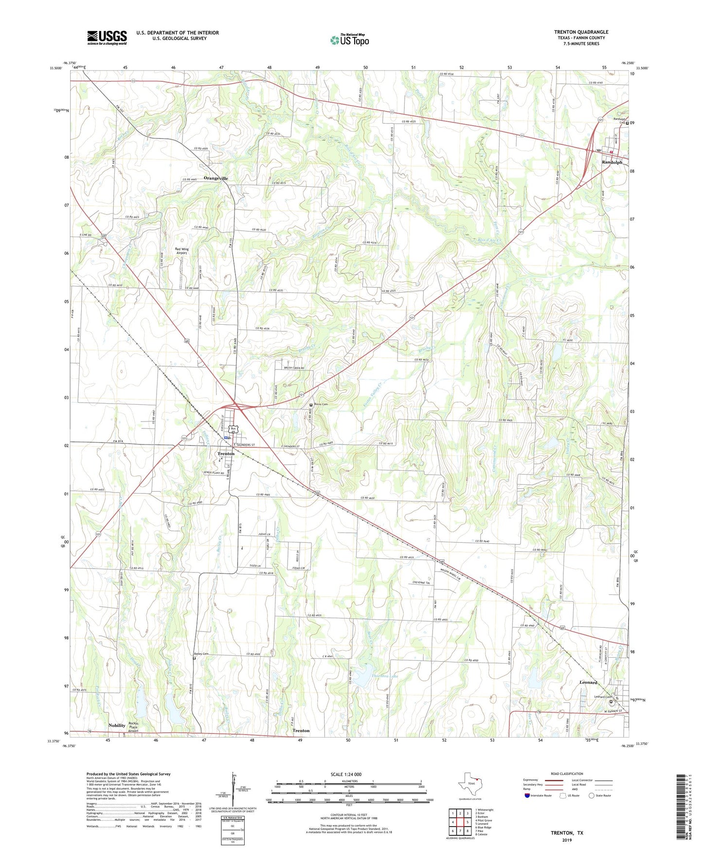
2022 topographic map quadrangle Trenton in the state of Texas. Scale: 1:24000. Based on the newly updated USGS 7.5' US Topo map series, this map is in the following counties: Fannin. The map contains contour data, water features, and other items you are used to seeing on USGS maps, but also has updated roads and other features. This is the next generation of topographic maps. Printed on high-quality waterproof paper with UV fade-resistant inks.
Quads adjacent to this one:
West: Pilot Grove
Northwest: Whitewright
North: Ector
Northeast: Bonham
East: Leonard
Southeast: Celeste
South: Pike
Southwest: Blue Ridge
This map covers the same area as the classic USGS quad with code o33096d3.
Contains the following named places: Bailey Cemetery, Blanton Chapel, Blanton Creek, Brushy Creek, Buchanan Cemetery, Burns Cemetery, Casey Field, Chinquapin Creek, Church of Christ, City of Trenton, Cottonwood Creek, Culling Family Cemetery, Deel and Whitworth Cemetery, Delba, East Shady Grove Cemetery, East Shady Grove Church, Foster Valley Creek, Gods Delight Lake, Gods Delight Lake Dam, Indian Creek Cemetery, Indian Creek Church, Leonard Cemetery, Nobility, Orangeville, Pace Creek, Porter Creek, Randolph, Randolph Fire Department, Randolph Post Office, Red Wing Airport, Rock Creek, Soil Conservation Service Site 38 Dam, Soil Conservation Service Site 38 Reservoir, Soil Conservation Service Site 39 Dam, Soil Conservation Service Site 39 Reservoir, Soil Conservation Service Site 45 Dam, Texas No Name Number 36 Dam, Thornton Lake, Trenton, Trenton City Hall, Trenton Elementary School, Trenton High School, Trenton Police Department, Trenton Post Office, Union Hill, Valley Creek Cemetery, Valley Creek Church, ZIP Code: 75490