MyTopo
Wolfe City Texas US Topo Map
Couldn't load pickup availability
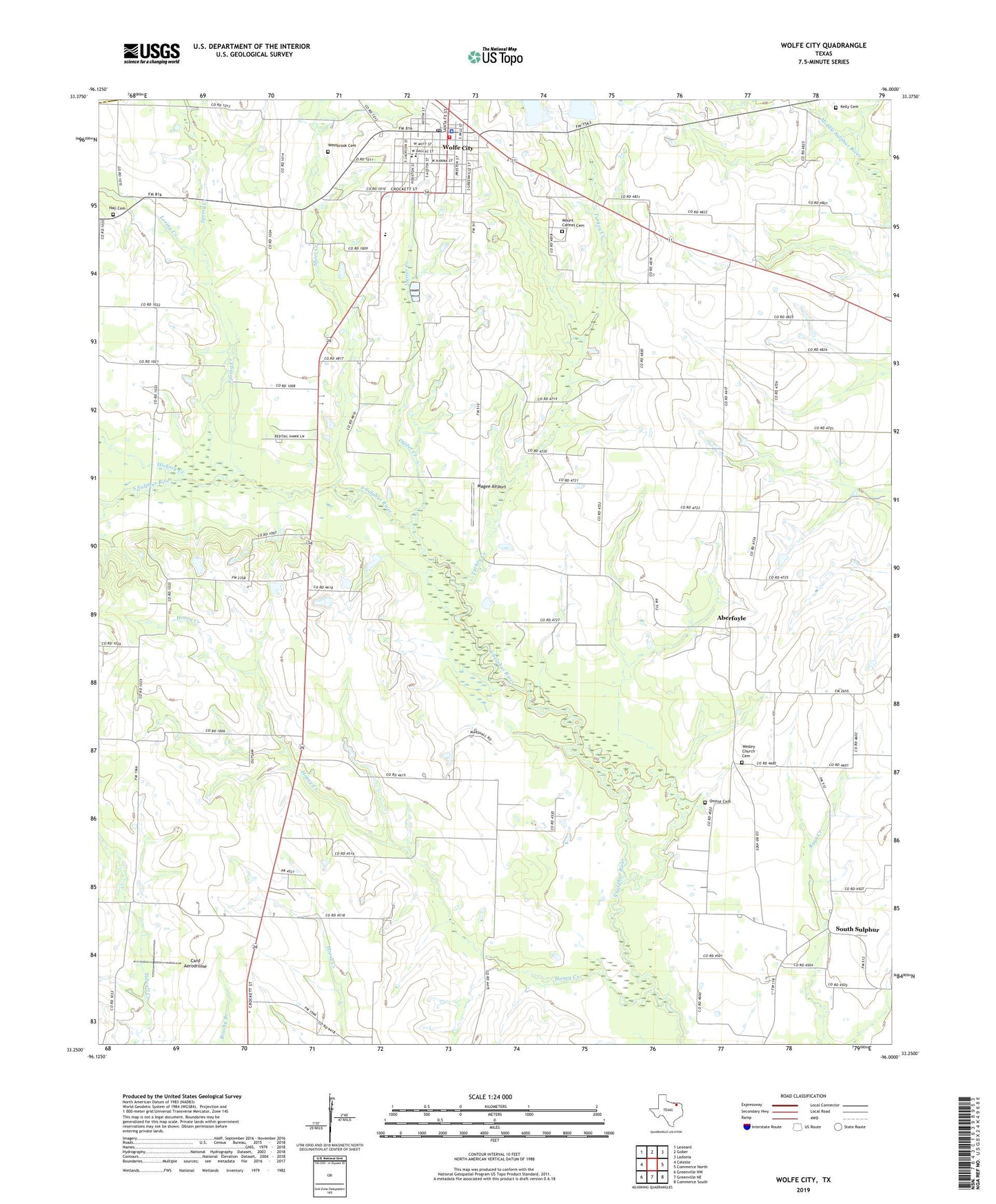
2022 topographic map quadrangle Wolfe City in the state of Texas. Scale: 1:24000. Based on the newly updated USGS 7.5' US Topo map series, this map is in the following counties: Hunt, Fannin. The map contains contour data, water features, and other items you are used to seeing on USGS maps, but also has updated roads and other features. This is the next generation of topographic maps. Printed on high-quality waterproof paper with UV fade-resistant inks.
Quads adjacent to this one:
West: Celeste
Northwest: Leonard
North: Gober
Northeast: Ladonia
East: Commerce North
Southeast: Commerce South
South: Greenville NE
Southwest: Greenville NW
This map covers the same area as the classic USGS quad with code o33096c1.
Contains the following named places: Aberfoyle, Card Aerodrome, City of Wolfe City, Hall Cemetery, Henington Airport, Hickory Creek, Honey Creek, Honey Creek Church, Hunt County Constable's Office Precinct 3, Kelly Cemetery, Loring Creek, Magee Airport, Mount Carmel Cemetery, Mynatt Field, Onstot Cemetery, Oyster Creek, Short Creek, South Sulphur, Spring Creek, Turkey Creek, Webb Hill Church, Wesley Church Cemetery, Westbrook Cemetery, White Rock, Wolfe City, Wolfe City City Hall, Wolfe City Division, Wolfe City Elementary School, Wolfe City High School, Wolfe City Middle School, Wolfe City Police Department, Wolfe City Post Office, Wolfe City Reservoir, Wolfe City Reservoir Number 1 Dam, Wolfe City Reservoir Number 2, Wolfe City Reservoir Number 2 Dam, Wolfe City Reservoirs, Wolfe City Volunteer Fire Department, ZIP Code: 75496