MyTopo
Chances Store Texas US Topo Map
Couldn't load pickup availability
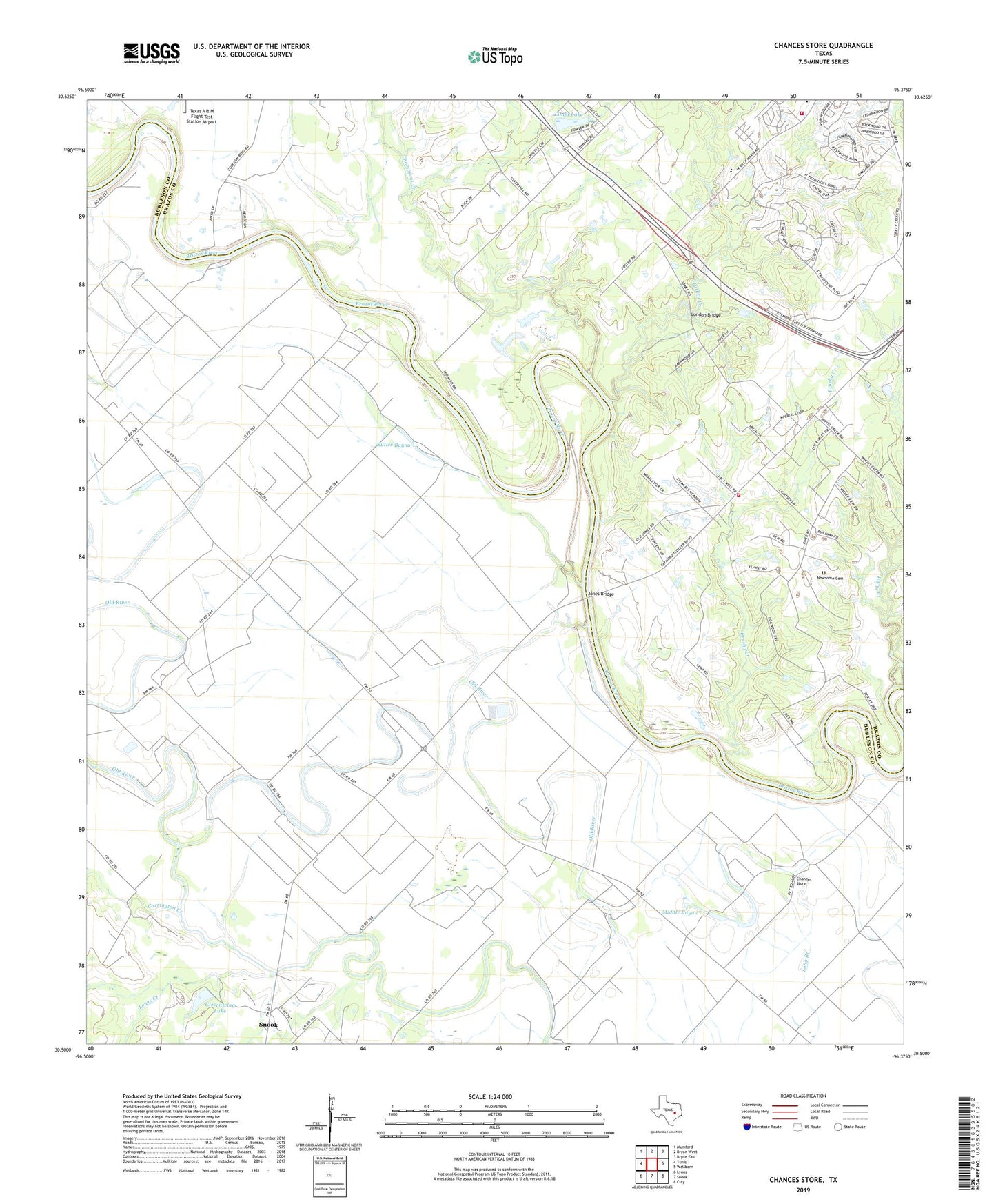
2019 topographic map quadrangle Chances Store in the state of Texas. Scale: 1:24000. Based on the newly updated USGS 7.5' US Topo map series, this map is in the following counties: Burleson, Brazos. The map contains contour data, water features, and other items you are used to seeing on USGS maps, but also has updated roads and other features. This is the next generation of topographic maps. Printed on high-quality waterproof paper with UV fade-resistant inks.
Quads adjacent to this one:
West: Tunis
Northwest: Mumford
North: Bryan West
Northeast: Bryan East
East: Wellborn
Southeast: Clay
South: Snook
Southwest: Lyons
Contains the following named places: Brazos County Precinct 4 Volunteer Fire Department Station 3, Brushy Creek, Bushy Church, Butler Bayou, Carrington Creek, Chances Store, Clayton Church, Dabner Hill Church, Fosters Store, Giesensclag Lake, Giesensclag Lake Dam, Grant, Jones Bridge, Jones High School, Lewis Creek, Linda Lake, Linda Lake Dam, London Bridge, Middle Bayou, Newsome Cemetery, Pleasant Grove Church, Saint Mark Church, Steele-Milburn Field, Thompsons Creek, Turkey Creek, White Creek