MyTopo
Clay Texas US Topo Map
Couldn't load pickup availability
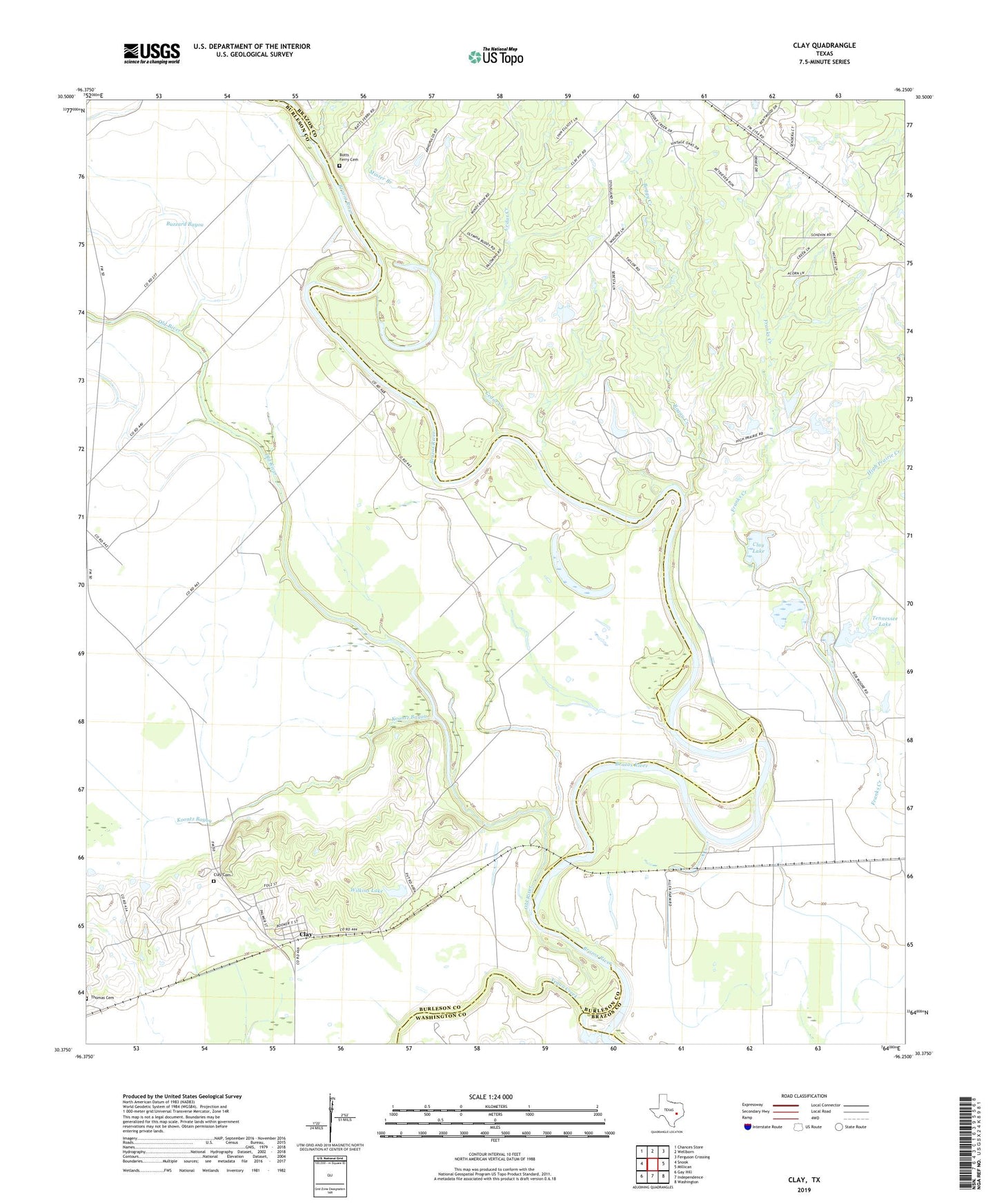
2022 topographic map quadrangle Clay in the state of Texas. Scale: 1:24000. Based on the newly updated USGS 7.5' US Topo map series, this map is in the following counties: Burleson, Brazos, Washington. The map contains contour data, water features, and other items you are used to seeing on USGS maps, but also has updated roads and other features. This is the next generation of topographic maps. Printed on high-quality waterproof paper with UV fade-resistant inks.
Quads adjacent to this one:
West: Snook
Northwest: Chances Store
North: Wellborn
Northeast: Ferguson Crossing
East: Millican
Southeast: Washington
South: Independence
Southwest: Gay Hill
This map covers the same area as the classic USGS quad with code o30096d3.
Contains the following named places: Boggy Creek, Botts Ferry Cemetery, Buzzard Bayou, Cedar Creek, Clay, Clay Cemetery, Clay Census Designated Place, Clay Lake, High Prairie Creek, Koontz Bayou, Minter Branch, Old River, Tennessee Lake, Tennessee Lake Dam, Thomas Cemetery, Wilkins Lake, Wilkins Lake Dam, Yegua Creek