MyTopo
Cibolo Ranch Texas US Topo Map
Couldn't load pickup availability
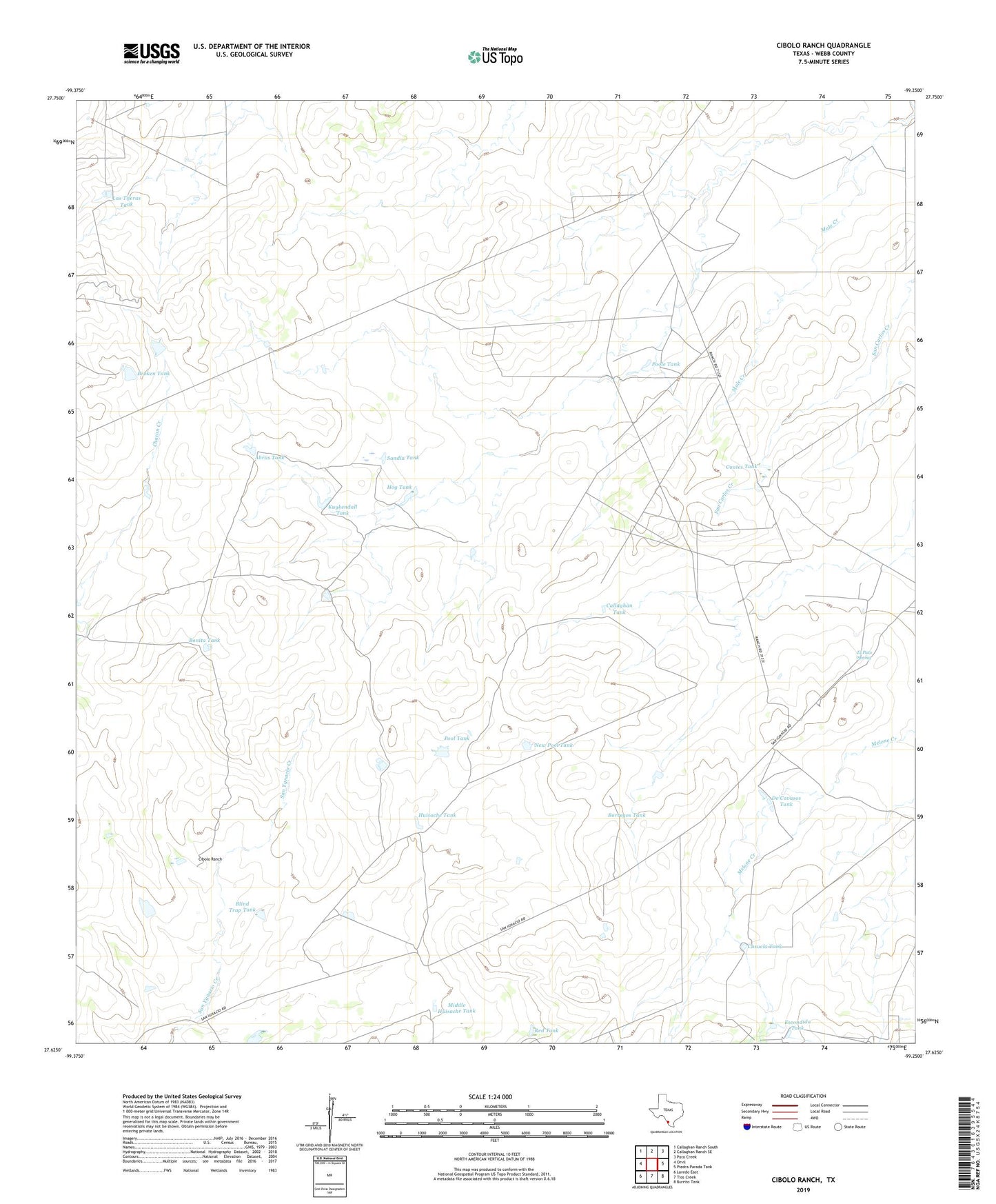
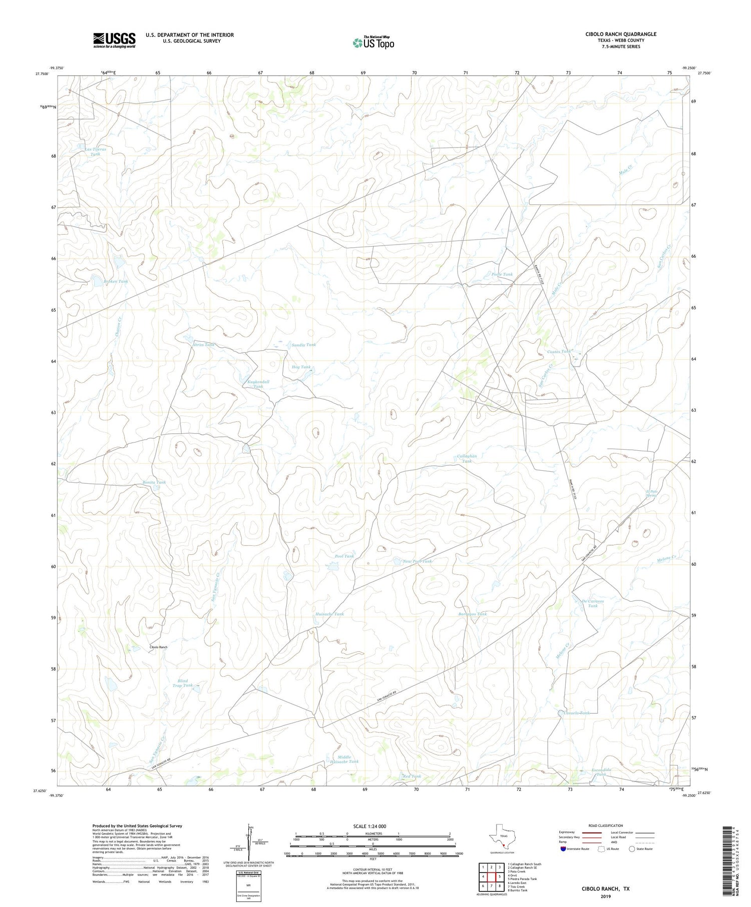
2019 topographic map quadrangle Cibolo Ranch in the state of Texas. Scale: 1:24000. Based on the newly updated USGS 7.5' US Topo map series, this map is in the following counties: Webb. The map contains contour data, water features, and other items you are used to seeing on USGS maps, but also has updated roads and other features. This is the next generation of topographic maps. Printed on high-quality waterproof paper with UV fade-resistant inks.
Quads adjacent to this one:
West: Orvil
Northwest: Callaghan Ranch South
North: Callaghan Ranch SE
Northeast: Pato Creek
East: Piedra Parada Tank
Southeast: Burrito Tank
South: Tios Creek
Southwest: Laredo East
Contains the following named places: Abras Tank, Baylor County Free Library, Blind Trap Tank, Bonita Tank, Borden Camp, Borregos Tank, Broken Tank, Buenos Aires Well, Callaghan Tank, Casuela Tank, Cibolo Ranch, Cuates Tank, De Cavasos Tank, El Pato Spring, Escondida Tank, Hog Tank, Huisache Tank, Juan De Leon Well, Kuykendall Tank, Las Tijeras Tank, Middle Huisache Tank, New Pool Tank, Pool Tank, Poole Tank, Red Tank, Sandia Tank, Tres Esquinas Well