MyTopo
Piedra Parada Tank Texas US Topo Map
Couldn't load pickup availability
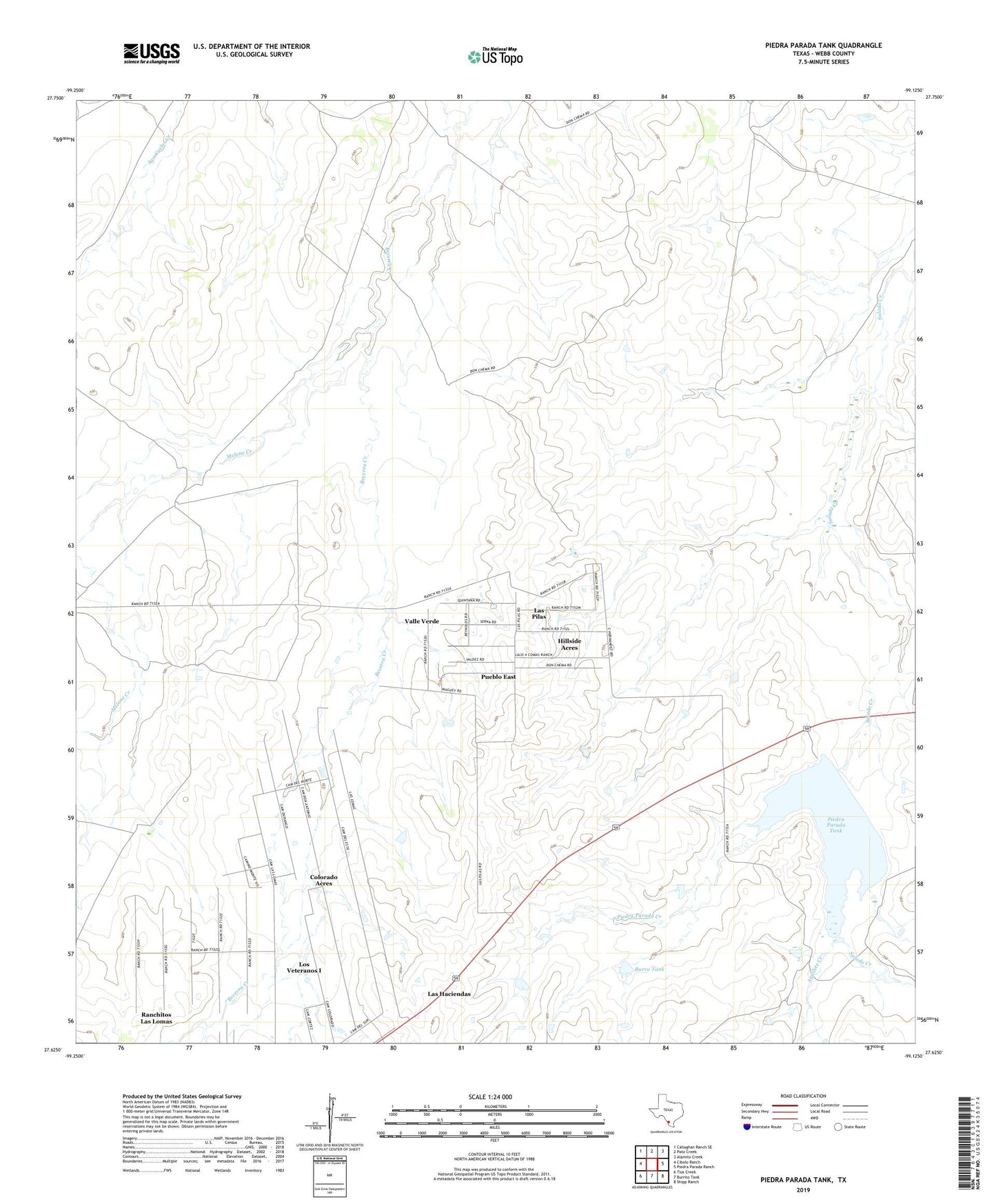
2022 topographic map quadrangle Piedra Parada Tank in the state of Texas. Scale: 1:24000. Based on the newly updated USGS 7.5' US Topo map series, this map is in the following counties: Webb. The map contains contour data, water features, and other items you are used to seeing on USGS maps, but also has updated roads and other features. This is the next generation of topographic maps. Printed on high-quality waterproof paper with UV fade-resistant inks.
Quads adjacent to this one:
West: Cibolo Ranch
Northwest: Callaghan Ranch SE
North: Pato Creek
Northeast: Alamito Creek
East: Piedra Parada Ranch
Southeast: Shipp Ranch
South: Burrito Tank
Southwest: Tios Creek
This map covers the same area as the classic USGS quad with code o27099f2.
Contains the following named places: Aguilete Creek, Burro Tank, Colorado Acres Census Designated Place, Colorado Acres Colonia, East Gate Acres Colonia, Hillside Acres Census Designated Place, Hillside Acres Number 1 Colonia, Hillside Acres Number 2 Colonia, Las Haciendas Census Designated Place, Las Pilas Census Designated Place, Las Pilas Colonia Number 1, Las Pilas Colonia Number 2, Los Veteranos 59 Colonia, Los Veteranos I Census Designated Place, Melone Creek, Piedra Parada Creek, Piedra Parada Tank, Pueblo East Census Designated Place, Pueblo East Colonia, Ranchitos Las Lomas, Ranchitos Las Lomas Census Designated Place, Ranchitos las Lomas Number 2 Colonia, Regency Village Colonia, Valle Verde Census Designated Place, Valle Verde Colonia, Vaquillas Dam, Vaquillas Reservoir, Village East Colonia