MyTopo
Clairemont East Texas US Topo Map
Couldn't load pickup availability
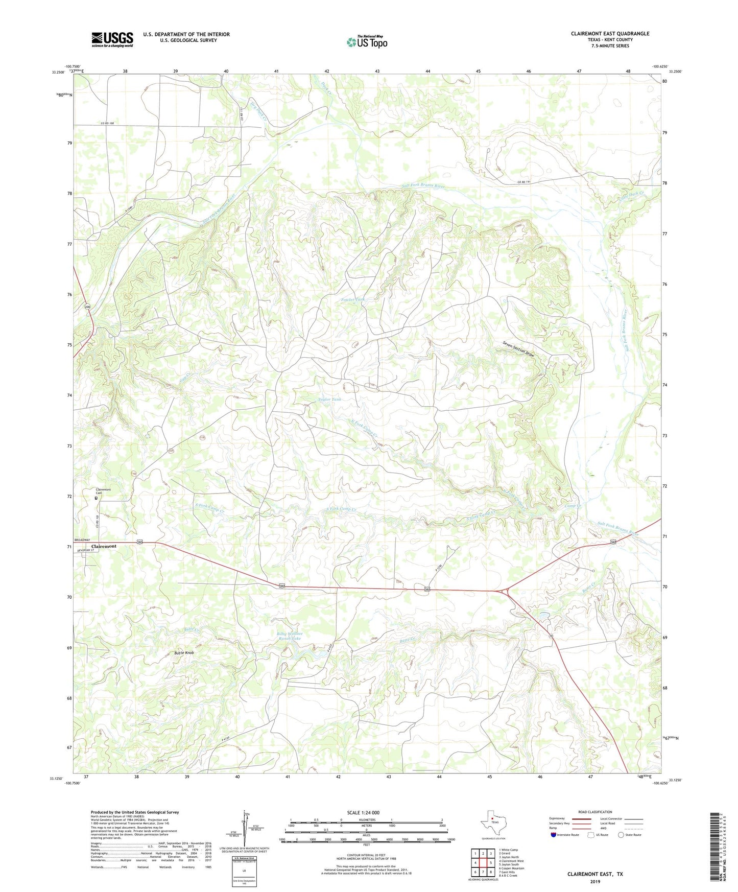
2019 topographic map quadrangle Clairemont East in the state of Texas. Scale: 1:24000. Based on the newly updated USGS 7.5' US Topo map series, this map is in the following counties: Kent. The map contains contour data, water features, and other items you are used to seeing on USGS maps, but also has updated roads and other features. This is the next generation of topographic maps. Printed on high-quality waterproof paper with UV fade-resistant inks.
Quads adjacent to this one:
West: Clairemont West
Northwest: White Camp
North: Girard
Northeast: Jayton North
East: Jayton South
Southeast: A B C Creek
South: Gant Hills
Southwest: Cooper Mountain
Contains the following named places: Bilby Wallace Ranch Lake, Bilby Wallace Ranch Lake Dam, Butte Knob, Camp Creek, Clairemont Cemetery, Clairemont East Oil Field, Clairemont North Oil Field, Dry Duck Creek, Duck Creek, Fowler Tank, Gyp Creek, Little Duck Creek, North Fork Camp Creek, O Bar O Ranch, Seven Section Draw, South Fork Camp Creek, Taylor Tank