MyTopo
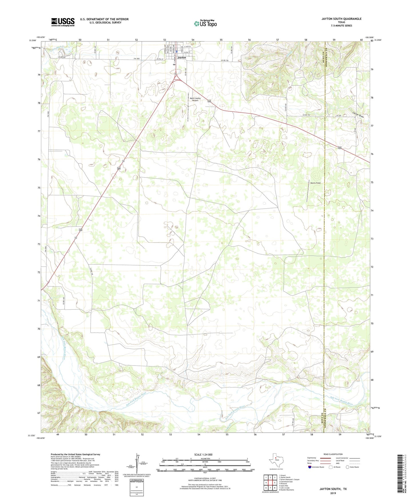
Jayton South Texas US Topo Map
Couldn't load pickup availability
2022 topographic map quadrangle Jayton South in the state of Texas. Scale: 1:24000. Based on the newly updated USGS 7.5' US Topo map series, this map is in the following counties: Kent, Stonewall. The map contains contour data, water features, and other items you are used to seeing on USGS maps, but also has updated roads and other features. This is the next generation of topographic maps. Printed on high-quality waterproof paper with UV fade-resistant inks.
Quads adjacent to this one:
West: Clairemont East
Northwest: Girard
North: Jayton North
Northeast: Seven Diamond L Canyon
East: Peacock
Southeast: Double Mountains
South: A B C Creek
Southwest: Gant Hills
This map covers the same area as the classic USGS quad with code o33100b5.
Contains the following named places: A B C Creek, Butte Creek, City Jayton Lake Dam, First National Bank Building, Jayton, Jayton City Hall, Jayton City Lake, Jayton Park, Jayton Post Office, Kent County Airport, Kent County Emergency Medical Services, Kent County Sheriff's Office, Norris Field