MyTopo
White Camp Texas US Topo Map
Couldn't load pickup availability
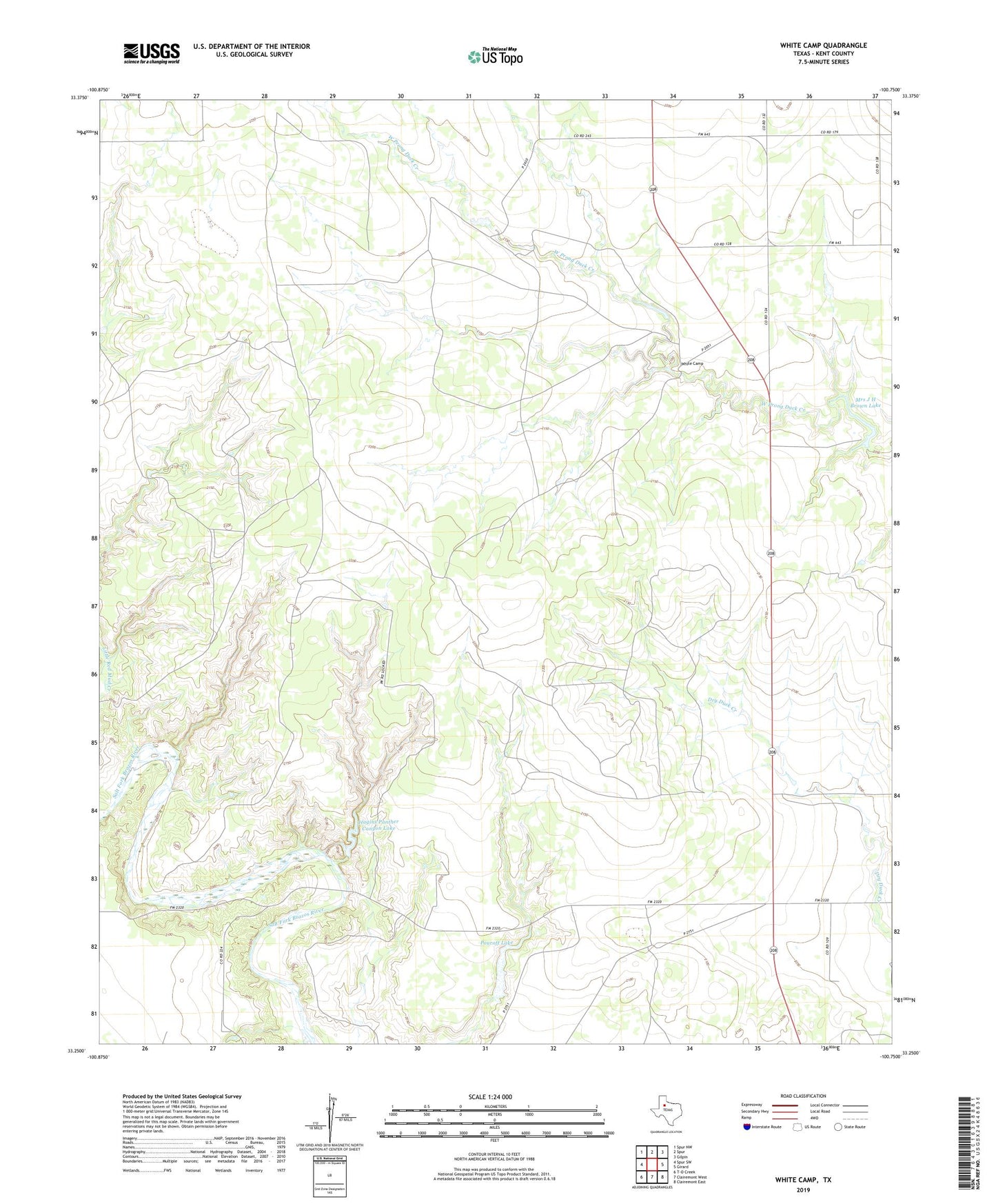
2022 topographic map quadrangle White Camp in the state of Texas. Scale: 1:24000. Based on the newly updated USGS 7.5' US Topo map series, this map is in the following counties: Kent. The map contains contour data, water features, and other items you are used to seeing on USGS maps, but also has updated roads and other features. This is the next generation of topographic maps. Printed on high-quality waterproof paper with UV fade-resistant inks.
Quads adjacent to this one:
West: Spur SW
Northwest: Spur NW
North: Spur
Northeast: Gilpin
East: Girard
Southeast: Clairemont East
South: Clairemont West
Southwest: T-O Creek
This map covers the same area as the classic USGS quad with code o33100c7.
Contains the following named places: Antelope Church, Hagins Panther Canyon Lake, Hagins Panther Canyon Lake Dam, Jayton North Division, Mrs J H Brown Lake, Mrs J H Brown Lake Dam, Pouroff Lake, Pouroff Lake Dam, White Camp