MyTopo
Coralina Ranch Texas US Topo Map
Couldn't load pickup availability
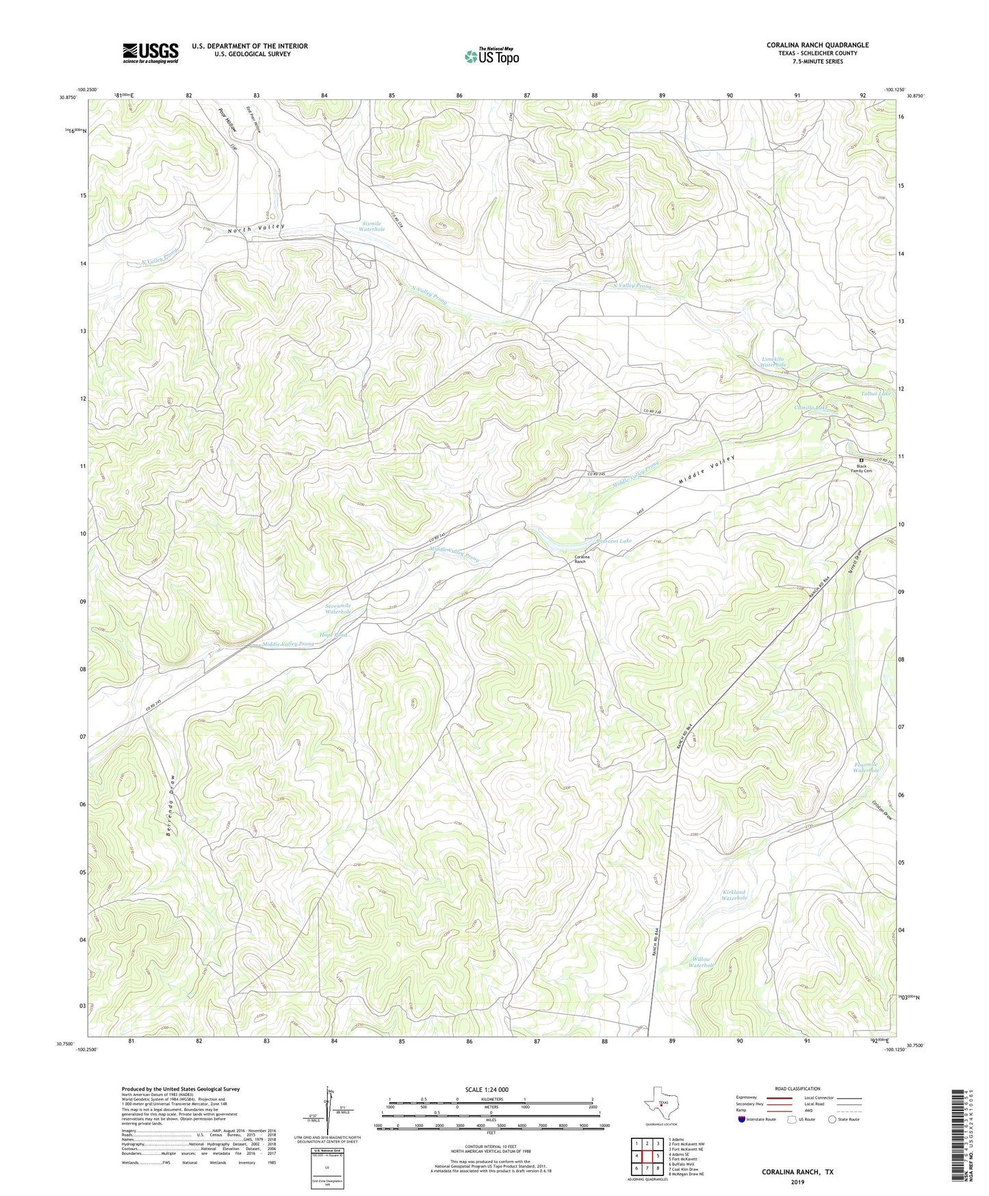
2019 topographic map quadrangle Coralina Ranch in the state of Texas. Scale: 1:24000. Based on the newly updated USGS 7.5' US Topo map series, this map is in the following counties: Schleicher. The map contains contour data, water features, and other items you are used to seeing on USGS maps, but also has updated roads and other features. This is the next generation of topographic maps. Printed on high-quality waterproof paper with UV fade-resistant inks.
Quads adjacent to this one:
West: Adams SE
Northwest: Adams
North: Fort McKavett NW
Northeast: Fort McKavett NE
East: Fort McKavett
Southeast: McKegan Draw NE
South: Coal Kiln Draw
Southwest: Buffalo Well
Contains the following named places: Berrenda Draw, Black Family Cemetery, Black Waterhole, Camilla Lake, Colston Draw, Coralina Ranch, Crescent Lake, Derrick Ranch, East Poor Hollow, Fourmile Waterhole, Hope Pond, Kirkland Waterhole, Limekiln Waterhole, Middle Valley, Penn Tillery Gas Field, Poor Hollow, Powell Ranch, Quemado Ranch, Sevenmile Waterhole, Sixmile Waterhole, Susch Ranch, Willow Waterhole