MyTopo
Fort McKavett Texas US Topo Map
Couldn't load pickup availability
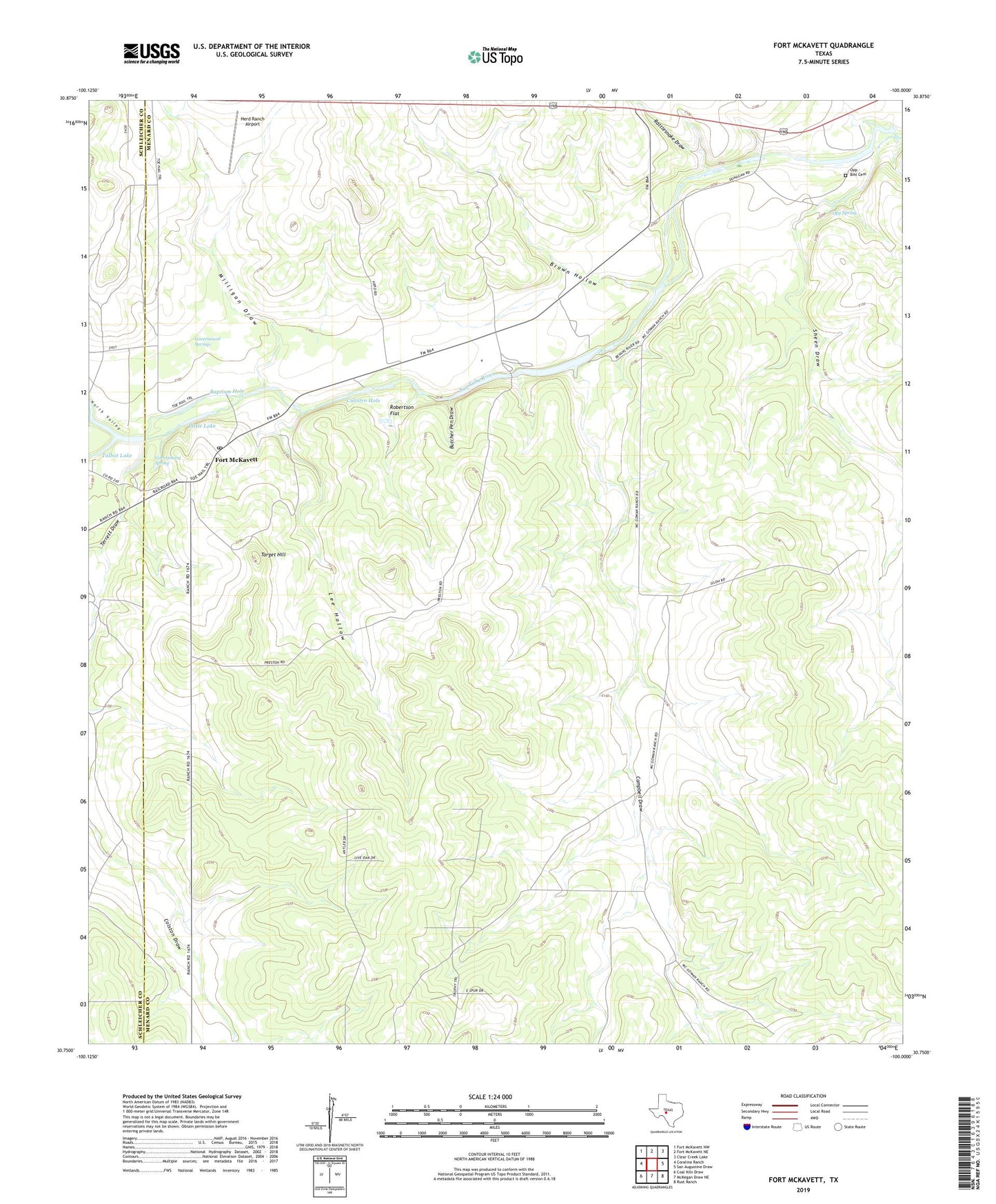
2022 topographic map quadrangle Fort McKavett in the state of Texas. Scale: 1:24000. Based on the newly updated USGS 7.5' US Topo map series, this map is in the following counties: Menard, Schleicher. The map contains contour data, water features, and other items you are used to seeing on USGS maps, but also has updated roads and other features. This is the next generation of topographic maps. Printed on high-quality waterproof paper with UV fade-resistant inks.
Quads adjacent to this one:
West: Coralina Ranch
Northwest: Fort McKavett NW
North: Fort McKavett NE
Northeast: Clear Creek Lake
East: San Augustine Draw
Southeast: Rust Ranch
South: McKegan Draw NE
Southwest: Coal Kiln Draw
This map covers the same area as the classic USGS quad with code o30100g1.
Contains the following named places: Baptism Hole, Brown Hollow, Butcher Pen Draw, Calistro Hole, Camp Sol Mayer, Campbell Draw, Fort McKavett, Fort McKavett Cemetery, Fort McKavett Post Office, Fort McKavett State Historical Park, Government Spring, Government Springs, Herd Ranch Airport, Lee Hollow, Little Lake, Middle Valley Prong, Milligan Draw, North Valley, North Valley Prong, Opp - Bihl Cemetery, Opp Spring, Rattlesnake Draw, Robertson Flat, Sheen Draw, Stinking Windmill, Talbot Lake, Target Hill, Terrett Draw