MyTopo
Cove Texas US Topo Map
Couldn't load pickup availability
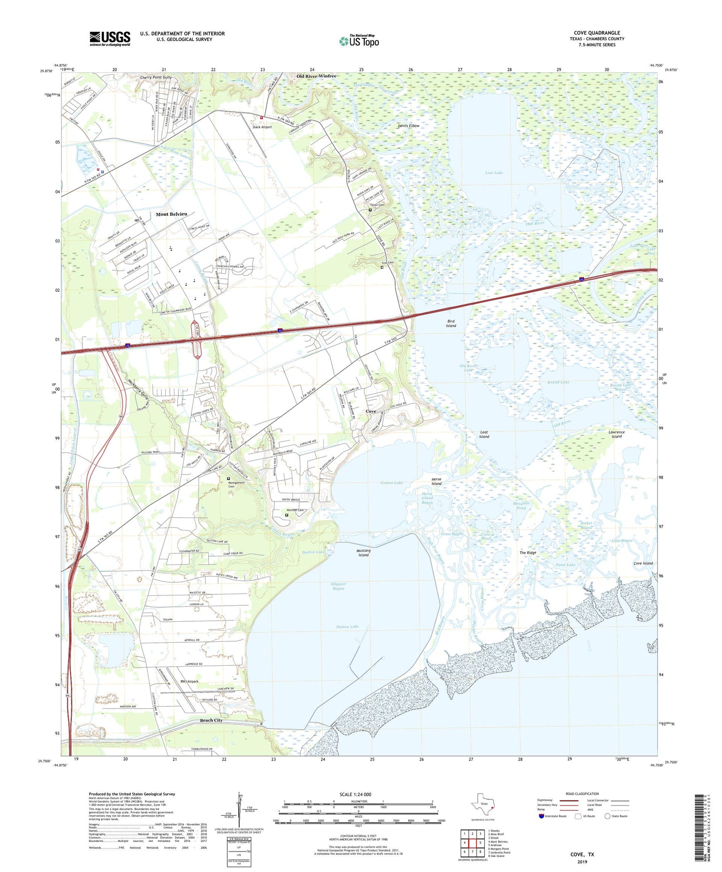
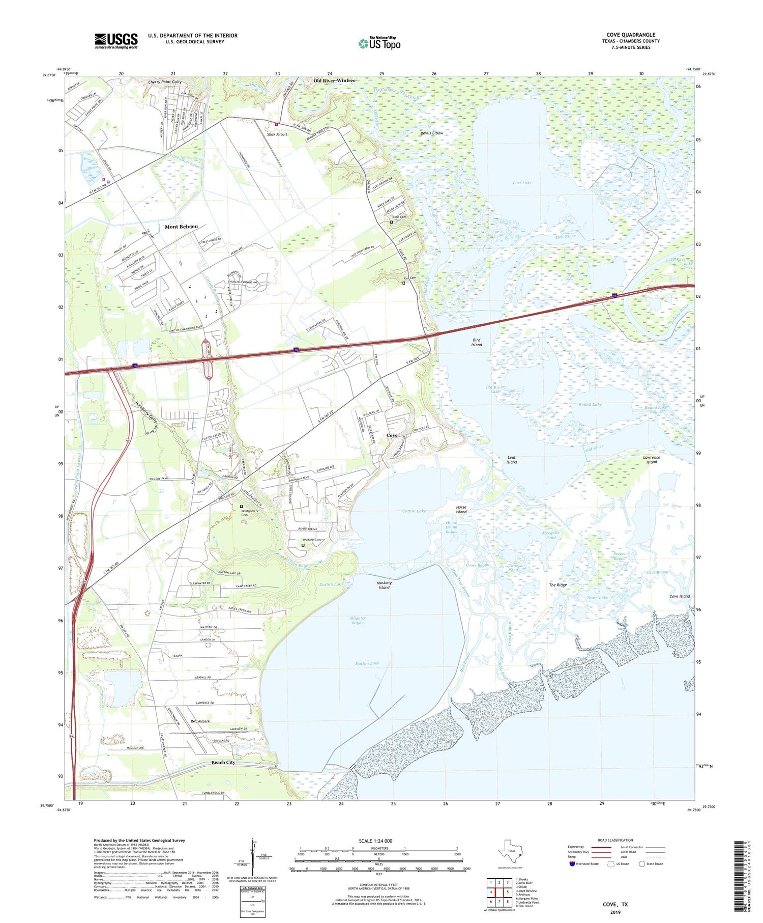
2019 topographic map quadrangle Cove in the state of Texas. Scale: 1:24000. Based on the newly updated USGS 7.5' US Topo map series, this map is in the following counties: Chambers. The map contains contour data, water features, and other items you are used to seeing on USGS maps, but also has updated roads and other features. This is the next generation of topographic maps. Printed on high-quality waterproof paper with UV fade-resistant inks.
Quads adjacent to this one:
West: Mont Belvieu
Northwest: Sheeks
North: Moss Bluff
Northeast: Shiloh
East: Anahuac
Southeast: Oak Island
South: Umbrella Point
Southwest: Morgans Point
Contains the following named places: Alligator Bayou, Barbers Hill-Mont Belvieu Museum, Bird Island, Cane Pond, Cedar Bayou Generating Pond Levee, Cedar Boyou Generating Station Clng, Chambers County Constable's Office Precinct 4, Cherry Point Gully, City of Cove, City of Old River-Winfree, Cotton Bayou, Cotton Lake, Cove, Cove Bayou, Cove City Hall, Cove Island, Cross Bayou, Devils Elbow, Double Bayou, Dunn Bayou, Dunn Lake, Dutton Lake, Hackberry Gully, High Tree Bayou, Horse Island, Horse Island Bayou, Icet Cemetery, Lawrence Island, Lawrence Lakes, Leat Island, Little Caney Creek, Lost Lake, Lost Lake Oil Field, Lost River, Mayes Lake, Mesquite Pond, Mont Belvieu City Hall, Mont Belvieu Division, Mont Belvieu Fire Department, Mont Belvieu Police Department, Mont Belvieu Post Office, Montgomery Cemetery, Mustang Island, North Cotton Lake Oil Field, Old River Lake, Old River Winffree Volunteer Fire Department, Old River-Winfree, Peterson Bayou, Pocket Bayou, Red Bayou, Red Lake, Round Lake, Round Lake Bayou, RWJ Airpark, Saint Emily Church, Slack Airport, South Cotton Lake Oil Field, The Ridge, Tilton Cemetery, Wet Marsh Pond, Winfree Cemetery, Winfree School, ZIP Codes: 77523, 77580