MyTopo
Oak Island Texas US Topo Map
Couldn't load pickup availability
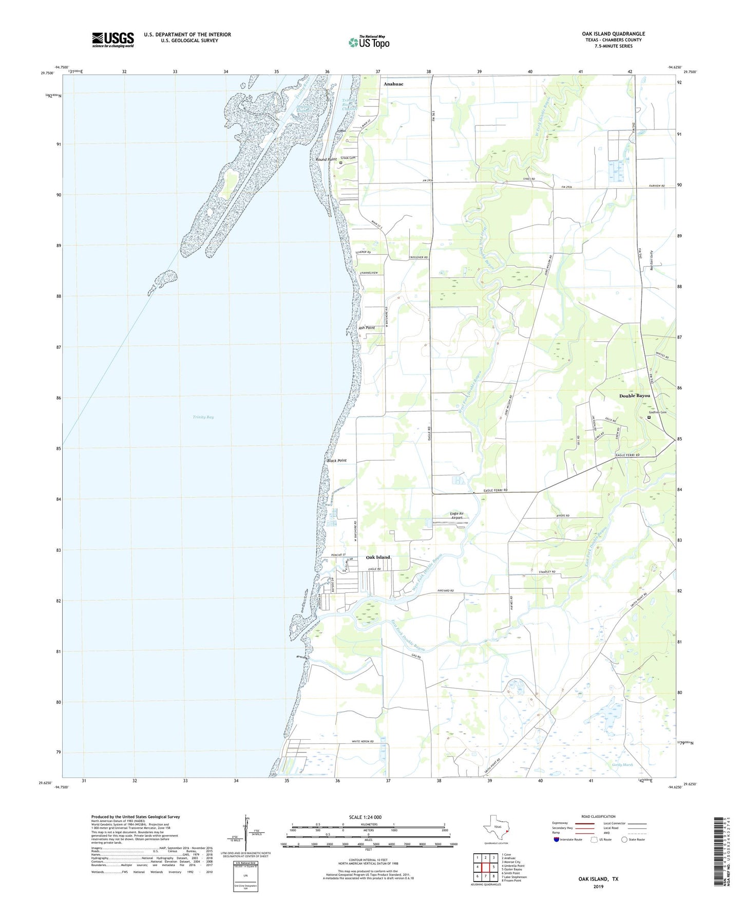
2022 topographic map quadrangle Oak Island in the state of Texas. Scale: 1:24000. Based on the newly updated USGS 7.5' US Topo map series, this map is in the following counties: Chambers. The map contains contour data, water features, and other items you are used to seeing on USGS maps, but also has updated roads and other features. This is the next generation of topographic maps. Printed on high-quality waterproof paper with UV fade-resistant inks.
Quads adjacent to this one:
West: Umbrella Point
Northwest: Cove
North: Anahuac
Northeast: Monroe City
East: Oyster Bayou
Southeast: Frozen Point
South: Lake Stephenson
Southwest: Smith Point
This map covers the same area as the classic USGS quad with code o29094f6.
Contains the following named places: Anahuac Channel, Anahuac Division, Ash Point, Beason Park, Black Point, Chambers County, Crook Cemetery, Double Bayou, Double Bayou Gas Field, Double Bayou Park, Double Bayou School, Eagle Air Airport, East Fork Double Bayou, Godfrey Cemetery, KRTW-TV (Baytown), Mount Zion Church, North Fishers Reef Gas Field, Oak Island, Oak Island Census Designated Place, Round Point, Saint Paul Church, Trinity River, West Fork Double Bayou