MyTopo
Cowl Spur Texas US Topo Map
Couldn't load pickup availability
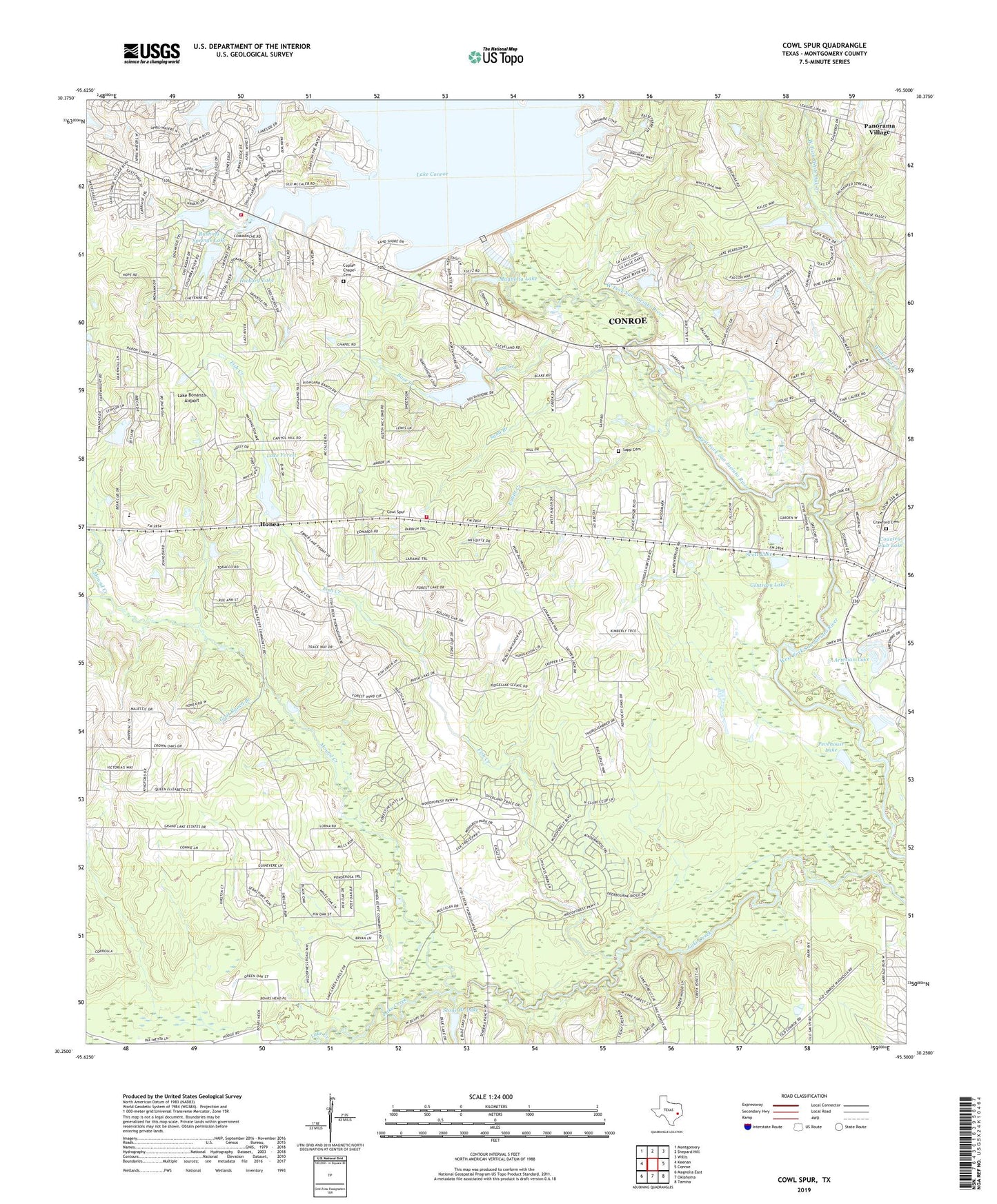
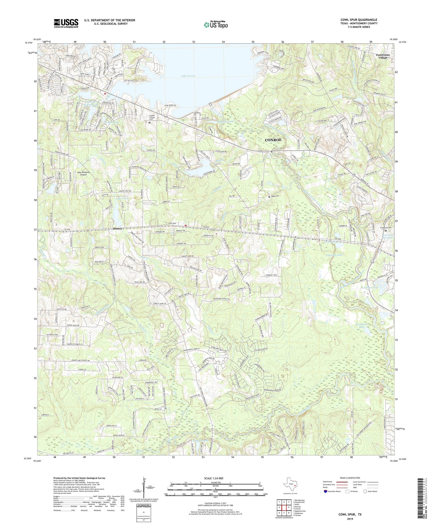
2019 topographic map quadrangle Cowl Spur in the state of Texas. Scale: 1:24000. Based on the newly updated USGS 7.5' US Topo map series, this map is in the following counties: Montgomery. The map contains contour data, water features, and other items you are used to seeing on USGS maps, but also has updated roads and other features. This is the next generation of topographic maps. Printed on high-quality waterproof paper with UV fade-resistant inks.
Quads adjacent to this one:
West: Keenan
Northwest: Montgomery
North: Shepard Hill
Northeast: Willis
East: Conroe
Southeast: Tamina
South: Oklahoma
Southwest: Magnolia East
Contains the following named places: Artesian Lake, Artesian Lake Dam, Base Creek, Conroe Dam, Contrary Lake, Coplan Chapel Cemetery, Country Club Lake Dam, Cowl Spur, Crawford Cemetery, East Fork White Oak Creek, Egypt Creek, Fish Creek, Fish Creek Dam, Goat Ranch Branch, Hickory Lake, Hickory Lake Dam, Honea, Jones Chapel, Lake Bonanza, Lake Bonanza Airport, Lake Bonanza Dam, Lake Conroe Fire Department - First Responders, Lake Conroe Fire Department Station 31, Lake Conroe Fire Department Station 32, Lake Conroe Forest Dam, Lake Creek Oil Field, Lake Forest, Lake Forest Falls, Lake Forest Falls Dam, Leonidas, Magnolia Lake, Montgomery County, Mound Creek, Pevehouse Lake, Rush Creek, Rushing Springs Lake, Rushing Springs Lake Dam, Sand Branch, Sapp Cemetery, Scott Lake, Stone Branch Lake, Stone Branch Lake Dam, Stowe Branch, West Conroe Oil Field, West Fork White Oak Creek, White Oak Creek, ZIP Code: 77304